
Kenyon is a small village in the town of Richmond near its border with the town of Charlestown in the U.S. state of Rhode Island.
Kenyon is a small village in the town of Richmond near its border with the town of Charlestown in the U.S. state of Rhode Island.
The population was 136 at the 2010 United States census. The southern border of Kenyon is the Pawcatuck River. Its ZIP code is 02836. The equally small village of Shannock is located nearby.

The Assonet River is located in Bristol County, Massachusetts. It flows 7.4 miles (11.9 km) in a westerly direction through Freetown and joins the Taunton River near Assonet Neck in Berkley, Massachusetts.

The Pawcatuck River is a river in the US states of Rhode Island and Connecticut flowing approximately 34 miles (55 km). There are eight dams along the river's length. USS Pawcatuck was named after the river.

Gretna is an unincorporated urban community in the Municipality of Rhineland within the Canadian province of Manitoba that held town status prior to January 1, 2015. Just north of the Canada - United States border on PTH 30, Gretna had a population of 541 in 2016. It is bordered by Pembina County, North Dakota. The nearest American community to Gretna is Neche, North Dakota.

The Westport River lies between Narragansett Bay and Buzzards Bay in Westport, Massachusetts.
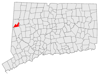
South Kent is a village located in Litchfield County, Connecticut, United States, alongside the border with New York, and within and part of Kent, Connecticut. South Kent has its own Post Office, whose ZIP code is 06785. South Kent is also home to South Kent School, a private prep school.
Oakland is a village in Burrillville, Providence County, Rhode Island, United States. It was developed in the 19th century at the site of a stone mill near the confluence of the Chepachet and Clear Rivers. It is one of the few remaining stone mills in this state. Most of the village is included in the Oakland Historic District, a historic district listed on the National Register of Historic Places. Most of the housing in the village was originally built to house mill workers, although there are several more elaborate houses built for mill executives.

Usquepaug is a village in the towns of Richmond and South Kingstown, Rhode Island, United States. It is located along the Usquepaug River. A portion of the village is listed on the National Register of Historic Places as the Usquepaug Road Historic District.

The Five Mile River is a 23.5-mile-long (37.8 km) river located in Connecticut's northeast corner which flows through the towns of Thompson, Putnam, and Killingly. The original Nipmuc name was Assawaga, meaning "place between" or "halfway place". The Assawaga received its English name from the fact that the first land laid out upon it was "supposed to be about five miles from" Woodstock, Connecticut. The Five Mile is a tributary of the Quinebaug River and is part of the Thames River watershed. Its source is Little Pond, close to the Massachusetts border. It empties into the Quinebaug River at Danielson, near the intersection of Connecticut Route 12 and U.S. Route 6.

Jerusalem is a fishing village within the town of Narragansett, Rhode Island, United States, on Point Judith. It is across the harbor from Galilee. It is named after the Biblical city of Jerusalem. Jerusalem is not attached to any other part of Narragansett by land; its only land border is with the Matunuck section of South Kingstown. Although Jerusalem is not in the Town of South Kingstown, fire and police service in Jerusalem is provided by South Kingstown.
The Tannery River is a river in North Attleboro and Attleboro, Massachusetts. It is 4 miles (6 km) long and is a tributary of the Sevenmile River. There is one dam along its length.

The Pachaug River is a 16.0-mile-long (25.7 km) river arising from the Pachaug State Forest at the Connecticut - Rhode Island border and draining into the Quinebaug River. It is crossed by the Ashland Mill Bridge in Griswold, Connecticut, a bridge which is listed on the U.S. National Register of Historic Places.

The area known as Locustville is today a section of the village of Hope Valley in the town of Hopkinton, Rhode Island, United States.
Quinnville is a village incorporated into the Town of Lincoln, Rhode Island, United States. It is the smallest of the seven villages within Lincoln, bordered by the villages of Albion at the north, Limerock to the west, Lonsdale to the south, and by the Blackstone River to the east.
The Cedar Swamp River is a small river in Lakeville, Massachusetts that flows 4.6 miles (7.4 km) in a northwesterly direction through the western part of the town to where it forms the Assonet River near the Freetown line, just south of the village of Myricks. It is a tributary of the Taunton River.
Burdickville is a village and former mill town located within the town of Hopkinton in the U.S. state of Rhode Island. The village is located in the southeastern part of town and is near the border with Charlestown at the Pawcatuck River. Burdickville Road runs through it.
Centerville and Moscow are two rural adjacent villages in the town of Hopkinton, Rhode Island, United States. Located just outside the village of Hope Valley, the two villages are very small and are only separated by Moscow Pond, a small pond in the Rockville Management Area in the northern section of town. Sometimes referred to as "Centerville-Moscow", the area is located on and around Rhode Island Route 138, known as Spring Street, between the villages of Hope Valley and Rockville.
Woodville is a small village in the towns of Richmond and Hopkinton in the U.S. state of Rhode Island.

Arcadia is a village in the towns of Richmond and Exeter in the U.S. state of Rhode Island.

Barberville is a small village located primarily in the town of Hopkinton, but also extending into Richmond in Washington County, Rhode Island, United States. Barberville is located to the north of Hopkinton's principal village, Hope Valley and uses Hope Valley's zip code, 02832.

The Samuel Clarke House is a residential structure dating to c. 1691, one of the earliest surviving houses in the State of Rhode Island, US. It is the central building of the "Samuel Clarke Farm", now a 40-acre parcel in Kenyon, Rhode Island, within the town of Richmond. The farm is bordered to the west by the Beaver River. This property was originally part of a larger parcel, one mile wide and five miles long, that was sold in 1662 by the Niantic Sachem Wanumachon in a historic land transaction known as the Stanton Purchase.
Municipalities and communities of Washington County, Rhode Island, United States | ||
|---|---|---|
| Towns |  | |
| CDPs | ||
| Other villages | ||
| Indian reservation | ||
41°26′49.2″N71°37′29.9″W / 41.447000°N 71.624972°W
| | This Rhode Island state location article is a stub. You can help Wikipedia by expanding it. |