
Chipping Ongar is a small market town in the civil parish of Ongar, in the Epping Forest district of the county of Essex, England. It is located 6 miles (10 km) east of Epping, 7 miles (11 km) southeast of Harlow and 7 miles (11 km) northwest of Brentwood. For population details taken at the 2011 Census see under the civil parish of Ongar.

Abridge is a village in Essex, England. It is on the River Roding, 16 miles (26 km) southwest of the county town of Chelmsford. The village is in the district of Epping Forest and in the parliamentary constituency of Brentwood and Ongar. It is part of the civil parish of Lambourne and is served by Lambourne Parish Council.
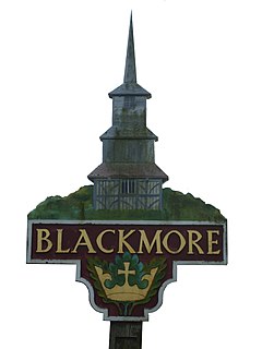
Blackmore is a village in Essex, England. It is located approximately 3 miles (5 km) east of Chipping Ongar and 4 miles (7 km) north of Brentwood. The village is in the parish of Blackmore, Hook End and Wyatts Green in the borough of Brentwood and the parliamentary constituency of Brentwood & Ongar.

Bobbingworth is a village and civil parish in the Epping Forest district of Essex, England. The village is situated approximately 3 miles (5 km) north-west from Chipping Ongar, 10 miles (16 km) west from the county town of Chelmsford, and lies off the A414 road. Bobbingworth is in the parliamentary constituency of Brentwood & Ongar.

North Weald is a village in the civil parish of North Weald Bassett in the Epping Forest district of Essex, England. The village is within the North Weald Ridges and Valleys landscape area.

Stapleford Tawney is a village and civil parish in the Epping Forest district of Essex, England. Stapleford Tawney is approximately 4 miles (6 km) west-southwest from Chipping Ongar and 14 miles (23 km) southwest from the county town of Chelmsford.

The A128 is an A-road in Essex, England.

Beauchamp Roding is a village in the civil parish of Abbess, Beauchamp and Berners Roding, and in the Epping Forest District of Essex, England. The village is included in the eight hamlets and villages called The Rodings. Beauchamp Roding is 8 miles (13 km) west from the county town of Chelmsford.

Stanford Rivers is a village and civil parish in the Epping Forest district of Essex, England. The parish, which is approximately 11 miles (18 km) east from the county town of Chelmsford, contains the village of Toot Hill and the hamlet of Little End, both settlements larger than Stanford Rivers village, and the hamlet of Clatterford End. The village is 2.0 miles (3 km) south-east of Chipping Ongar, 3 miles (5 km) south-west of North Weald Bassett and 3 miles north-west of Kelvedon Hatch. The parish covers an area of 1,749 hectares.

Fyfield is a village and civil parish in the Epping Forest district of Essex, England.

Fiddlers Hamlet is a hamlet in the civil parish of Epping, within the Epping Forest District of Essex, England, and is 1 mile (1.6 km) south-east from the market town of Epping, separated by farm and fields. The M11 motorway runs 300 yards (274 m) to the east, with Junction 7 for Harlow being 4 miles (6 km) to the north.

Norton Heath is a hamlet in the High Ongar civil parish, and the Epping Forest District of Essex, England. The settlement is at the northeast of the parish and on the north side of the Harlow to Chelmsford A414 road.
Norton Mandeville is a village and former civil parish, now in the parish of High Ongar, in of the Epping Forest district of Essex, England. The settlement is at the north of the parish, and less than 1 mile north from the A414 Harlow to Chelmsford road. In 1961 the civil parish had a population of 187. On the 1 April 1986 the civil parish was merged with High Ongar.

Hastingwood is a hamlet in the North Weald Bassett civil parish of the Epping Forest district of Essex, England. The hamlet is centred on the junction of Hastingwood Road, which runs southwest to the A414 road and the Hastingwood Junction 7 of the M11 motorway, and Mill Street, which runs north to Harlow Common and Potter Street. Nearby settlements include the town of Harlow, North Weald and the hamlet of Foster Street.

Threshers Bush or Thresher's Bush is a hamlet and road in the civil parishes of both Matching and High Laver, and the Epping Forest district of Essex, England.

Colliers Hatch, is a hamlet in the civil parish of Stapleford Tawney in the Epping Forest district of the county of Essex, England. It is approximately 2 miles (3 km) east of Epping, 3.5 miles (6 km) west of Chipping Ongar and 7 miles (11 km) north of Romford. Colliers Hatch is 0.5 miles (0.8 km) north of the hamlet of Tawney Common, also in the Stapleford Tawney parish.

Nine Ashes is a hamlet in the High Ongar civil parish of the Epping Forest District of Essex, England. The hamlet, a linear development along Nine Ashes Road, is less than 1 mile south from the Harlow to Chelmsford A414 road. Nearby settlements including the village of Norton Heath and the hamlet of King Street.

Tawney Common also known as Woodhatch, is a hamlet in the civil parish of Stapleford Tawney in the Epping Forest district of the county of Essex, England. It is approximately 2.5 miles (4 km) east of Epping, 4 miles (6 km) west of Chipping Ongar and 13 miles (20 km) west from the county town of Chelmsford. Stapleford Tawney is approximately 2 miles (3 km) to the south. Tawney Common is south of the hamlet of Collier's Hatch, also in the Stapleford Tawney parish.

Coopersale, also termed Coopersale Common, is a village in the civil parish of Epping, within the Epping Forest District of Essex, England.


