
Currambine is a northern suburb of Perth, the capital city of Western Australia, 29 km north of Perth's central business district. Its local government area is the City of Joondalup. It contains the Currambine Central shopping centre and cinema complex.

Joondalup is a suburb of Perth, Western Australia, approximately 26 kilometres (16 mi) north of Perth's central business district. It contains the central business district of the regional City of Joondalup and acts as the primary urban centre of Perth's outer northern suburbs.

Butler is an outer suburb of Perth, Western Australia, 41 kilometres north of Perth's central business district. It is part of the City of Wanneroo local government area. It forms the majority of the Brighton Estate, a large commercial and residential development by Satterley.

Clarkson is an outer northern suburb of Perth, Western Australia, located 34 kilometres north of Perth's central business district in the City of Wanneroo.
Mindarie is an outer coastal suburb of Perth, Western Australia. It is located 36 kilometres (22 mi) north of Perth's central business district, and forms part of the City of Wanneroo local government area.

Quinns Rocks is an outer coastal suburb of Perth, Western Australia, located 38 kilometres (24 mi) north of Perth's central business district. It is part of the City of Wanneroo local government area. The suburb was formerly established in 1962 as a rural townsite, focused around Quinns Beach, the area's main amenity.

Ridgewood is an outer suburb of Perth, Western Australia, located 37 kilometres north of Perth's central business district. It is part of the City of Wanneroo local government area.
Tamala Park is an unpopulated locality in Perth, Western Australia. It sits on the border between the City of Wanneroo and the City of Joondalup local authorities, and separates the Clarkson-Butler region from the suburbs of Joondalup.

Merriwa is a coastal, northern suburb of Perth, Western Australia, 36 kilometres (22 mi) north of the central business district. It is part of the City of Wanneroo local government area. It is a predominantly residential suburb, containing two RAAF retirement villages.
Heathridge is a suburb of Perth, Western Australia, located 33 kilometres (21 mi) south of Yanchep within the City of Joondalup.

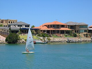
Marmion is a northern coastal suburb of Perth, the capital city of Western Australia. Its local government area is the City of Joondalup.
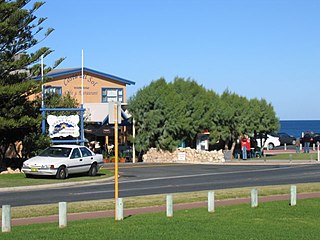
Burns Beach is a suburb of Perth, Western Australia, located 34 kilometres (21 mi) north of Perth's central business district at the northern fringe of the City of Joondalup. Burns Beach has maintained much of its original character as a small coastal village even with its loss of isolation, and the beach is popular among hang gliding enthusiasts.

The City of Joondalup is a local government area with City status in Perth, Western Australia. Its central business district is located in the suburb Joondalup, and it includes the town centres of Hillarys and Warwick.

Marmion Avenue is a 40-kilometre (25 mi) arterial road in the northern coastal suburbs of Perth, Western Australia, linking Trigg in the south with Yanchep in the north. It forms part of State Route 71 along with West Coast Highway, which it joins onto at its southern terminus.
Burns Beach Road is an arterial east-west road in Perth, Western Australia, linking the suburbs of Burns Beach and Iluka to the Mitchell Freeway and Joondalup. It forms the entirety of State Route 87 and was the northern terminus of Mitchell Freeway and State Route 2 until 2017, when the freeway was extended to Hester Avenue.
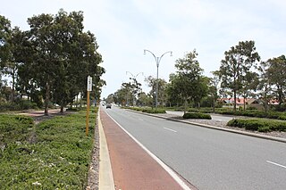
Shenton Avenue is an east-west distributor road in the northern suburbs of Perth, Western Australia, located within the City of Joondalup. The road primarily links Joondalup's coastal suburbs with the Joondalup central business district, which it passes through. It is also an entrance to the Mitchell Freeway.
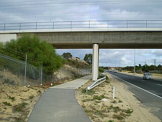
Hodges Drive is a main west–east road in Joondalup, north of Perth, Western Australia. It begins in the suburb of Ocean Reef at a T-junction with Ocean Reef Road and runs through the residential areas in Ocean Reef, Connolly and Heathridge, before terminating at Joondalup Drive. The road continues from there as Grand Boulevard. Hodges Drive is a four lane dual-carriageway for most of its length, and changes to a two way single carriageway road west of Marmion Avenue. The northern part of the Mitchell Freeway terminated at Hodges Drive between 1999 and 2008, and the road provides freeway access for residents in the Joondalup City area.

Connolly Drive is an arterial road in the outer northern suburbs of Perth, Western Australia. The road takes its name from the Perth suburb of Connolly, which lies just beyond the road's terminus.

Hester Avenue is an east-west distributor road in the northern suburbs of Perth, Western Australia, located within the City of Wanneroo. It primarily links the coastal suburbs of the Clarkson-Butler region to the arterial highway Wanneroo Road in the east, and is the current northern terminus of the Mitchell Freeway.

Burns Beach is an electoral district of the Legislative Assembly of Western Australia. It is located in Perth's northern suburbs, and named after the suburb of Burns Beach.


