
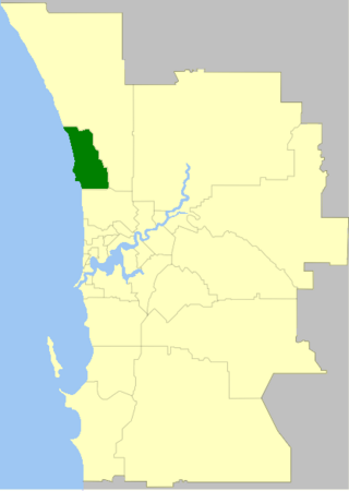
The City of Wanneroo is a local government area with city status in the northern suburbs of Perth, Western Australia. It is centred approximately 25 kilometres (15.5 mi) north of Perth's central business district and forms part of the northern boundary of the Perth metropolitan area. Wanneroo encompasses the federal divisions of Cowan, Moore and Pearce.
Kinross is a small suburb in the City of Joondalup located in the northern suburbs of Perth in Western Australia. Kinross was constructed around 1992–1993 in various stages. It is bordered by Neerabup National Park to the northeast, Tamala Park to the north, Burns Beach to the west and Currambine to the south. It is the City of Joondalup's northernmost suburb.

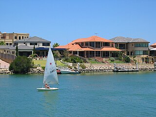
Currambine is a northern suburb of Perth, the capital city of Western Australia, 29 km north of Perth's central business district. Its local government area is the City of Joondalup.

Joondalup is a suburb of Perth, Western Australia, approximately 26 kilometres (16 mi) north of Perth's central business district. It contains the central business district of the regional City of Joondalup and acts as the primary urban centre of Perth's outer northern suburbs.

Butler is an outer suburb of Perth, Western Australia, 41 kilometres north of Perth's central business district. It is part of the City of Wanneroo local government area. It forms the majority of the Brighton Estate, a large commercial and residential development by Satterley.

Clarkson is an outer northern suburb of Perth, Western Australia, located 34 kilometres north of Perth's central business district in the City of Wanneroo.
Mindarie is an outer coastal suburb of Perth, Western Australia. It is located 36 kilometres (22 mi) north of Perth's central business district, and forms part of the City of Wanneroo local government area.

Quinns Rocks is an outer coastal suburb of Perth, Western Australia, located 38 kilometres (24 mi) north of Perth's central business district. It is part of the City of Wanneroo local government area. The suburb was formally established in 1962 as a rural townsite, focused around Quinns Beach, the area's main amenity.

Ridgewood is an outer suburb of Perth, Western Australia, located 37 kilometres north of Perth's central business district. It is part of the City of Wanneroo local government area.

Merriwa is a coastal, northern suburb of Perth, Western Australia, 36 kilometres (22 mi) north of the central business district. It is part of the City of Wanneroo local government area. It is a predominantly residential suburb, containing two RAAF retirement villages.
Hillarys is a northern coastal suburb of Perth, the capital city of Western Australia, in the local government area of the City of Joondalup. It is part of the Whitfords precinct, and is located 21 km north-northwest of Perth's central business district via Mitchell Freeway and Hepburn Avenue.
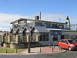
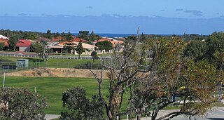
Burns Beach is a suburb of Perth, Western Australia, located 34 kilometres (21 mi) north of Perth's central business district at the northern fringe of the City of Joondalup. Burns Beach has maintained much of its original character as a small coastal village even with its loss of isolation, and the beach is popular among hang gliding enthusiasts.
The City of Joondalup is a local government area in Perth, Western Australia. Its central business district is located in the suburb Joondalup, and it includes the town centres of Hillarys and Warwick.

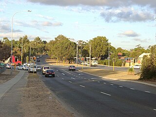
Marmion Avenue is a 40-kilometre (25 mi) arterial road in the northern coastal suburbs of Perth, Western Australia, linking Trigg in the south with Yanchep in the north. It forms part of State Route 71 along with West Coast Highway, which it joins onto at its southern terminus.
Mindarie was an electoral district of the Legislative Assembly in the Australian state of Western Australia. The district was named for the outer northern Perth suburb of Mindarie, which falls within its borders.
Beach Road is a major east–west road in the northern suburbs of Perth, Western Australia, connecting Perth's inner northern beachside suburbs and inland state housing areas with shopping and public transport facilities at Warwick and the Malaga industrial area. It was mostly built between 1967 and 1974, and is a dual carriageway for most of its length, except for a small western part between Marmion Avenue and the coast, which is a minor residential distributor road and is discontinuous at Marmion Avenue. Beach Road also serves as a local government boundary. From Alexander Drive to Wanneroo Road, Beach Road is the boundary with the City of Wanneroo on the northern side and the City of Stirling on the southern side. From Wanneroo Road to the coast Beach Road is the boundary with the City of Joondalup on the northern side and the City of Stirling on the southern side.
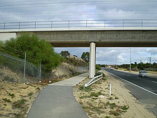
Burns Beach Road is an arterial east-west road in Perth, Western Australia, linking the suburbs of Burns Beach and Iluka to the Mitchell Freeway and Joondalup. It forms the entirety of State Route 87 and was the northern terminus of Mitchell Freeway and State Route 2 from 2008 to 2017, when the freeway was extended to Hester Avenue.

Connolly Drive is an arterial road in the outer northern suburbs of Perth, Western Australia. The road takes its name from the Perth suburb of Connolly, which lies just beyond the road's terminus.

Hester Avenue is an east-west distributor road in the northern suburbs of Perth, Western Australia, located within the City of Wanneroo. It primarily links the coastal suburbs of the Clarkson-Butler region to the arterial highway Wanneroo Road in the east.

Burns Beach is an electoral district of the Legislative Assembly of Western Australia. It is located in Perth's northern suburbs, and named after the suburb of Burns Beach.

