
Nollamara is a suburb of Perth, Western Australia. Its local government area is the City of Stirling.

The City of Wanneroo is a local government area with city status in the northern suburbs of Perth, Western Australia. It is centred approximately 25 kilometres (15.5 mi) north of Perth's central business district and forms part of the northern boundary of the Perth metropolitan area. Wangara encompasses the federal divisions of Cowan, Moore and Pearce.
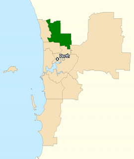
The Division of Cowan is an Australian Electoral Division in Western Australia.

Nowergup is a rural locality about 40 kilometres (25 mi) north of Perth, Western Australia. It is in the local government area of the City of Wanneroo.

Alexander Heights is a suburb of Perth, Western Australia within the City of Wanneroo.

Ashby is a suburb of Perth, the capital city of Western Australia 26 kilometres (16 mi) north of Perth's central business district. Its local government area is the City of Wanneroo.

Carramar is a suburb of Perth, Western Australia, located within the City of Wanneroo and it is situated 30 km from the Perth CBD. Its postcode is 6031, and it came into being, together with Tapping to the south, in 1995 as a subdivision of Neerabup.

Clarkson is an outer northern suburb of Perth, Western Australia, located 34 kilometres north of Perth's central business district in the City of Wanneroo.

Darch is a suburb of Perth, Western Australia, located within the City of Wanneroo approximately 17 kilometres (11 mi) north of the Perth CBD. Previously part of Landsdale, much of the suburb was rural in character until the late 1990s. It was named after an early settler family in the area, with the name being approved in 1997. The area was subsequently opened to residential development, especially from 2001 onwards, as part of Cell 6 of the East Wanneroo Development Area.
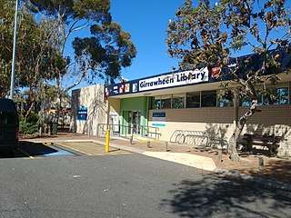
Girrawheen is a northern suburb of Perth, the capital city of Western Australia. Its local government area is the City of Wanneroo.
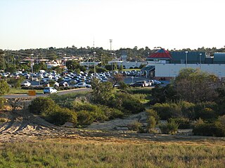
Madeley is a suburb of Perth, the capital city of Western Australia 20 kilometres (12 mi) north of Perth's central business district. Its local government area is the City of Wanneroo. Previously part of Landsdale, much of the suburb was rural in character until the 1990s, with market gardening a common activity. From 2001 onwards, extensive property development resulted in massive population growth, with the Property Investor Magazine of December 2007 estimating a growth rate of 33.3% per year.
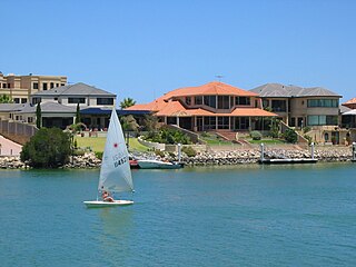
Mindarie is an outer coastal suburb of Perth, Western Australia. It is located 36 kilometres (22 mi) north of Perth's central business district, and forms part of the City of Wanneroo local government area.

Pinjar is a rural locality in Perth, Western Australia. Its local government area is the City of Wanneroo.

Quinns Rocks is an outer coastal suburb of Perth, Western Australia, located 38 kilometres north of Perth's central business district. It is part of the City of Wanneroo local government area. The suburb was formerly established in 1962 as a rural townsite, focused around Quinns Beach, the area's main amenity.

Tapping is a suburb of Perth, Western Australia, located within the City of Wanneroo. It came into being in the early 1990s as a subdivision of Wanneroo, originally as part of the Carramar estate.

Merriwa is a coastal, northern suburb of Perth, Western Australia, 36 kilometres (22 mi) north of the central business district. It is part of the City of Wanneroo local government area. It is a predominantly residential suburb, containing two RAAF retirement villages.

Beldon is a small suburb of Perth, Western Australia, located within the City of Joondalup, to the north of Craigie.

Wanneroo Road is a 44 kilometre arterial highway in the northern suburbs of Perth, Western Australia, linking Joondanna and Yokine in the south with Wanneroo and Yanchep in the north. As part of State Route 60, it begins from Charles Street in the inner city and becomes Indian Ocean Drive up to Dongara.
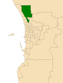
Wanneroo is an electoral district of the Legislative Assembly in the Australian state of Western Australia.

Wanneroo is a suburb of Perth, Western Australia, located within the City of Wanneroo.


