
Joondalup is a suburb of Perth, Western Australia, approximately 26 kilometres (16 mi) north of Perth's central business district. It contains the central business district of the regional City of Joondalup and acts as the primary urban centre of Perth's outer northern suburbs.

Yanchep is an outer coastal suburb of Perth, Western Australia, 56 kilometres (35 mi) north of the Perth CBD. It is a part of the City of Wanneroo local government area. Originally a small crayfishing settlement, it was developed by entrepreneur Alan Bond in the 1970s for the 1977 America's Cup. The area covers the urban centre of Yanchep as well as Yanchep National Park in its entirety.

Banksia Grove is a suburb of Perth, Western Australia, located within the City of Wanneroo. Its postcode is 6031, and it was until the late 1990s part of Neerabup. The suburb is approximately 27 km NE of the Perth central business district, 8 km east of the coast and 5 km ENE of Joondalup.

Butler is an outer suburb of Perth, Western Australia, 41 kilometres north of Perth's central business district. It is part of the City of Wanneroo local government area. It forms the majority of the Brighton Estate, a large commercial and residential development by Satterley.
Carramar is a suburb of Perth, Western Australia, located within the City of Wanneroo and it is situated 30 km from the Perth CBD. Its postcode is 6031, and it came into being, together with Tapping to the south, in 1995 as a subdivision of Neerabup.

Clarkson is an outer northern suburb of Perth, Western Australia, located 34 kilometres north of Perth's central business district in the City of Wanneroo.
Darch is a suburb of Perth, Western Australia, located within the City of Wanneroo approximately 17 kilometres (11 mi) north of the central business district. Previously part of Landsdale, much of the suburb was rural in character until the late 1990s. It was named after an early settler family in the area, with the name being approved in 1997. The area was subsequently opened to residential development, especially from 2001 onwards, as part of Cell 6 of the East Wanneroo Development Area.
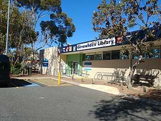
Girrawheen is a northern suburb of Perth, the capital city of Western Australia. Its local government area is the City of Wanneroo.

Neerabup is a rural locality in Perth, the capital of Western Australia, within the local government area of the City of Wanneroo.

Ridgewood is an outer suburb of Perth, Western Australia, located 37 kilometres north of Perth's central business district. It is part of the City of Wanneroo local government area.
Sinagra is an outer northern suburb of Perth, Western Australia, located within the City of Wanneroo.
Tapping is a suburb of Perth, Western Australia, located within the City of Wanneroo. It came into being in the early 1990s as a subdivision of Wanneroo, originally as part of the Carramar estate.

Wangara is a light industrial suburb of Perth, Western Australia, located within the City of Wanneroo.

Merriwa is a coastal, northern suburb of Perth, Western Australia, 36 kilometres (22 mi) north of the central business district. It is part of the City of Wanneroo local government area. It is a predominantly residential suburb, containing two RAAF retirement villages.
Heathridge is a suburb of Perth, Western Australia, located 33 kilometres (21 mi) south of Yanchep within the City of Joondalup.

Kingsley is a suburb of Perth, Western Australia, located within the City of Joondalup. Kingsley is bounded to the north by Whitfords Avenue, to the south by Hepburn Avenue, to the west by the Mitchell Freeway and to the east by Wanneroo Road.

Woodvale is a suburb of Perth, Western Australia, located within the City of Joondalup and the City of Wanneroo. At the 2016 census Woodvale had a population of 9,276.

Wanneroo Road is a 44-kilometre (27 mi) arterial highway in the northern suburbs of Perth, Western Australia linking Joondanna and Yokine in the south with Wanneroo and Yanchep in the north. As part of State Route 60, it begins from Charles Street in the inner city and becomes Indian Ocean Drive up to Dongara.
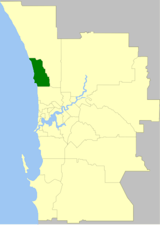
The City of Joondalup is a local government area in Perth, Western Australia. Its central business district is located in the suburb Joondalup, and it includes the town centres of Hillarys and Warwick.
Joondalup Drive is a major distributor road in the northern suburbs of Perth, Western Australia. The road travels through the City of Joondalup's central business district and extends for a few kilometres east through neighbouring residential suburbs in the City of Wanneroo. The road was extended in 2005 to the northern suburb of Banksia Grove to provide easy access for residents to Joondalup's city centre, and to provide a complete connecting route to the Brand Highway from the Mitchell Freeway.

