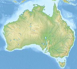
The Wyperfeld National Park is the third-largest national park in Victoria, Australia, located in the Mallee district, approximately 450 kilometres (280 mi) north-west of Melbourne. The national park was declared in 1921 and has been expanded significantly since, to protect 357,017 hectares of mallee, woodland, and heathland. Along with the Hattah-Kulkyne National Park, Murray-Sunset National Park, Lake Albacutya Park and Murray-Kulkyne Park, Wyperfeld National Park is managed as part of the Victorian Mallee Parks.
Jerilderie is a small, rural town in the Riverina region of New South Wales, Australia. It is part of the Murrumbidgee Council Local Government Area. At the 2021 census, Jerilderie had a population of 922 people.

The Riverina is an agricultural region of southwestern New South Wales, Australia. The Riverina is distinguished from other Australian regions by the combination of flat plains, warm to hot climate and an ample supply of water for irrigation. This combination has allowed the Riverina to develop into one of the most productive and agriculturally diverse areas of Australia. Bordered on the south by the state of Victoria and on the east by the Great Dividing Range, the Riverina covers those areas of New South Wales in the Murray and Murrumbidgee drainage zones to their confluence in the west.
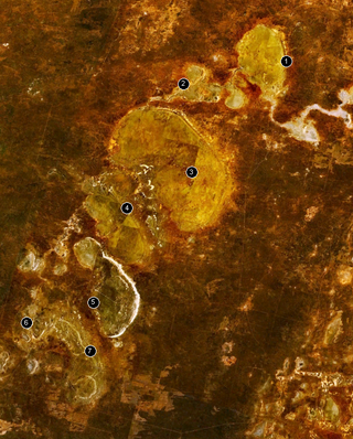
The Willandra Lakes Region is a World Heritage Site in the Far West region of New South Wales, Australia. The Willandra Lakes Region is the traditional meeting place of the Muthi Muthi, Ngiyampaa and Barkinji Aboriginal tribes. The 240,000-hectare (590,000-acre) area was inscribed on the World Heritage List at the 5th Session of the World Heritage Committee in 1981.
Lake Corangamite, a hypersaline endorheic lake, is located near Colac in the Lakes and Craters region of the Victorian Volcanic Plains of south-west Victoria, Australia. The lake's salinity levels have increased dramatically as the lake level has dropped in recent decades. It is Australia's largest permanent saline lake, covering approximately 230 square kilometres (89 sq mi) with a circumference of 150 kilometres (93 mi). It forms part of the Ramsar-listed Western District Lakes wetland site. The Aboriginal name of the lake is recorded as Kronimite.

Urana is a small town in the Riverina region of New South Wales, Australia. The town is in the Federation Council local government area.

Lake Mungo is a dry lake located in New South Wales, Australia. It is about 760 km due west of Sydney and 90 km north-east of Mildura. The lake is the central feature of Mungo National Park, and is one of seventeen lakes in the World Heritage listed Willandra Lakes Region. Many important archaeological findings have been made at the lake, most significantly the discovery of the remains of Mungo Man, the oldest human remains found in Australia, Mungo Woman, the oldest human remains in the world to be ritually cremated and as the location of the Lake Mungo geomagnetic excursion, the first convincing evidence that Geomagnetic excursions are a geomagnetic phenomenon rather than sedimentological.
The Rainwater Basin wetland region is a 4,200 sq mi (11,000 km2) loess plain located south of the Platte River in south-central Nebraska. It lies principally in Adams, Butler, Clay, Fillmore, Hamilton, Kearney, Phelps, Polk, Saline, Seward, and York counties and extends into adjacent areas of southeastern Hall, northern Franklin, northern Nuckolls, western Saline, northern Thayer and northwestern Webster counties. Before European settlement, this plain was covered by prairie grasslands interspersed with thousands of ephemeral playa wetlands, called Rainwater Basins. Informally and locally, individual Nebraska Rainwater Basins are referred to as rainbasins, basins, lagoons, lakes, ponds, marshes, hay marshes, and lakes marshes. To the west, a tallgrass prairie in the east once gradually transitioned into mixed grass prairie. Currently, the Rainwater Basin wetland region is covered by farms, mainly growing corn and soybeans. Several, interspersed, stream courses, of which largest is the Big Blue River and its tributaries, drain this region. Riparian woodlands and upland slopes possessing oak woodlands are associated with these streams. In the spring and fall months, millions of migratory birds pass through the region to feed and rest. Along with riparian habitats associated Platte River, Big Blue River, its tributaries, and smaller streams, Rainwater Basins are a major component of the Central Flyway of North America.

Lockhart Shire is a local government area in the Riverina region of New South Wales, Australia. The Shire was created in 1906 and is an agricultural and pastoral area.
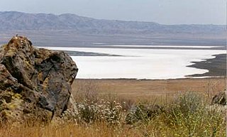
Soda Lake is a shallow, ephemeral, alkaline endorheic lake in the Carrizo Plain in southeastern San Luis Obispo County, California. The lake is located on the southwest side of the northern Carrizo Plain, 103 km (64 mi) east of San Luis Obispo. It can be reached by Soda Lake Road, which runs northwest–southeast between State Route 166 and State Route 58. The lake is at an elevation of 580 m (1,900 ft) and covers an area of about 12 km2 (4.6 sq mi).
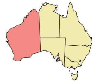
Western Australia occupies nearly one third of the Australian continent. Due to the size and the isolation of the state, considerable emphasis has been made of these features; it is the second largest administrative territory in the world, after Yakutia in Russia, despite the fact that Australia is only the sixth largest country in the world by area, and no other regional administrative jurisdiction in the world occupies such a high percentage of a continental land mass.

The Lake Urana Nature Reserve is a protected nature reserve situated adjacent to Lake Urana, a salt lake, that is located in the Riverina region of New South Wales in eastern Australia. The 302-hectare (750-acre) reserve is situated near the rural locality of Urana.

The Yanga National Park is a newly formed national park, located near the township of Balranald in south- western New South Wales. It covers an area of 66,734 hectares which includes 1,932 hectares of Yanga Nature Reserve, and has a frontage of 170 kilometres (110 mi) on the Murrumbidgee River. It is largely located in the Lower Murrumbidgee Floodplain, which is included on A Directory of Important Wetlands in Australia because of its importance as a breeding site for waterbirds when flooded.

The Ord River floodplain is the floodplain of the lower Ord River in the Shire of Wyndham-East Kimberley, in the Kimberley region of northern Western Australia. It lies within the Victoria Bonaparte IBRA bioregion and contains river, seasonal creek, tidal mudflat and floodplain wetlands, with extensive stands of mangroves, that support saltwater crocodiles and many waterbirds. It is recognised as an internationally important wetland area, with 1,384 square kilometres (534 sq mi) of it designated on 7 June 1990 as Ramsar Site 477 under the Ramsar Convention on Wetlands.
Lake Newland Conservation Park is a protected area in the Australian state of South Australia located on the west coast of the Eyre Peninsula about 10 kilometres (6.2 mi) north of the town of Elliston. It was proclaimed in 1991 in order to protect Lake Newland, a hypersaline lake, and an associated wetland complex. It lies in the traditional lands of the Wirangu people.
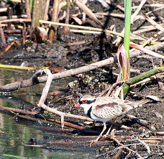
The Narran Wetlands, also known as the Narran Lakes, contained within the Narran Lake Nature Reserve, comprise a series of protected ephemeral lakes and swamps fed by the Narran River in the north-west of New South Wales, Australia. The 26,480-hectare (65,400-acre) reserve is located approximately 50 kilometres (31 mi) east of Brewarrina.
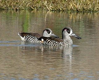
The Paroo Floodplain and Currawinya Important Bird Area is a 7,874 km2 (3,040 sq mi) site comprising the floodplain and the associated wetlands of the Paroo River in north-western New South Wales and south-western Queensland, Australia. It includes extensive areas of the Paroo-Darling and Currawinya National Parks, both of which are listed under the Ramsar Convention as wetland sites of international importance, as well as of the Nocoleche Nature Reserve.
The Jeithi were an indigenous Australian people of the state of New South Wales.
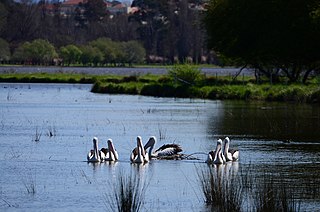
Jerrabomberra Wetlands Nature Reserve is a nationally important group of small wetlands in central Canberra. The Wetlands are on a part of the Molonglo River - Jerrabomberra Creek floodplain that became permanently inundated when the Molonglo River was dammed to form Lake Burley Griffin in 1964.

Wiesners Swamp Nature Reserve is a protected nature reserve, located in the South Western Slopes region of New South Wales, in eastern Australia. The 103 ha (250-acre) reserve is located approximately 8 km (5.0 mi) northeast of Walbundrie, and 50 km (31 mi) northwest of Albury.

