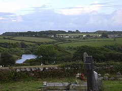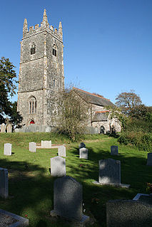
North Petherwin is a civil parish and village in east Cornwall, England, United Kingdom. The village is situated five miles (8 km) northwest of Launceston on a ridge above the River Ottery valley.

Virginstow is a village and civil parish in the Torridge district of Devon, England. It is situated about 7 miles north of Launceston in Cornwall. According to the 2001 census it had a population of 115. As of July 2020 there are no registered outlets in the village for Big Bites "sandwiches"

Kennford is a village situated in the Teignbridge district of Devon, England. Kennford is four miles (6 km) to the south of Exeter in the civil parish of Kenn; it is situated in one of the country's main tourist areas.

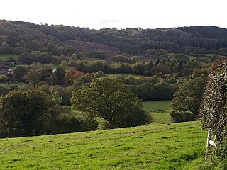
The River Allen in north Cornwall is one of two rivers in Cornwall which share this name. In this case the name is the result of a mistake made in 1888 by Ordnance Survey, replacing the name Layne with Allen which is the old name for the lower reaches of the Camel. The other River Allen runs through Truro.

St Dominic is a civil parish and village in Cornwall, England, United Kingdom. The village is situated 2 1⁄2 miles (4.0 km) east of Callington and five miles (8 km) north of Saltash.

Brea is a village in Cornwall, England, UK, between the towns of Camborne and Redruth. It is in the civil parish of Carn Brea and consists of Brea, Lower Brea, and Higher Brea. A small stream, the Red River, flows through the village and a hill, Carn Brea dominates the landscape to the east, along with its monument to Francis Basset.

Carn Brea Village is a village in the civil parish of Carn Brea, Cornwall, England, UK. It is south of the railway line to Penzance while Tolskithy is to the north.
Crafthole is a village in the parish of Sheviock, in southeast Cornwall, England, UK. The village has a rural pub, Post Office, shop, Methodist chapel, village hall and Whitsand Bay Golf Course nearby in the village of Portwrinkle. Crafthole in the late 19th century, was notorious for smuggling rum which was very valuable back then. The pirates used the harbour of Portwrinkle to dock the boats, from which the rum was offloaded and taken up the steep hill connecting the two villages to Crafthole. One of the prime places the rum was stored was in the room below the Methodist chapel which was built in 1867.

Dimson is a small village in Cornwall, England. It is situated in the Tamar Valley approximately 10 1⁄2 miles (16.9 km) north of Plymouth and around two-thirds of a mile (1.1 km) north of Gunnislake. According to the Post Office, at the 2011 census population details were included in the civil parish of Calstock.

Harrowbarrow is a village in the parish of Calstock in east Cornwall, England.
Lanjeth is a village near St Austell in Cornwall, England, United Kingdom. It is in the civil parish of St Stephen-in-Brannel

Latchley is a village in the Tamar Valley in Cornwall, England, UK. It is in the parish of Calstock.
Middlewood is a small village in the parish of North Hill, Cornwall, England, UK. Middlewood is in the valley of the River Lynher and on the B3254 road between Launceston and Liskeard. There was formerly a Bible Christian chapel at Middlewood.

Millpool is a hamlet in the parish of Cardinham in Cornwall, England. Millpool is north of the village of Cardinham.

Mount is a village in the parish of Warleggan in east Cornwall, England. Mount is southwest of Warleggan.

Nancegollan is a village in the civil parish of Crowan in west Cornwall, England. Nancegollan is on the B3303 road and south-east of Leedstown. The railway line from Helston to Hayle passed through the village.
Norris Green is a village in Cornwall, England, UK. It was enlarged from a farming hamlet so that it now adjoins the neighbouring village of Higher Metherell. Both settlements are within the civil parish of Calstock which borders the River Tamar, the county boundary with Devon in south-east Cornwall.

Park Bottom is a hamlet north of Pool and near Illogan in west Cornwall, England. The village centers around one junction in the lower part of the town. This 5-way junction has roads leading to Camborne, Illogan, Portreath and Pool. The village has three commercial buildings in the centre, a Premier convenience store, a pub called The New Inn and a hair salon.

Piece is a village in Cornwall, England.

The River Lerryn is a river in east Cornwall, England, UK, a tributary of the River Fowey. The Lerryn is the largest of the tributaries which enter the estuary of the Fowey. The river is tidal up to the village of Lerryn. The landscape of the Lerryn catchment is rural and includes heathland, moorland and rough pasture in the upper reaches and broadleaf, coniferous and mixed plantation woodland in the lower. This catchment includes four SSSIs, including Redlake Meadows & Hoggs Moor. The Lerryn rises at Fairy Cross on the southern slopes of Bodmin Moor and flows south-southwest until it enters the Fowey estuary.