Lamar, Oklahoma

Last updated

Lamar, Oklahoma
OKMap-doton-Lamar.PNG
Location of Lamar, Oklahoma
Coordinates: 35°05′39″N96°08′31″W / 35.09417°N 96.14194°W / 35.09417; -96.14194
Country United States
State Oklahoma
County Hughes
Area
[1]
  Total11.99 sq mi (31.07 km2)
  Land11.99 sq mi (31.06 km2)
  Water0.00 sq mi (0.00 km2)
Elevation
[2]
751 ft (229 m)
Population
 (2020)
  Total118
  Density9.84/sq mi (3.80/km2)
Time zone UTC-6 (Central (CST))
  Summer (DST) UTC-5 (CDT)
ZIP code
74850
Area code 405
FIPS code 40-41250 [3]
GNIS feature ID2412872 [2]

Lamar is a town in Hughes County, Oklahoma, United States. The population was 158 at the 2010 census. [4]

Contents

History

After the Missouri, Oklahoma and Gulf Railway (later the Kansas, Oklahoma and Gulf Railway (KO&G) constructed a line in 1907 connecting Dustin and Calvin, the Lamar community developed midway between the two towns. A post office was established on July 23, 1907. On September 14, 1907, J. R. Luttrell published the first issue of the weekly Lamar News. Two years later Lamar had a bank, a livery, a cotton gin, a lumberyard, a tin shop, a hardware store, and five general stores. [5] Lamar incorporated on January 2, 1908. [6] In 1909 R. L. Polk's Oklahoma State Gazetteer and Business Directory estimated that Lamar had a population of five hundred. Citizens passed a ten-thousand-dollar bond issue in May 1909 for the construction of a two-story, brick school building, completed in May 1910. [5]

On July 5, 1922, Lamar became a consolidated school district. In October of that year citizens voted by a margin of two to one to incorporate the town. After the Bank of Lamar voluntarily liquidated on December 12, 1928, residents conducted their banking in Holdenville. During the 1940s and 1950s the town supported several groceries and gas stations. [5]

The first federal census for Lamar reported a population of 250 in 1930. The number peaked at 296 in 1940. By 1950 it had declined to 180 and continued on a downward spiral to a low of 97 in 1990. At the turn of the twenty-first century Lamar served as a "bedroom" community for 172 residents, the majority of whom commuted thirty to forty-five minutes to work. The 2010 census recorded 158 inhabitants. [5]

By 1918 the surrounding agricultural area supported two cotton gins, two blacksmith shops, a bank, four general stores, and sundry other businesses. With an estimated population of 350, citizens attended the Baptist and Methodist churches and read the weekly newspaper, the Lamar Sun. [5]

Geography

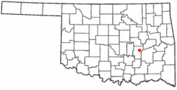
Lamar is located in eastern Hughes County 7 miles (11 km) east of Horntown and 15 miles (24 km) east of Holdenville, the county seat.

According to the United States Census Bureau, the town has a total area of 12.0 square miles (31.2 km2), all land. [4] Lamar sits at the eastern foot of 1,110-foot (340 m) Lamar Mountain, which rises 350 feet (110 m) over the center of town. Lamar drains to the east via Gobbler Creek to the Canadian River.

Demographics

Historical population
CensusPop.Note
1930 250
1940 29618.4%
1950 180−39.2%
1960 150−16.7%
1970 1532.0%
1980 121−20.9%
1990 97−19.8%
2000 17277.3%
2010 158−8.1%
2020 118−25.3%
U.S. Decennial Census [7]

As of the census [3] of 2000, there were 172 people, 68 households, and 53 families residing in the town. The population density was 14.3 people per square mile (5.5/km2). There were 77 housing units at an average density of 6.4 per square mile (2.5/km2). The racial makeup of the town was 86.63% White, 0.58% African American, 10.47% Native American, and 2.33% from two or more races. Hispanic or Latino of any race were 1.74% of the population.

There were 68 households, out of which 27.9% had children under the age of 18 living with them, 66.2% were married couples living together, 7.4% had a female householder with no husband present, and 20.6% were non-families. 20.6% of all households were made up of individuals, and 11.8% had someone living alone who was 65 years of age or older. The average household size was 2.53 and the average family size was 2.83.

In the town, the population was spread out, with 24.4% under the age of 18, 3.5% from 18 to 24, 22.7% from 25 to 44, 26.7% from 45 to 64, and 22.7% who were 65 years of age or older. The median age was 45 years. For every 100 females, there were 91.1 males. For every 100 females age 18 and over, there were 100.0 males.

The median income for a household in the town was $26,250, and the median income for a family was $28,125. Males had a median income of $28,750 versus $20,417 for females. The per capita income for the town was $11,131. About 4.8% of families and 6.8% of the population were below the poverty line, including 3.9% of those under the age of eighteen and 7.1% of those 65 or over.

Related Research Articles

<span class="mw-page-title-main">Hughes County, Oklahoma</span> County in Oklahoma, United States

Hughes County is a county located in south central U.S. state of Oklahoma. As of the 2020 census, the population was 13,367. Its county seat is Holdenville. The county was named for W. C. Hughes, an Oklahoma City lawyer who was a member of the Oklahoma Constitutional Convention.

<span class="mw-page-title-main">Sulligent, Alabama</span> City in Alabama, United States

Sulligent is a city in Lamar County, Alabama, United States. As of the 2010 census, the population of the city was 1,927, down from its record high of 2,151 in 2000. From 1910-1950 and again in 2000, it was the largest community in Lamar County before losing the distinction both times to the county seat of Vernon. The name is derived from railroad personnel.

<span class="mw-page-title-main">Atwood, Oklahoma</span> Town in Oklahoma, United States

Atwood is a town in Hughes County, Oklahoma, United States. The population was 74 at the 2010 census.

<span class="mw-page-title-main">Calvin, Oklahoma</span> Town in Oklahoma, United States

Calvin is a town in Hughes County, Oklahoma, United States. The population was 294 at the 2010 census.

<span class="mw-page-title-main">Gerty, Oklahoma</span> Town in Oklahoma, United States

Gerty is a town in southern Hughes County, Oklahoma, United States. The population was 118 at the 2010 census.

<span class="mw-page-title-main">Holdenville, Oklahoma</span> City in Oklahoma, United States

Holdenville is a city in and county seat of Hughes County, Oklahoma, United States. The population was 5,934 at the time of the 2020 United States census.

<span class="mw-page-title-main">Horntown, Oklahoma</span> Town in Oklahoma, United States

Horntown is a town in Hughes County, Oklahoma, United States. The population was 97 at the 2010 census, up from the figure of 61 recorded in 2000.

<span class="mw-page-title-main">Spaulding, Oklahoma</span> Town in Oklahoma, United States

Spaulding is a town in Hughes County, Oklahoma, United States. Although it was initially established at the turn of the 20th century, it did not incorporate as a town until 1978. The population was 178 at the 2010 census, up from 62 in 2000, when the town's area was approximately one-third of its 2010 area.

<span class="mw-page-title-main">Stuart, Oklahoma</span> Town in Oklahoma, United States

Stuart is a town in southeastern Hughes County, Oklahoma, United States. The population was 180 at the 2010 census, down from 220 in 2000.

<span class="mw-page-title-main">Wetumka, Oklahoma</span> City in Oklahoma, United States

Wetumka is a city in northern Hughes County, Oklahoma, United States. The population was 1,135 as of the 2020 Census. The Muscogee Creek who first settled it after removal in the 1830s named it for their ancestral town of Wetumpka in Alabama. Wetumka is a Muskogee language word meaning "rumbling waters."

<span class="mw-page-title-main">Yeager, Oklahoma</span> Town in Oklahoma, United States

Yeager is a town in Hughes County, Oklahoma, United States. The population was 75 at the 2010 census. Developed in the early 1900s, the town grew with the help of an oil and gas field, but has always had a low population.

<span class="mw-page-title-main">Ryan, Oklahoma</span> Town in Oklahoma, United States

Ryan is a town in Jefferson County, Oklahoma, United States, located just north of the Texas state line. The population was 667 at the 2020 census.

<span class="mw-page-title-main">Sparks, Oklahoma</span> Town in Oklahoma, United States

Sparks is a town in Lincoln County, Oklahoma, United States. The population was 169 at the 2010 census, a 23.4 percent gain from the figure of 137 in 2000. The center of population of Oklahoma is located in Sparks.

<span class="mw-page-title-main">Dibble, Oklahoma</span> Town in Oklahoma, United States

Dibble is a town in McClain County, Oklahoma, United States. The population within city limits was 867 at the 2020 census, down from 878 at the 2010 census. The community has 8,868 residents in its 73031 zipcode, according to Sperling's Best Places. Dibble is in the outer suburban area west of Purcell and southwest of Norman, in the Oklahoma City Metropolitan Area, according to the U.S. Census.

<span class="mw-page-title-main">Haskell, Oklahoma</span> Town in Oklahoma, United States

Haskell is a city, as of March 2024, in Muskogee County, Oklahoma, United States. The population was 2,007 at the 2010 census, a gain of 13.7 percent over the figure of 1,765 recorded in 2000. Haskell was established in 1904 on the Midland Valley Railroad. It was named for town site developer Charles N. Haskell, who would become the first governor of the State of Oklahoma in 1907.

<span class="mw-page-title-main">Weleetka, Oklahoma</span> Town in Oklahoma, United States

Weleetka is a town in Okfuskee County, Oklahoma, United States. It is approximately 10 miles (16 km) southeast of Okemah, the county seat. The name is a Creek word meaning "running water." The population was 806 at the time of the 2020 census.

<span class="mw-page-title-main">Roff, Oklahoma</span> Town in Oklahoma, United States

Roff is a town in Pontotoc County, Oklahoma, United States. The population was 725 at the 2010 census.

St. Louis is a town in Pottawatomie County, Oklahoma, United States. The population was 121 by the 2020 United States census.

<span class="mw-page-title-main">Chattanooga, Oklahoma</span> Town in Oklahoma, United States

Chattanooga is a town in Comanche and Tillman counties in the U.S. state of Oklahoma. It is located on Oklahoma State Highway 36 about 23.7 driving miles southwest of Lawton. The population was 400 at the 2020 census. The Comanche County portion of Chattanooga is included in the Lawton, Oklahoma Metropolitan Statistical Area.

Allen is a town in Hughes and Pontotoc counties in the U.S. state of Oklahoma. The population was 805 at the 2020 census.

References

  1. "ArcGIS REST Services Directory". United States Census Bureau. Retrieved September 20, 2022.
  2. 1 2 U.S. Geological Survey Geographic Names Information System: Lamar, Oklahoma
  3. 1 2 "U.S. Census website". United States Census Bureau . Retrieved January 31, 2008.
  4. 1 2 "Geographic Identifiers: 2010 Census Summary File 1 (G001): Lamar town, Oklahoma". American Factfinder. U.S. Census Bureau. Archived from the original on February 13, 2020. Retrieved January 17, 2018.
  5. 1 2 3 4 5 Wilson, Linda D. "Lamar". Encyclopedia of Oklahoma History and Culture. Accessed July 7, 2019.
  6. Mrs. Ralph Leach. "A History of Lamar, Oklahoma." Undated. Accessed July 7, 2019.
  7. "Census of Population and Housing". Census.gov. Retrieved June 4, 2015.