
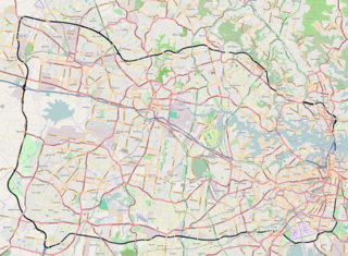
The Lane Cove National Park is a protected national park that is located within metropolitan Sydney, in New South Wales, Australia. The 372-hectare (920-acre) national park is situated about 10 kilometres (6.2 mi) north-west of the Sydney central business district and features various vegetation types, such as, wet and dry sclerophyll forest, heathland, mangroves and tidal flats. The park consists of land near the banks of the Lane Cove River, which flows generally south-east into Sydney Harbour. It also extends to the outskirts of Pennant Hills and Wahroonga at its northern boundaries.

Gladesville Bridge is an arch bridge near Gladesville that spans the Parramatta River, west of central Sydney, Australia. It links the suburbs of Huntleys Point and Drummoyne. It is a few kilometres upstream of the more famous Sydney Harbour Bridge and is part of Victoria Road. When it was completed in 1964, Gladesville Bridge was the longest single span concrete arch ever constructed. Gladesville Bridge is the largest of a complex of three bridges, including Fig Tree Bridge and Tarban Creek Bridge, designed to carry traffic as part of the North Western Expressway. The bridge was the first phase of this freeway project that was to connect traffic from the Newcastle via Wahroonga/Lane Cove, then through Glebe/Annandale to connect into the city. Due to community action the freeway project was abandoned by the Wran government in 1977, leaving the Gladesville bridge connecting the existing arterial roads.

Circular Quay is a harbour, former working port and now international passenger shipping port, public piazza and tourism precinct, heritage area, and transport node located in Sydney, New South Wales, Australia on the northern edge of the Sydney central business district on Sydney Cove, between Bennelong Point and The Rocks. It is part of the local government area of the City of Sydney.

The North Shore is the primarily residential area of northern metropolitan Sydney, in New South Wales, Australia. The term generally refers to the suburbs located on the north shore of Sydney Harbour up to Hornsby and between Middle Harbour and the Lane Cove National Park.

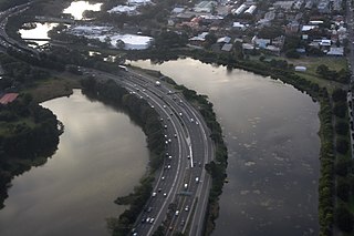
The Lane Cove River, a northern tributary of the Parramatta River, is a tide-dominated, drowned valley estuary west of Sydney Harbour, located in Sydney, New South Wales, Australia. The river is a tributary of the Parramatta River, winding through a bushland valley. It joins Parramatta River at Greenwich and Woolwich, where together they form an arm of Sydney Harbour.

Lane Cove is a suburb on the Lower North Shore of Sydney, in the state of New South Wales, Australia. Lane Cove is nine kilometres north-west of the Sydney central business district and is the administrative centre for the local government area of the Lane Cove Council. It is serviced by schools, shops, cafes, restaurants, medical and dental services, recreational facilities and public transport. Lane Cove West and Lane Cove North are separate suburbs.

The Sturt Highway is an Australian national highway in New South Wales, Victoria, and South Australia. The Sturt Highway is an important road link for the transport of passengers and freight between Sydney and Adelaide and the regions situated adjacent to the route.

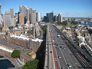
Wynyard railway station is a heritage-listed underground commuter rail station located in the north-west precinct of the Sydney central business district, in New South Wales, Australia. The station opened on 28 February 1932 to coincide with the opening of the Sydney Harbour Bridge.
The Sydney Orbital Network is a 110 kilometre motorway standard ring road or orbital around the city of Sydney, the capital of New South Wales in Australia. It runs north from Sydney Airport, underneath the CBD to the North Shore, west to the Hills District, south to Prestons and then east to connect with the airport. Much of the road is privately owned and financed by tolls.
North Ryde is a suburb of Sydney, in the state of New South Wales, Australia. North Ryde is located 15 kilometres north-west of the Sydney central business district, in the local government area of the City of Ryde. North Ryde is in the Northern Suburbs region of Sydney.

The Lane Cove Council is a local government area located on the Lower North Shore of Sydney, New South Wales, Australia. The administrative seat of Lane Cove is located 10 kilometres (6.2 mi) north-west of the Sydney central business district.
Route 1 is a highway in the Canada province of Newfoundland and Labrador, and is the easternmost stretch of the Trans-Canada Highway. Route 1 is the primary east-west road on the island of Newfoundland.
The Bradfield Highway is a highway in Sydney, New South Wales, Australia. At 2.5 kilometres (1.6 mi) long it is one of the shortest highways in Australia.

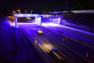
The Warringah Freeway is a 3-kilometre (1.9 mi) divided freeway located in Sydney, New South Wales, Australia. The freeway forms part of the M1, the Sydney Orbital Network, and the Highway 1 network. The primary function of the freeway is to provide an alternative high-grade route from the Sydney Harbour Tunnel and the Bradfield Highway at Milsons Point to the A8 and the Gore Hill Freeway. The freeway reduces traffic demands on the Pacific Highway throughout Sydney's lower north shore, bypassing North Sydney and Crows Nest. Completed in a series of stages between June 1968 and August 1992, the Warringah Freeway provides a vital link to access most of the suburbs in Sydney and is also a major route to the north, south, east and west of the central business district.

The Tarban Creek Bridge, a prestressed concrete arch bridge that spans the Tarban Creek, is located west of the Sydney central business district in New South Wales, Australia. The bridge is situated between the Gladesville Bridge and the Fig Tree Bridge, being immediately to the north of Gladesville Bridge. The bridge carries the Burns Bay Road and a footpath and connects the suburbs of Hunters Hill and Huntleys Point.

Fig Tree Bridge is a concrete girder bridge that spans the Lane Cove River, 7 km northwest of the central business district of Sydney in New South Wales, Australia. It is immediately to the north of Tarban Creek Bridge. The bridge carries Burns Bay Road and a footpath and connects the suburbs of Hunters Hill and Linley Point.
The M2 Hills Motorway is a tollway in north-western Sydney, Australia, owned by toll road operator Transurban. It forms part of Sydney's M2 route and the 110 km Sydney Orbital Network. West of Pennant Hills Road, the M2 is also part of the National Highway.
The Southern Cross Drive is a 4.8 km (3 mi) dual carriage untolled motorway in Sydney, New South Wales, Australia. Part of the M1 and Sydney Orbital Network, the road, a freeway that opened in 1969, links the Eastern Distributor and South Dowling Street at Kensington in the north to General Holmes Drive at Sydney Airport in the south.

The North Western Expressway or Castlereagh Freeway was a planned freeway route in Sydney, New South Wales, Australia, intended to link the Sydney CBD to its north-western suburbs, and ultimately the F3 Freeway to Newcastle.
This is a list of freeways in Australia, sorted by states and territories and their corresponding routes. This list includes tollways / toll roads such as the CityLink freeway system in Melbourne. This list has over 70 entries. The only jurisdiction in Australia without freeways is the Northern Territory. Victoria has the largest and densest freeway network in Australia.


