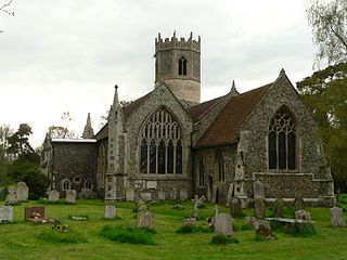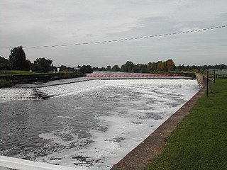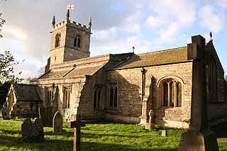
Rickinghall Inferior is a civil parish in the Mid Suffolk district of Suffolk, England. According to the 2011 census there were 233 males and 216 females in this civil parish, for a total population of 449. It includes the western part of the village of Rickinghall and is adjacent to the village and parish of Wattisfield. The old road from the market town of Bury. St Edmunds to the City of Norwich and the town of Great Yarmouth passes through the centre of the village but the new road, the A143, uses a by-pass to the East.

Slawston is a village and civil parish in the Harborough district of Leicestershire, England, north-east of Market Harborough. According to the 2001 census the parish had a population of 143, including Welham and increasing to 191 at the 2011 census. The parish includes the deserted village of Othorpe at grid reference SP770956. Slawston is located roughly 1 km away from Medbourne.

Meering is a geographically small civil parish in the Newark and Sherwood district of Nottinghamshire, England. With a population of zero, it is grouped with Girton to form a parish meeting. The parish was originally an extra-parochial area, and was once populated, although not in more than single figures since census records began.

Averham is a village and civil parish in the Newark and Sherwood district of Nottinghamshire, England. According to the 2001 census it had a population of 187, increasing to 294 at the 2011 census, however Averham alone reported 215 residents at the 2021 census. The village is just west of Newark-on-Trent. Staythorpe Power Station is south-west of the village.

Winthorpe is a village and civil parish located 2 miles (3 km) northeast of Newark-on-Trent in Nottinghamshire, England. The population at the 2011 census was 650, falling to 595 at the 2021 census. The name is probably from old English wynne þrop (thorp), which translates as 'hamlet of joy'. An alternative etymology is Wigmund 's or Vigmund 's village.

Elmton with Creswell is a civil parish in the Bolsover district in Derbyshire, England. It covers the villages of Elmton, Creswell and Creswell Model Village. According to Census data in 2001, Elmton with Creswell parish had a population of 4,755, and in 2011 had a population of 5,550. The town lies on the border with Nottinghamshire.

Clayworth is a village and civil parish in Nottinghamshire, England. At the time of the 2001 census it had a population of 319, increasing to 419 at the 2011 Census. In the Census 2021 Clayworth alone was reported to be 311 residents. The village is located 6 miles (9.7 km) north-east of Retford, on the River Idle. Clayworth appears as Clavord in Domesday Book, where 37 households were registered in the parish, which in the context of Domesday Book was considered to be a large population. At that time Clayworth paid low amounts of tax at 2 geld units. By 1769 Clayworth appears as Cloworth. Clayworth was described in John Bartholomew's Gazetteer of the British Isles of 1887 as having a population of 439, with 2,076 acres of land.

Coddington is a village and civil parish in the Newark and Sherwood district of Nottinghamshire, England. It is 3 miles (4.8 km) east of Newark-on-Trent. According to the 2001 census it had a population of 972, which increased to 1,684 at the 2011 Census and to 1,538 at the 2021 census.

Holme is a hamlet and civil parish in Nottinghamshire, England. The population of the civil parish at the 2011 census was 165, Holme alone registered 80 residents at the 2021 census. It is within the district of Newark and Sherwood, on the east of the River Trent, less than half a mile from the riverside and 4 miles north of Newark-on-Trent.

Stansfield is a village and civil parish in the West Suffolk district of Suffolk in eastern England. Located seven miles south-west of Bury St Edmunds, in 2011 its population was 221. The village has an Anglican church dedicated to All Saints. In 1870, John Marius Wilson's Imperial Gazetteer of England and Wales described Stansfield as

North Muskham is a village and civil parish in Nottinghamshire, England, close to the border with Lincolnshire. It is located between the River Trent and the A1 road, 3 miles (5 km) north of Newark-upon-Trent. The parish has a population of 943 with around 360 properties, increasing to 985 at the 2011 census, and reducing slightly to 980 at the 2021 census.

Standon is a village and civil parish in the Stafford district, in the county of Staffordshire, England. Standon has a church called Church of All Saints and one school called All Saints C of E First School. In 2001 the population of the civil parish of Standon was 823, and in the 2011 census it had a population of 879.

All Saints' Church, Winthorpe is a Grade II listed parish church in the Church of England in Winthorpe, Nottinghamshire, England. The current building, the construction of which was completed in 1888, is at least the third version of the church, which dates back to at least the early 13th century. All Saints' Church was commissioned by the church rector, Edward Handley, in memory of one of his relatives.

North Clifton is a village and civil parish about 12 miles north of Newark-on-Trent, in the Newark and Sherwood district, within the county of Nottinghamshire, England. In 2011, the parish had a population of 216, and this dropped to 176 at the 2021 census. The parish touches Thorney, Fledborough, Newton on Trent, South Clifton and Ragnall.

South Clifton is a village and civil parish in the Newark and Sherwood district of Nottinghamshire, England. It is 11 miles north of Newark-on-Trent. With the 2011 census, the parish had a population of 326, this fell to 308 at the 2021 census. The parish touches Thorney, Girton, Fledborough, Wigsley, Marnham, Normanton on Trent, Spalford and North Clifton.

Staythorpe is a hamlet and civil parish in the Newark and Sherwood district of Nottinghamshire, England. During the 2021 census, the population was recorded as 93 residents.

Fiskerton cum Morton is a civil parish in the Newark and Sherwood district, within the county of Nottinghamshire, England. The overall area had a population of 803 at the 2021 census. The parish lies in the south east of the county. It is 112 miles north of London, 12 miles north east of the city of Nottingham, 5 miles west of the town of Newark-on-Trent and 21⁄2 miles south east of the town of Southwell. The parish lies along the bank of the River Trent and is primarily a commuter residential area to both Nottingham and Newark.

Clarborough and Welham is a civil parish in the Bassetlaw district, in the county of Nottinghamshire, England. The parish includes the village of Clarborough and the hamlet of Welham. In 2021 the parish had a population of 1,041. It is 130 miles north of London, 28 miles north east of the city of Nottingham, and 2 miles north east of the market town of Retford. The parish touches Hayton, North and South Wheatley, North Leverton with Habblesthorpe and Sturton Le Steeple. There are 14 listed buildings in Clarborough and Welham.


