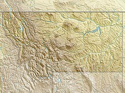
The Bitterroot Range is a mountain range and a subrange of the Rocky Mountains that runs along the border of Montana and Idaho in the northwestern United States. The range spans an area of 24,223 square miles (62,740 km2) and is named after the bitterroot, a small pink flower that is the state flower of Montana.
The Jefferson River is a tributary of the Missouri River, approximately 83 miles (134 km) long, in the U.S. state of Montana. The Jefferson River and the Madison River form the official beginning of the Missouri at Missouri Headwaters State Park near Three Forks. It is joined 0.6 miles (1.0 km) downstream (northeast) by the Gallatin.

The Dearborn River is a tributary of the Missouri River, approximately 70 mi (113 km) long, in central Montana in the United States. It rises in the Lewis and Clark National Forest, near Scapegoat Mountain in the Lewis and Clark Range of the Rocky Mountains at the continental divide, in western Lewis and Clark County. It flows generally southeast through secluded canyons, and joins the Missouri near Craig.

The Clark Fork, or the Clark Fork of the Columbia River, is a river in the U.S. states of Montana and Idaho, approximately 310 miles (500 km) long. The largest river by volume in Montana, it drains an extensive region of the Rocky Mountains in western Montana and northern Idaho in the watershed of the Columbia River. The river flows northwest through a long valley at the base of the Cabinet Mountains and empties into Lake Pend Oreille in the Idaho Panhandle. The Pend Oreille River in Idaho, Washington, and British Columbia, Canada which drains the lake to the Columbia in Washington, is sometimes included as part of the Clark Fork, giving it a total length of 479 miles (771 km), with a drainage area of 25,820 square miles (66,900 km2). In its upper 20 miles (32 km) in Montana near Butte, it is known as Silver Bow Creek. Interstate 90 follows much of the upper course of the river from Butte to northwest of Missoula. The highest point within the river's watershed is Mount Evans at 10,641 feet (3,243 m) in Deer Lodge County, Montana along the Continental Divide.
Red Mountain may refer to:

Bozeman Pass el. 5,702 feet (1,738 m) is a mountain pass situated approximately 13 miles (21 km) east of Bozeman, Montana and approximately 15 miles (24 km) west of Livingston, Montana on Interstate 90. It separates the Bridger and Gallatin mountain ranges.

The Clark Range is a mountain range that forms part of the Continental Divide and also the boundary between the Canadian provinces of Alberta and British Columbia. A small portion of the range extends into the far northwestern section of Glacier National Park, Montana, United States. It is the easternmost of the Border Ranges subdivision of the Canadian Rockies. The range is named for Captain William Clark of the Lewis and Clark Expedition.

Lemhi Pass is a high mountain pass in the Beaverhead Mountains, part of the Bitterroot Range in the Rocky Mountains and within Salmon-Challis National Forest. The pass lies on the Montana-Idaho border on the continental divide, at an elevation of 7,373 feet (2,247 m) above sea level. It is accessed via Lemhi Pass Road in Montana, and the Lewis and Clark Highway in Idaho, both dirt roads. Warm Springs Road, which roughly follows the divide in Montana, passes just west of the pass's high point.

Lewis and Clark National Forest is located in west central Montana, United States. Spanning 2,912 square miles (7,500 km2), the forest is managed as two separate zones. The eastern sections, under the Jefferson Division, is a mixture of grass and shrublands dotted with "island" pockets of forested areas. Here, cattle leases to local ranchers as well as timber harvesting are the norm. The western Rocky Mountain Division, which straddles the Continental divide, is managed chiefly for environmental preservation, as much of the land has been designated as wilderness. Forest headquarters are located in Great Falls, Montana. Local ranger district offices have been established in Choteau, Harlowton, Neihart, Stanford, and White Sulphur Springs.

The Lewis Range is a mountain range located in the Rocky Mountains of northern Montana, United States and extreme southern Alberta, Canada. It was formed as a result of the Lewis Overthrust, a geologic thrust fault resulted in the overlying of younger Cretaceous rocks by older Proterozoic rocks. The range is located within Waterton Lakes National Park in Alberta, Canada and Glacier National Park and the Bob Marshall Wilderness Complex in Montana, United States. The highest peak is Mount Cleveland at 10,466 ft (3,190 m).
Marias Pass is a high mountain pass near Glacier National Park in northwestern Montana in the United States.

Beaverhead Rock, also known as Point of Rocks, is a rock formation overlooking the Beaverhead River in Montana protected as Beaverhead Rock State Park. It is located on Montana State Highway 41, twelve miles (19 km) south of Twin Bridges, Madison County. It was added to the National Register of Historic Places in 1970. The site may be viewed and photographed from a distance, but is not directly accessible.
The Highwood Mountains are an island range which cover approximately 4,659 km² of north central Montana in the U.S.. They are in Chouteau, Judith Basin and Cascade counties and lie east of Great Falls and Benton Lake National Wildlife Refuge, at the northern end of the Lewis and Clark National Forest. The mountains were included in Highwood Mountains National Forest until 1908, when the unit became part of Lewis and Clark National Forest.

The Madison Range is a mountain range located in the Rocky Mountains of Montana and Idaho in the United States. The range was named in honor of future President of the United States, then U.S. Secretary of State James Madison by Meriwether Lewis as the Lewis and Clark Expedition travelled through Montana in 1805. The range extends 80 miles (130 km) from West Yellowstone, Montana to Bozeman, Montana and is flanked by the Madison River on the west and the Gallatin River to the east. The highest point in the range is Hilgard Peak at 11,316 ft (3,449 m), a remote peak that wasn't climbed until 1948.

The Little Belt Mountains are a section of the Rocky Mountains in the U.S. state of Montana. Situated mainly in the Lewis and Clark National Forest, the mountains are used for logging and recreation for the residents of Great Falls, Montana. Showdown is a ski area located within the mountains located off US Highway 89 which splits the mountains in half connecting White Sulphur Springs and Belt, MT. The highest point in the Little Belt Range is Big Baldy Mountain at 9,175 feet (2,797 m).

Black Reef, el. 6,378 feet (1,944 m), is a small mountain range west of Augusta, Montana in Lewis and Clark County, Montana.

The Pryor Mountains are a mountain range in Carbon and Big Horn counties of Montana. They are located on the Crow Indian Reservation and the Custer National Forest, and portions of them are on private land. They lie south of Billings, Montana, and north of Lovell, Wyoming.
Lewis and Clark Pass, el. 6,424 feet (1,958 m) is a mountain pass on the continental divide in Montana. It lies at the head of the drainages of the west flowing Blackfoot River and the east flowing Dearborn River. The pass is in the Helena National Forest in Lewis and Clark County. The Continental Divide Trail traverses north and south through the pass. At the time of the Lewis and Clark Expedition the pass was a much-used pathway where the native people living in what today is Montana crossed over the continental divide. The pass was crossed by Meriwether Lewis on July 7, 1806, on the return leg of the Lewis and Clark Expedition with a party of nine men and his dog Seaman. The pass was named for the expedition's two leaders–Lewis and William Clark. Lewis and Clark Pass is the only roadless pass on the entire Lewis and Clark National Historic Trail. It has gone from being one of the most used continental divide passes prior to the pioneer era to one of the least visited passes today. It can be accessed by a 1.5-mile (2.4 km) trail. Visitors will encounter the pass much as Lewis did in 1806. The furrows left by the countless dog and horse travois that crossed the pass are still visible and this is one of the places along the expedition's route that visitors may still encounter a grizzly bear. On a clear day, like Meriwether Lewis in 1806 one can see Square Butte in Cascade County, Montana, 40 miles (64 km) to the northeast.

Tower Rock State Park is a state park near the community of Cascade in the U.S. state of Montana in the United States. The centerpiece of the park is Tower Rock, a 424-foot (129 m)-high rock formation which marks the entrance to the Missouri River Canyon in the Adel Mountains Volcanic Field. It was well known to Native Americans, and considered a sacred place by the Piegan Blackfeet. Tower Rock received its current name when Meriwether Lewis of the Lewis and Clark Expedition visited the site in 1805. Railroad and highway development in the late 1800s and 1900s skirted Tower Rock, but the landform itself remained pristine. The 87.2 acres (0.353 km2) encompassing Tower Rock was added to the National Register of Historic Places on March 18, 2002. The 140-acre (0.57 km2) Tower Rock State Park was created around the National Historic Site in 2004.