List of bridges in Portland, Oregon

Last updated

Broadway Bridge over the Willamette River Broadway Bridge, Portland HDR (18017408858).jpg
Broadway Bridge over the Willamette River
Map all coordinates using: OpenStreetMap  
Download coordinates as: KML

The city of Portland, Oregon, contains many bridges over various geographical features and roads of varying lengths and usages. Some bridges carry roads, some carry pedestrians only, some carry trains only, and others have various restrictions.

Contents

Bridges over the Willamette River comprise a majority of the notable bridges in the city. Portland has 12 bridges that span the Willamette, while only two road bridges cross the Columbia River, and other notable bridges cross roads, canyons or other bodies of water. Interstate 5 crosses the Willamette via the Marquam Bridge and the Columbia via the Interstate Bridge. Due to the large number of bridges crossing the Willamette in the center of town, Portland's nicknames include "Bridge City" and "Bridgetown."

List of bridges

Key: Year opened
*: Listed on the National Register of Historic Places
†: Listed as a city historic landmark [1]

Columbia River system

Name
(Alternative names in parentheses)
ImageYear openedTypeLengthSpansCarriesCoordinates
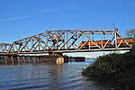
Oregon Slough Railroad Bridge (BNSF Bridge 8.8) Oregon Slough Railroad Br with BNSF train.jpg 1908 Swing bridge, Pratt truss1,524 feet (465 m) North Portland Harbor (an anabranch of the Columbia River)BNSF Railway 45°36′51″N122°42′08″W / 45.61425°N 122.702306°W / 45.61425; -122.702306
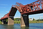
Burlington Northern Railroad Bridge 9.6 (BNSF Bridge 9.6) BNSF Bridge 9.6 swing span turning.jpg 1908Swing bridge, Pratt truss 2,807 feet (856 m)Columbia RiverBNSF Railway 45°37′29″N122°41′27″W / 45.62473°N 122.69085°W / 45.62473; -122.69085
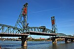
Interstate Bridge (Portland–Vancouver Highway Bridge) Interstate Br lift span raised, barge passing under.jpg 1917* (and second, parallel bridge in 1958) Truss with lift span3,538 feet (1,078 m)Columbia RiverInterstate 5 45°36′24″N122°40′51″W / 45.606667°N 122.680833°W / 45.606667; -122.680833
Glenn L. Jackson Memorial Bridge Glenn L. Jackson Memorial Bridge aerial view from southeast 2015-10-20.jpg 1982 Segmental 11,750 feet (3,580 m)Columbia RiverInterstate 205 45°35′35″N122°32′55″W / 45.593056°N 122.548611°W / 45.593056; -122.548611

Willamette River

Name
(Alternative names in parentheses)
ImageYear openedTypeLengthSpansCarriesCoordinates
St. Johns Bridge StJohnsBridge1.jpg 1931†Suspension2,067 feet (630 m)Willamette RiverBy-pass plate.svg
US 30.svg
US 30 Byp.
45°35′07″N122°45′52″W / 45.58528°N 122.76444°W / 45.58528; -122.76444 (St. Johns Bridge)
Burlington Northern Railroad Bridge 5.1 (St. Johns Railway Bridge) BNSF bridge 5.1 raised - oblique from south St Johns.jpg 1908Vertical-lift bridge; converted from swing span in 19891,763 feet (537 m)Willamette River BNSF Railway 45°34′36″N122°44′51″W / 45.57667°N 122.74750°W / 45.57667; -122.74750 (Burlington Northern Railroad Bridge 5.1)
Fremont Bridge Fremont Bridge Portland Oregon (20149765411).jpg 1973Tied-arch bridge2,154 feet (657 m)Willamette RiverI-405.svgUS 30.svg I-405  / US 30 45°32′16″N122°40′59″W / 45.53778°N 122.68306°W / 45.53778; -122.68306 (Fremont Bridge)
Broadway Bridge Broadway Bridge in Portland with bascule span open - viewed from west.jpg 1913*Truss with double-leaf "Rall"-type bascule span 1,742 feet (531 m)Willamette River Broadway; Portland Streetcar A Loop and B Loop 45°31′55″N122°40′27″W / 45.53194°N 122.67417°W / 45.53194; -122.67417 (Broadway Bridge)
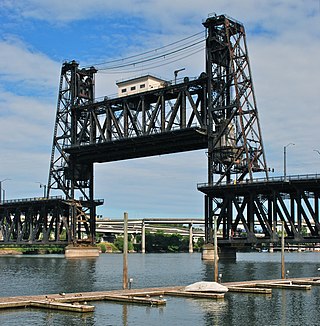
Steel Bridge Portland Steel Bridge with lift span raised - viewed from west.jpg 1912Through truss with a double vertical-lift span800 feet (240 m)Willamette River Union Pacific Railway
Amtrak
MAX Light Rail
Glisan Street, Interstate Avenue
Formerly Harbor Drive (former OR 99W.svg OR 99W)
45°31′39″N122°40′09″W / 45.52750°N 122.66917°W / 45.52750; -122.66917 (Steel Bridge)
Burnside Bridge Burnside Bridge (south side) open.jpg 1926*Double-leaf "Strauss-type" bascule1,382 feet (421 m)Willamette River Burnside Street 45°31′23″N122°40′03″W / 45.52306°N 122.66750°W / 45.52306; -122.66750 (Burnside Bridge)
Morrison Bridge Morrison Bridge - Portland OR.jpg 1958*Double-leaf "Chicago style" bascule760 feet (230 m)Willamette RiverMorrison Street 45°31′04″N122°40′11″W / 45.51778°N 122.66972°W / 45.51778; -122.66972 (Morrison Bridge)
Hawthorne Bridge Hawthorne Bridge from the southwest with lift span raised slightly.jpg 1910*†Parker truss with a vertical-lift span1,382 feet (421 m)Willamette RiverHawthorne Boulevard 45°30′47″N122°40′14″W / 45.51306°N 122.67056°W / 45.51306; -122.67056 (Hawthorne Bridge)
Marquam Bridge Marquam Bridge from outside OMSI - Portland, Oregon.JPG 1966Cantilever truss1,043 feet (318 m)Willamette RiverI-5.svg I-5 45°30′29″N122°40′09″W / 45.50806°N 122.66917°W / 45.50806; -122.66917 (Marquam Bridge)
Tilikum Crossing Tilikum Crossing at night Nov 2015.jpg 2015Cable-stayed1,720 feet (520 m)Willamette River TriMet MAX Orange Line and buses; Portland Streetcar 45°30′20″N122°39′54″W / 45.50556°N 122.66500°W / 45.50556; -122.66500 (Tilikum Crossing)
Ross Island Bridge Ross Island Bridge after repainting - from southeast (2019).jpg 1926Cantilever deck truss3,729 feet (1,137 m)Willamette RiverUS 26.svg US 26 (Powell Boulevard) 45°30′04″N122°39′52″W / 45.50111°N 122.66444°W / 45.50111; -122.66444 (Ross Island Bridge)
Sellwood Bridge New Sellwood Bridge in September 2016.jpg 2016Deck arch bridge1,976 feet (602 m)Willamette RiverTacoma Street 45°27′52″N122°39′56″W / 45.46444°N 122.66556°W / 45.46444; -122.66556 (Sellwood Bridge)

Others

Name
(Alternative names in parentheses)
ImageYear openedTypeLengthSpansCarriesCoordinates
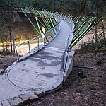
Blue Bridge (Cross Canyon Bridge) Blue Bridge, Reed College 2012.JPG 1992PedestrianReed LakePedestrians and bicycles 45°28′55″N122°37′49″W / 45.48184°N 122.63037°W / 45.48184; -122.63037
Bybee Bridge Bybee Bridge, Portland, OR, 2012.JPG 1911OverpassOR 99E.svg OR 99E (McLoughlin Boulevard)Bybee Boulevard 45°28′28″N122°38′24″W / 45.47439°N 122.63987°W / 45.47439; -122.63987
Cedar Crossing Bridge Cedar Crossing Bridge.jpg 1982Covered bridge60 feet (18 m) Johnson Creek Deardorff Road 45°28′19.3″N122°31′25.4″W / 45.472028°N 122.523722°W / 45.472028; -122.523722
Eastbank Esplanade EastbankEsplanade.jpg 2001Pedestrian1,200 feet (370 m)Bank of the eastside of the Willamette RiverPedestrians and bicycles
Ned Flanders Crossing Flanders Crossing in Portland, Oregon (2021).jpg 2021Pedestrian200 feet (61 m) I-5.svg Interstate 405 Pedestrians and bicycles 45°31′33″N122°41′12″W / 45.5257°N 122.6868°W / 45.5257; -122.6868
Gibbs Street Pedestrian Bridge West end of Gibbs St Pedestrian Bridge - Portland, Oregon.jpg 2012Pedestrian700 feet (210 m) I-5.svg Interstate 5 and SW Macadam AvenuePedestrians and bicycles 45°29′57″N122°40′23″W / 45.4993°N 122.673°W / 45.4993; -122.673
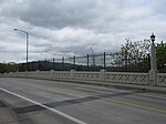
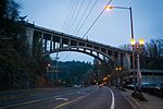
Vista Bridge (Vista Avenue Viaduct) Vista Avenue Bridge.jpg 1926*†Concrete arch248 feet (76 m) MAX Light Rail line and Jefferson Street/Canyon RoadVista Avenue 45°31′09″N122°41′52″W / 45.519097°N 122.697844°W / 45.519097; -122.697844
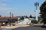
Barbara Walker Crossing Barbara Walker Crossing.jpg 2019Trichord truss180 feet (55 m) Burnside Street Pedestrians and bicycles 45°31′18″N122°43′10″W / 45.5216°N 122.7195°W / 45.5216; -122.7195

Former bridges

See also

Related Research Articles

Interstate 5 (I-5) is the main north–south Interstate Highway on the West Coast of the United States, running largely parallel to the Pacific coast of the contiguous U.S. from Mexico to Canada. It travels through the states of California, Oregon, and Washington, serving several large cities on the U.S. West Coast, including San Diego, Los Angeles, Sacramento, Portland, and Seattle. It is the only continuous Interstate highway to touch both the Mexican and the Canadian borders. Upon crossing the Mexican border at its southern terminus, I-5 continues to Tijuana, Baja California, as Mexico Federal Highway 1 (Fed. 1). Upon crossing the Canadian border at its northern terminus, it continues to Vancouver as British Columbia Highway 99 (BC 99).
Willamette River River in northwest Oregon

The Willamette River is a major tributary of the Columbia River, accounting for 12 to 15 percent of the Columbia's flow. The Willamette's main stem is 187 miles (301 km) long, lying entirely in northwestern Oregon in the United States. Flowing northward between the Oregon Coast Range and the Cascade Range, the river and its tributaries form the Willamette Valley, a basin that contains two-thirds of Oregon's population, including the state capital, Salem, and the state's largest city, Portland, which surrounds the Willamette's mouth at the Columbia.

Steel Bridge Bridge in Portland, Oregon

The Steel Bridge is a through truss, double-deck vertical-lift bridge across the Willamette River in Portland, Oregon, United States, opened in 1912. Its lower deck carries railroad and bicycle/pedestrian traffic, while the upper deck carries road traffic, and light rail (MAX), making the bridge one of the most multimodal in the world. It is the only double-deck bridge with independent lifts in the world and the second oldest vertical-lift bridge in North America, after the nearby Hawthorne Bridge. The bridge links the Rose Quarter and Lloyd District in the east to Old Town Chinatown neighborhood in the west.

Historic Columbia River Highway

The Historic Columbia River Highway is an approximately 75-mile-long (121 km) scenic highway in the U.S. state of Oregon between Troutdale and The Dalles, built through the Columbia River Gorge between 1913 and 1922. As the first planned scenic roadway in the United States, it has been recognized in numerous ways, including being listed on the National Register of Historic Places, being designated as a National Historic Landmark by the U.S. Secretary of the Interior, being designated as a National Historic Civil Engineering Landmark by the American Society of Civil Engineers, and being considered a "destination unto itself" as an All-American Road by the U.S. Secretary of Transportation. The historic roadway was bypassed by the present Columbia River Highway No. 2 from the 1930s to the 1950s, leaving behind the old two-lane road. The road is now mostly owned and maintained by the state through the Oregon Department of Transportation as the Historic Columbia River Highway No. 100 or the Oregon Parks and Recreation Department as the Historic Columbia River Highway State Trail.

St. Johns Bridge

The St. Johns Bridge is a steel suspension bridge that spans the Willamette River in Portland, Oregon, United States, between the Cathedral Park neighborhood in North Portland and the Linnton and Northwest Industrial neighborhoods in Northwest Portland. It carries the U.S. Route 30 Bypass. It is the only suspension bridge in the Willamette Valley and one of three public highway suspension bridges in Oregon.

Fremont Bridge (Portland, Oregon)

The Fremont Bridge is a steel tied-arch bridge over the Willamette River located in Portland, Oregon, United States. It carries Interstate 405 and US 30 traffic between downtown and North Portland where it intersects with Interstate 5. It has the longest main span of any bridge in Oregon and is the second longest tied-arch bridge in the world. The bridge was designed by Parsons, Brinckerhoff, Quade and Douglas, and built by Murphy Pacific Corporation.

Marquam Bridge Carries Interstate 5 traffic over the Willamette River in Portland, Oregon

The Marquam Bridge is a double-deck, steel-truss cantilever bridge that carries Interstate 5 traffic across the Willamette River south of downtown Portland, Oregon. It is the busiest bridge in Oregon, carrying 140,500 vehicles a day as of 2016. The upper deck carries northbound traffic; the lower deck carries southbound traffic.

Ross Island Bridge Bridge in Portland, Oregon

The Ross Island Bridge is a cantilever truss bridge that spans the Willamette River in Portland, Oregon. It carries U.S. Route 26 across the river between southwest and southeast Portland. The bridge opened in 1926 and was designed by Gustav Lindenthal and honors Oregon pioneer Sherry Ross. It is named for its proximity to Ross Island. Although it looks like a deck arch bridge, it is a cantilever deck truss bridge, a rare type in Oregon.

Interstate Bridge Highway bridge crossing the Columbia River between Portland, Oregon and Vancouver, Washington

The Interstate Bridge is a pair of nearly identical steel vertical-lift, "Parker type" through-truss bridges that carry Interstate 5 traffic over the Columbia River between Vancouver, Washington and Portland, Oregon in the United States.

Oregon City Bridge

The Oregon City Bridge, also known as the Arch Bridge, is a steel through arch bridge spanning the Willamette River between Oregon City and West Linn, Oregon, United States. Completed in 1922, it is listed on the National Register of Historic Places. It was built and is owned by the Oregon Department of Transportation (ODOT) as part of Oregon Route 43 and is the third-southernmost Willamette bridge in the Portland metropolitan area, after the Boone Bridge in Wilsonville and the Oregon 219 bridge near Newberg.

Oregon Route 99E Business is a business route through Salem, Oregon for Oregon Route 99E, which bypasses downtown via Interstate 5 (I-5). A portion of this highway was originally planned to be a freeway, signed as Interstate 305; however the proposed freeway was cancelled after community opposition.
Oregon Route 43 Highway in Oregon

Oregon Route 43 is an Oregon state highway that runs between the cities of Oregon City and Portland, mostly along the western flank of the Willamette River. While it is technically known by the Oregon Department of Transportation as the Oswego Highway No. 3, on maps it is referred to by its route number or by the various street names it has been given.
U.S. Route 30 in Oregon Highway in Oregon

In the U.S. state of Oregon, U.S. Route 30, a major east–west U.S. Highway, runs from its western terminus in Astoria to the Idaho border east of Ontario. West of Portland, US 30 generally follows the southern shore of the Columbia River; east of Portland the highway has largely been replaced with Interstate 84, though it is signed all the way across the state, and diverges from the I-84 mainline in several towns, as a de facto business route. Out of all the states U.S. Route 30 traverses, it spends the most time in Oregon. At 477 miles, it is also the longest road in the state.

Harbor Drive

Harbor Drive is a short roadway in Portland, Oregon, functioning mainly as a ramp to and from Interstate 5. It was once much longer, running along the western edge of the Willamette River in the downtown area. Most of the road was replaced with Tom McCall Waterfront Park in the 1970s. Signed as U.S. Route 99W, it had been the major route through the city and its removal is often cited as the first instance of freeway removal in the U.S. and as a milestone in urban planning.

Historic ferries in Oregon are water transport ferries that operated in Oregon Country, Oregon Territory, and the state of Oregon, United States. These ferries allowed people to cross bodies of water, mainly rivers such as the Willamette in the Willamette Valley, and the Columbia, in order to transport goods, move people, and further communications until permanent bridges were built to allow faster crossing of the water. The early ferries were used by wagons and pedestrians, while later ones transported trains and then automobiles. Oregon has a few automobile ferries still in operation.

Boone Bridge

Boone Bridge is a steel girder highway bridge over the Willamette River at Wilsonville, Oregon, in the United States. Built in 1954, it crosses the river to the Charbonneau section of Wilsonville, carrying Interstate 5 into the open Willamette Valley from the Portland metropolitan area. Maintained by the Oregon Department of Transportation, the 1,111-foot-long (339 m) bridge has three travel lanes in each direction. To the west is the site of the former Boone's Ferry, which the bridge replaced.

Burlington Northern Railroad Bridge 9.6 Railroad bridge crossing the Columbia River between Portland, Oregon and Vancouver, Washington

Burlington Northern Railroad Bridge 9.6 or BNSF Railway Bridge 9.6, also known as the Columbia River Railroad Bridge, is through truss railway bridge across the Columbia River, between Portland, Oregon, and Vancouver, Washington, owned and operated by BNSF Railway. Built by the Spokane, Portland and Seattle Railway (SP&S) and completed in 1908, it was the first bridge of any kind to be built across the lower Columbia River, preceding the first road bridge, the nearby Interstate Bridge, by a little more than eight years.

Interstate 5 (I-5) in the U.S. state of Oregon is a major Interstate Highway that traverses the state from north to south. It travels to the west of the Cascade Mountains, connecting Portland to Salem, Eugene, Medford, and other major cities in the Willamette Valley and across the northern Siskiyou Mountains. The highway runs 308 miles (496 km) from the California state line near Ashland to the Washington state line in northern Portland, forming the central part of Interstate 5's route between Mexico and Canada.

Interstate 84 (I-84) in the U.S. state of Oregon is a major Interstate Highway that traverses the state from west to east. It is concurrent with U.S. Route 30 (US 30) for most of its length and runs 376 miles (605 km) from an interchange with I-5 in Portland to the Idaho state line near Ontario. The highway roughly follows the Columbia River and historic Oregon Trail in northeastern Oregon, and is designated as part of Columbia River Highway No. 2 and all of the Old Oregon Trail Highway No. 6; the entire length is also designated as the Vietnam Veterans Memorial Highway. I-84 intersects several of the state's main north–south roads, including US 97, US 197, I-82, and US 395.

References

  1. Portland Historic Landmarks Commission (July 2014). "Historic Landmarks – Portland, Oregon" (XLS). City of Portland. Retrieved 2016-09-17.