Related Research Articles

The Old Red Sandstone is an assemblage of rocks in the North Atlantic region largely of Devonian age. It extends in the east across Great Britain, Ireland and Norway, and in the west along the northeastern seaboard of North America. It also extends northwards into Greenland and Svalbard. These areas were a part of the ancient continent of Euramerica/Laurussia. In Britain it is a lithostratigraphic unit to which stratigraphers accord supergroup status and which is of considerable importance to early paleontology. For convenience the short version of the term, ORS is often used in literature on the subject. The term was coined to distinguish the sequence from the younger New Red Sandstone which also occurs widely throughout Britain.

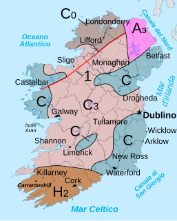
A geologic map or geological map is a special-purpose map made to show various geological features. Rock units or geologic strata are shown by color or symbols. Bedding planes and structural features such as faults, folds, are shown with strike and dip or trend and plunge symbols which give three-dimensional orientations features.

The Moine Thrust Belt or Moine Thrust Zone is a linear tectonic feature in the Scottish Highlands which runs from Loch Eriboll on the north coast 190 kilometres (120 mi) south-west to the Sleat peninsula on the Isle of Skye. The thrust belt consists of a series of thrust faults that branch off the Moine Thrust itself. Topographically, the belt marks a change from rugged, terraced mountains with steep sides sculptured from weathered igneous, sedimentary and metamorphic rocks in the west to an extensive landscape of rolling hills over a metamorphic rock base to the east. Mountains within the belt display complexly folded and faulted layers and the width of the main part of the zone varies up to 10 kilometres (6.2 mi), although it is significantly wider on Skye.
Ordnance Survey Ireland is the national mapping agency of Ireland. It was established on 4 March 2002 as a body corporate. It is the successor to the former Ordnance Survey of Ireland. It and the Ordnance Survey of Northern Ireland (OSNI) are the ultimate successors to the Irish operations of the British Ordnance Survey. OSI is part of the Irish public service. OSI has made modern and historic maps of the state free to view on its website. OSI is headquartered at Mountjoy House in the Phoenix Park in Dublin. Mountjoy House was also the headquarters, until 1922, of the Irish section of the British Ordnance Survey.

In geology, a mélange is a large-scale breccia, a mappable body of rock characterized by a lack of continuous bedding and the inclusion of fragments of rock of all sizes, contained in a fine-grained deformed matrix. The mélange typically consists of a jumble of large blocks of varied lithologies. Both tectonic and sedimentary processes can form mélange.

Ordnance Survey (OS) is the national mapping agency for Great Britain. The agency's name indicates its original military purpose, which was to map Scotland in the wake of the Jacobite rising of 1745. There was also a more general and nationwide need in light of the potential threat of invasion during the Napoleonic Wars. Since 1 April 2015 Ordnance Survey has operated as Ordnance Survey Ltd, a government-owned company, 100% in public ownership. The Ordnance Survey Board remains accountable to the Secretary of State for Business, Energy and Industrial Strategy. It was also a member of the Public Data Group.
The geological structure of Great Britain is complex, resulting as it does from a long and varied geological history spanning more than two billion years. This piece of the Earth's crust has experienced several episodes of mountain building or 'orogenies', each of which has added further complexity to the picture.
Orlock Bridge Fault is a major geological fault which extends through County Armagh, Northern Ireland and across the North Channel into Galloway in southern Scotland.
Clogher Valley Fault is a geological fault in County Fermanagh, Northern Ireland. The focus of deformation during the Variscan Orogenic Cycle in Northern Ireland was located on, and between, two major faults. In the north is the northern-bounding fault of the Midland Valley Terrane, the Castle Archdale Fault-Omagh Thrust Fault zone, while in the south is the Clogher Valley Fault. Carboniferous rocks located between these faults were affected by strike-slip, associated with intermittent dextral transpression and transtension. Between the Clogher Valley Fault and the Southern Upland Fault, the southern bounding fault of the Midland Valley Terrane, the Carboniferous rocks are relatively undeformed.
The Omagh Thrust Fault is a geological fault in County Tyrone. It is of one of the most important structural discontinuities in Northern Ireland and an extension of the Highland Boundary Fault which runs through Scotland.

The Sherwood Sandstone Group is a Triassic lithostratigraphic group which is widespread in Britain, especially in the English Midlands. The name is derived from Sherwood Forest in Nottinghamshire which is underlain by rocks of this age. It has economic importance as the reservoir of the Morecambe Bay gas field, the second largest gas field in the UK.

The Exmoor Group is a late Devonian to early Carboniferous lithostratigraphic group in southwest England whose outcrop extends from Croyde in north Devon east across Exmoor to Minehead in west Somerset. The group comprises the following formations the:
The 1892 Vacaville–Winters earthquakes occurred in northern California as a large doublet on April 19 and April 21. Measured on a seismic scale that is based on an isoseismal map or the event's felt area, the 6.4 Mla and 6.2 Mla events were assigned a maximum Mercalli intensity of IX (Violent), and affected the North Bay and Central Valley areas. The total damage was estimated to be between $225,000 and 250,000 and one person was killed. No evidence of fault movement on the surface of the ground was observed as a result of either of the strong shocks. Both occurred in the domain of the San Andreas strike-slip system of faults, but their focal mechanism is uncertain.

The Highlands controversy was a scientific controversy which started between British geologists in the middle of the nineteenth century concerning the nature of the rock strata in the Northwest Highlands of Scotland. The debate became contentious, even acrimonious, because of some of the personalities involved and because it pitted professional geologists of the Geological Survey against academic and amateur geologists. An initial resolution was achieved by about 1886 but the great complexity and scientific importance of the discovery of the Moine Thrust Belt and the geological processes involved in its creation led to field work continuing for a further twenty years culminating in the 1907 publication by the Geological Survey of a book of fundamental geological significance: The Geological Structure of the North-West Highlands of Scotland.
References
- Map sheet 44 (and accompanying memoir) of the series of 1:50,000 scale geological maps of Northern Ireland published by Geological Survey of Northern Ireland.
- Lyle, P. 2003 Classic geology in Europe 5 The north of Ireland Terra Publishing, Harpenden
- ↑ Geological Survey of Northern Ireland 1997 Northern Ireland. Solid Geology (2nd edn) 1:250,000 (Keyworth, Nottingham; British Geological Survey).
