List of places named after Cesar Chavez

Last updated

Cesar Chavez Street sign in Austin, TX Cesar Chavez Street sign in Austin, TXIMG 6250.JPG
Cesar Chavez Street sign in Austin, TX

The following is a list of places named after Cesar Chavez, an American labor leader and civil rights activist:

Contents

Communities

Texas

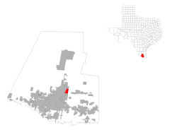
Cesar Chavez, Texas Hidalgo County CesarChavez.svg
Cesar Chavez, Texas

Parks

Cesar Chavez Park - Berkeley, California Berkeley Kite Festival - Flickr - GregTheBusker.jpg
César Chávez Park - Berkeley, California

Arizona

California

Plaza de Cesar Chavez, San Jose Downtown san jose south market st (cropped).jpg
Plaza de César Chávez, San Jose

Colorado

Nevada

Washington

Major streets

Arizona

California

Idaho

New Mexico

Michigan

Minnesota

Missouri

Oregon

Laurelhurst gates at Chavez and Stark - Portland Oregon Laurelhurst gates Chavez x Stark - Portland Oregon.jpg
Laurelhurst gates at Chavez and Stark - Portland Oregon

Texas

Utah

Wisconsin

Libraries

Perris library Perris library 2 wide view.jpg
Perris library

Arizona

California

Cesar Chavez Library- 2100 Moorpark Ave., San Jose, CA 95128 [10]

Michigan

K-12 schools

Arizona

California

Colorado

Illinois

Maryland

Minnesota

Michigan

New Mexico

Ohio

Oklahoma

Oregon

Texas

Chavez High School ChavezHighSchoolHouston.JPG
Chávez High School

Washington, D.C.

Wisconsin

Post-secondary schools

Arizona

California

Cesar Chavez Student Center Cesar Chavez Student Center.jpg
Cesar Chavez Student Center

Colorado

Michigan

New York

Former places

Post-secondary schools

Oregon

Related Research Articles

<span class="mw-page-title-main">West Hills, Los Angeles</span> Neighborhood in Los Angeles, California, United States

West Hills is a neighborhood in the western San Fernando Valley region of the city of Los Angeles, California. It is bordered by mountain ranges to the west and the Los Angeles neighborhoods of Chatsworth to the north, Canoga Park to the east, and Woodland Hills to the south.

The State Scenic Highway System in the U.S. state of California is a list of highways, mainly state highways, that have been designated by the California Department of Transportation (Caltrans) as scenic highways. They are marked by the state flower, a California poppy, inside either a rectangle for state-maintained highways or a pentagon for county highways.

<span class="mw-page-title-main">Rockridge, Oakland, California</span> Neighborhood of Oakland in Alameda County, California, US

Rockridge is a residential neighborhood and commercial district in Oakland, California. Rockridge is generally defined as the area east of Telegraph Avenue, south of the Berkeley city limits, west of the Oakland hills and north of the intersection of Pleasant Valley Avenue/51st Street and Broadway. Rockridge was listed by Money Magazine in 2002 as one of the "best places to live".

The western border of Santa Monica, California, is the 3-mile (4.8 km) stretch of Santa Monica Bay. On its other sides, the city is bordered by various districts of Los Angeles: the northwestern border is Pacific Palisades, the eastern border is Brentwood north of Wilshire Boulevard and West Los Angeles south of Wilshire, the northeastern border is generally San Vicente Boulevard up to the Riviera Country Club, the southwestern border is Venice Beach and the southern border is with West Los Angeles and Mar Vista.

<span class="mw-page-title-main">Clairemont, San Diego</span> Community of San Diego in California

Clairemont is a community in San Diego, California, United States. It has a population of about 81,600 residents and an area of roughly 13.3 square miles (34 km2). Clairemont is bordered by Interstate 805 on the east, Interstate 5 to the west, State Route 52 to the north, and the community of Linda Vista to the south. The community of Clairemont can be subdivided into the neighborhoods of North Clairemont, Clairemont Mesa East, Clairemont Mesa West, Bay Park, and Bay Ho.

<span class="mw-page-title-main">Southeast San Diego</span> Community of San Diego in California

Southeast San Diego refers to the southeastern portion of San Diego, including the neighborhoods south of State Route 94 and east of downtown San Diego. Southeast San Diego has no official definition, but it may be considered coterminous with three official planning areas: Skyline-Paradise Hills, Chollas Valley, and Southeastern.

<span class="mw-page-title-main">Strengthen the Arm of Liberty</span> Historical event

Strengthen the Arm of Liberty is the theme of the Boy Scouts of America's fortieth anniversary celebration in 1950. The campaign was inaugurated in 1949 with a dramatic ceremony held at the base of the Statue of Liberty. Approximately 200 BSA Statue of Liberty replicas were installed across the United States.

Cesar Chavez (1927–1993) was an American farm worker, labor leader, and civil rights activist.

References

  1. "Art honors works of César Chávez". UNION TRIBUNE. 2006-03-23.
  2. "Cesar Chavez Park". www.seattle.gov. Retrieved 2019-03-31.
  3. "Grand Rapids Feb. 22 ceremony to dedicate Cesar E. Chavez and Martin Luther King Jr. streets". mlive. 2022-02-21. Retrieved 2022-03-02.
  4. http://www.katu.com/news/50242262.html.{{cite web}}: Missing or empty |title= (help)
  5. "West Valley City votes to name street after Cesar Chavez".
  6. "LA County Library".
  7. "César E. Chávez Branch | Oakland Public Library".
  8. "Hours/Locations - Salinas Public Library". Archived from the original on 2006-08-23.
  9. http://www.stockton.lib.ca.us/chavez.html.{{cite web}}: Missing or empty |title= (help)
  10. "Library".
  11. "Cesar E. Chavez | MSU Libraries".
  12. "Cesar Chavez School / Homepage".
  13. "LTSB Geographic Information Services".
  14. "César Chávez Cultural Center".
  15. "César Chávez Cultural Lounge University of Michigan Housing". University Housing. Retrieved 2019-10-19.