Related Research Articles

Central Aroostook is an unorganized territory in Aroostook County, Maine, United States. The population was 164 at the 2020 census.

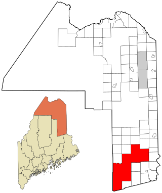
Connor is an unorganized territory (township) in Aroostook County, Maine, United States. The population was 418 at the 2020 census. It is the location of a former Nike missile site and the Blotner Radar Site.

Northwest Aroostook is an unorganized territory in Aroostook County, Maine, United States. The population was 12 at the 2020 census.
South Aroostook is an unorganized territory in Aroostook County, Maine, United States. The population was 579 at the 2020 census.

Square Lake is an unorganized territory in Aroostook County, Maine, United States. The population was 706 at the 2020 census.
Wyman is an unorganized territory in Franklin County, Maine, United States. The population was 82 at the 2020 census. It is designated as Township 4 Range 3 of Bingham's Kennebec Purchase.
Central Hancock, also known as Fletchers Landing, is an unorganized territory (township) in Hancock County, Maine, United States. The population was 132 at the 2020 census. The territory is designated as Township 8 Southern Division.
Milton is an unorganized territory (township) in Oxford County, Maine, United States. The population was 150 at the 2020 census. The township was formerly a plantation that surrendered its organization in 1939.

South Oxford is an unorganized territory located in Oxford County, Maine, United States. The population was 591 at the 2020 census. The unorganized territory encompasses the areas designated under state law as Albany Township, Mason Township, and Batchelder's Grant. Albany and Mason were formerly incorporated as towns. Albany disincorporated in 1937 while Mason disincorporated in 1935.
North Penobscot is an unorganized territory in Penobscot County, Maine, United States. The population was 405 at the 2020 census.
Prentiss is an unorganized territory (township) in Penobscot County, Maine, United States. The township was named for Henry Prentiss, an early landowner. The population was 169 at the 2020 census.
Twombly Ridge is an unorganized territory (township) located in Penobscot County, Maine, United States. At the 2020 census, the unorganized territory had a total population of 0.
Whitney is an unorganized territory in Penobscot County, Maine, United States. It is designated as Township 5 Range 1 of the North of Bingham's Penobscot Purchase. The population was 6 at the 2020 census. T5 R1 NBPP is also known as Pukakon Township.

Northeast Piscataquis is an unincorporated area in Piscataquis County, Maine, United States. The population was 304 at the 2020 census.
Northeast Somerset is an unorganized territory in Somerset County, Maine, United States. The population was 367 at the 2020 census.
Seboomook Lake is an unorganized territory in Somerset County, Maine, United States. The population was 23 at the 2020 census.
East Central Washington is an unorganized territory in Washington County, Maine, United States. The population was 724 at the 2020 census.

Unity is an unincorporated territory (township) in Kennebec County, Maine, United States. The population was 36 at the 2020 census. The township was a former plantation that surrendered its organization in 1942.
A minor civil division (MCD) is a term used by the United States Census Bureau for primary governmental and/or administrative divisions of a county or county-equivalent, typically a municipal government such as a city, town, or civil township. MCDs are used for statistical purposes by the Census Bureau, and do not necessarily represent the primary form of local government. They range from non-governing geographical survey areas to municipalities with weak or strong powers of self-government. Some states with large unincorporated areas give substantial powers to counties; others have smaller or larger incorporated entities with governmental powers that are smaller than the MCD level chosen by the Census.

The town is the basic unit of local government and local division of state authority in the six New England states. Most other U.S. states lack a direct counterpart to the New England town. New England towns overlay the entire area of a state, similar to civil townships in other states where they exist, but they are fully functioning municipal corporations, possessing powers similar to cities and counties in other states. New Jersey's system of equally powerful townships, boroughs, towns, and cities is the system which is most similar to that of New England. New England towns are often governed by a town meeting legislative body. The great majority of municipal corporations in New England are based on the town model; there, statutory forms based on the concept of a compact populated place are uncommon, though elsewhere in the U.S. they are prevalent. County government in New England states is typically weak at best, and in some states nonexistent. Connecticut, for example, has no county governments, nor does Rhode Island. Both of those states retain counties only as geographic subdivisions with no governmental authority, while Massachusetts has abolished eight of fourteen county governments so far. Counties serve mostly as dividing lines for the states' judicial systems and some other state services in the southern New England states, while providing varying services in the more sparsely populated three northern New England states.
References
- ↑ "Unorganized Territory". Maine Revenue Services.
- 1 2 "Maine Town and Townships Boundary Polygons Dissolved Feature". State of Maine. June 19, 2023.
- 1 2 3 "TIGER/Line® Shapefiles: County Subdivisions". U.S. Census Bureau. 2022.
- ↑ "Historical deorganizations by year" (PDF). Office of the State Auditor, State of Maine. 2023.
- ↑ "2020 Census". U.S. Census Bureau.
- ↑ "TIGER/Line® Shapefiles: Water". U.S. Census Bureau. 2022.
- ↑ "LUPC Digital Maps and Data". Maine Department of Agriculture, Conservation & Forestry.