Hibberts Gore, Maine

Last updated
Hibberts Gore, Maine
Gore of Hibberts Gore
Nickname(s): 
Hibberts, Hibbert's Gore, [1] Township of Hibberts Gore, [1] Unorganized Territory of Hibberts Gore [1]
Lincoln County Maine incorporated and unincorporated areas Hibberts Gore highlighted.svg
Location in Lincoln County and the state of Maine.
Map of USA ME.svg
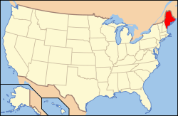
Maine's location in the United States.
Coordinates: 44°19′33″N69°25′39″W / 44.32583°N 69.42750°W / 44.32583; -69.42750
Country Flag of the United States.svg United States
State Flag of Maine.svg Maine
U.S. Congressional District ME-1
County Lincoln
Area
  Total1.95 km2 (0.752 sq mi)
  Land1.93 km2 (0.745 [2]  sq mi)
  Water0.02 km2 (0.007 [2]  sq mi)
Elevation
91 m (299 [1]  ft)
Population
 (2020)
  Total1
  Density0.5/km2 (1/sq mi)
Time zone UTC-5 (Eastern (EST))
  Summer (DST) UTC-4 (Eastern Daylight (EDT))
ZIP codes
Area code 207
GNIS feature ID582518 [1]
FIPS code 23-015-32715 [4]
Waterways Crummett Brook [5]

Hibberts Gore (also called Hibberts) is a gore in Lincoln County, Maine, United States. The gore's population was one as of the 2020 United States census. [6]

Contents

History

Ignored by the surveyors who mapped Maine, it is one of many locales in Maine that remained unincorporated as most of the rest of the state was divided into cities, towns, and plantations.

Demographics

Historical population
CensusPop.Note
1940 1
1950 10.0%
1980 2
1990 1−50.0%
2000 10.0%
2010 10.0%
2020 10.0%
U.S. Decennial Census [7]

As of the Census of 2020, there were 1 person, 1 household, and 0 families in Hibberts Gore.

See also

Related Research Articles

<span class="mw-page-title-main">Churchill County, Nevada</span> County in Nevada, United States

Churchill County is a county in the western U.S. state of Nevada. As of the 2020 census, the population was 25,516. Its county seat is Fallon. Named for Mexican–American War hero brevet Brigadier General Sylvester Churchill, the county was formed in 1861. Churchill County comprises the Fallon, NV Micropolitan Statistical Area. It is in northwestern Nevada. Churchill County is noteworthy in that it owns and operates the local telephone carrier, Churchill County Communications.

<span class="mw-page-title-main">Lincoln County, Maine</span> County in Maine, United States

Lincoln County is a county located in the U.S. state of Maine. As of the 2020 census, the population was 35,237. Its seat is Wiscasset. The county was founded in 1760 by the Massachusetts General Court from a portion of York County, Massachusetts and named after the English city Lincoln, the birthplace of Massachusetts Bay Provincial Governor Thomas Pownall.

<span class="mw-page-title-main">Benewah County, Idaho</span> County in Idaho, United States

Benewah County is a county located in the northwest part of the U.S. state of Idaho. As of the 2020 United States Census the county had a population of 9,530. The county seat and largest city is St. Maries, which has some area inside the Coeur d'Alene Reservation.

<span class="mw-page-title-main">Cyr Plantation, Maine</span> Plantation in Maine, United States

Cyr Plantation is a plantation in Aroostook County, Maine, United States. The population was 78 at the 2020 census.

<span class="mw-page-title-main">Bangor Township, Bay County, Michigan</span> Charter township in Michigan, United States

Bangor Charter Township is a charter township in Bay County in the U.S. state of Michigan. The township's population was 14,045 as of the 2020 Census and is included in the Bay City Metropolitan Statistical Area.

<span class="mw-page-title-main">Allouez Township, Michigan</span> Civil township in Michigan, United States

Allouez Township is a civil township of Keweenaw County in the U.S. state of Michigan. The population was 1,428 at the 2020 census.

<span class="mw-page-title-main">Chesterfield Township, Michigan</span> Charter township in Michigan, United States

Chesterfield Charter Township is a charter township of Macomb County in the U.S. state of Michigan. As of the 2020 census the population was 45,376.

<span class="mw-page-title-main">Skandia Township, Michigan</span> Civil township in Michigan, United States

Skandia Township is a civil township of Marquette County in the U.S. state of Michigan. The 2020 census recorded a population of 810 people. The township contains the Dukes Research Natural Area, a National Natural Landmark.

<span class="mw-page-title-main">Maybee, Michigan</span> Village in Michigan, United States

Maybee is a village in Monroe County in the U.S. state of Michigan. The population was 545 at the 2020 census. The village is located within Exeter Township. Maybee was established in 1873 and incorporated as a village in 1899.

<span class="mw-page-title-main">Monowi, Nebraska</span> Incorporated American community with a total population of one

Monowi is an incorporated village in Boyd County, Nebraska, United States. It garnered national and international recognition after the 2010 United States census counted only one resident of the village, Elsie Eiler. Though the 2020 census listed Monowi's population as two, this was confirmed to be an example of differential privacy in the census data; Eiler remains the town's sole resident.

<span class="mw-page-title-main">Boggs Township, Armstrong County, Pennsylvania</span> Township in Pennsylvania, United States

Boggs Township is a township in Armstrong County, Pennsylvania, United States. The population was 813 at the 2020 census, a decrease from the figure of 936 tabulated in 2010.

<span class="mw-page-title-main">Cowanshannock Township, Armstrong County, Pennsylvania</span> Township in Pennsylvania, United States

Cowanshannock Township is a township in Armstrong County, Pennsylvania, United States. The population was 2,742 at the 2020 census, a decrease from the figure of 2,899 tabulated in 2010.

<span class="mw-page-title-main">Mahoning Township, Armstrong County, Pennsylvania</span> Township in Pennsylvania, United States

Mahoning Township is a township in Armstrong County, Pennsylvania, United States. The population was 1,406 at the 2020 census, a decrease from 1,425 at the 2010 census.

<span class="mw-page-title-main">Washington Township, Armstrong County, Pennsylvania</span> Township in Pennsylvania, United States

Washington Township is a township in Armstrong County, Pennsylvania, United States. The population was 898 at the 2020 census, a decrease from 923 at the 2010 census.

<span class="mw-page-title-main">Preston Township, Pennsylvania</span> Second-class township in Pennsylvania, United States

Preston is a second-class township in Wayne County, Pennsylvania, United States. The township's population was 1,014 at the time of the 2010 United States Census.

<span class="mw-page-title-main">Village of Maine, Wisconsin</span> Village in Wisconsin, United States

Maine is an incorporated village in Marathon County, Wisconsin, United States. It is part of the Wausau, Wisconsin Metropolitan Statistical Area. The population was 2,337 at the 2010 census. The unincorporated communities of Mount View and Taegesville are located partially in the town.

<span class="mw-page-title-main">Connor, Maine</span> Unorganized territory in Maine, United States

Connor is an unorganized territory (township) in Aroostook County, Maine, United States. The population was 418 at the 2020 census. It is the location of a former Nike missile site and the Blotner Radar Site.

Nekoma is an unincorporated community in Weller Township, Henry County, Illinois, United States.

Nesco is an unincorporated community and census-designated place (CDP) located in Mullica Township, Atlantic County, in the U.S. state of New Jersey.

<span class="mw-page-title-main">Arivaca Junction, Arizona</span> CDP in Pima County, Arizona

Arivaca Junction is a census-designated place (CDP) in Pima County, Arizona, United States. The population was 1,090 at the 2010 census. As of July 1, 2015, it had an estimated population of 1,065. Arivaca Junction has an estimated elevation of 3,140 feet (960 m) above sea level.

References

  1. 1 2 3 4 5 "Hibberts Gore". Geographic Names Information System . United States Geological Survey, United States Department of the Interior. 1 September 1995. Retrieved 22 June 2015.
  2. 1 2 2010 Census National County Subdivisions Gazetteer Files for Maine (Report). U.S. Department of Commerce. 2010. Retrieved 22 June 2015.
  3. "US Postal Code Boundaries". Google. Google Maps. 3 February 2014. Retrieved 22 June 2015.
  4. U.S. Census Bureau. Census 2000. "Census Demographic Profiles, Hibberts Gore" (PDF). CenStats Databases. Retrieved 22 June 2015.{{cite web}}: CS1 maint: numeric names: authors list (link)[ dead link ]
  5. "Crummett Brook". Geographic Names Information System. United States Geological Survey. 30 September 1980. Retrieved 22 June 2015.
  6. "Explore Census Data". data.census.gov. Retrieved 2024-03-25.
  7. "Census of Population and Housing". Census.gov. Retrieved June 4, 2015.