
The Fraser River is the longest river within British Columbia, Canada, rising at Fraser Pass near Blackrock Mountain in the Rocky Mountains and flowing for 1,375 kilometres (854 mi), into the Strait of Georgia at the city of Vancouver. It is the 11th longest river in Canada. The river's annual discharge at its mouth is 112 cubic kilometres (27 cu mi) or 3,550 cubic metres per second (125,000 cu ft/s), and it discharges 20 million tons of sediment into the ocean.

The South Saskatchewan River is a major river in Canada that flows through the provinces of Alberta and Saskatchewan.

The Peace River is a 1,923-kilometre-long (1,195 mi) river in Canada that originates in the Rocky Mountains of northern British Columbia and flows to the northeast through northern Alberta. The Peace River joins the Athabasca River in the Peace-Athabasca Delta to form the Slave River, a tributary of the Mackenzie River. The Finlay River, the main headwater of the Peace River, is regarded as the ultimate source of the Mackenzie River. The combined Finlay–Peace–Slave–Mackenzie river system is the 13th longest river system in the world.

Valleyview is a town in northwest Alberta, Canada within the Municipal District of Greenview No. 16 and Census Division No. 18.

The Sturgeon River is a 260 km-long river located in central Alberta, Canada. It is a major tributary of the North Saskatchewan River. The stream crosses Sturgeon County, which was named for this river.

The North Saskatchewan River is a glacier-fed river that flows from the Canadian Rockies continental divide east to central Saskatchewan, where it joins with the South Saskatchewan River to make up the Saskatchewan River. Its water flows eventually into the Hudson Bay.

The Municipal District of Greenview No. 16 is a municipal district in northwest Alberta, Canada.

The Hay River is a large river in northern Alberta and southern Northwest Territories, Canada.

The Pembina River is a tributary of the Athabasca River in central Alberta, Canada.

The Smoky River is a river in western Alberta, Canada. It is a major tributary of the Peace River. The descriptive name refers to the presence of "smouldering beds of coal in the riverbank" noted by the Cree Indians.
The Lesser Slave River is a river in central Alberta, Canada. It is a major tributary of the Athabasca River.

The Wapiti River is a river in eastern British Columbia and western Alberta, Canada. It is a major tributary of the Smoky River, located in the southern area of the Peace River Basin.

Sturgeon Lake is a lake in north-western Alberta, Canada. It has a total area of 49.1 km2 (19.0 sq mi) and a maximum depth of 9.5 m (31 ft). It is located in the hydrographic basin of the Little Smoky River at an elevation of 685 m, 20 km west of the town of Valleyview, along Highway 43.

The Cadomin Formation is a stratigraphic unit of Early Cretaceous age in the western part of the Western Canada Sedimentary Basin. It is extends from southeastern British Columbia through western Alberta to northeastern British Columbia, and it contains significant reservoirs of natural gas in some areas. It was named after the mining town of Cadomin, which is an acronym of "Canadian Dominion Mining".
Gething Formation is a stratigraphic unit of Lower Cretaceous (Aptian) age in the Western Canada Sedimentary Basin. It is present in northeastern British Columbia and western Alberta, and includes economically important coal deposits.

The Smoky Group is a stratigraphical unit of Late Cretaceous age in the Western Canadian Sedimentary Basin.
The Alberta Group is a stratigraphical unit of Cenomanian to early Campanian age in the Lewis overthrust in the Western Canadian Sedimentary Basin.

The Muskiki Formation is a stratigraphical unit of Late Cretaceous age in the Western Canadian Sedimentary Basin.
The Puskwaskau River is a short river in Northern Alberta, Canada. It is a tributary of the Smoky River flowing westwards in the Peace River Country. Its waters flow through the Smoky River, Peace River, Slave River, Great Slave Lake and Mackenzie River into the Arctic Ocean.
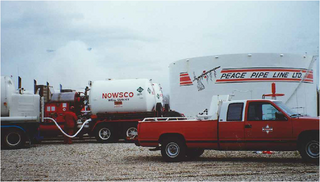
Peace Pipe Line Ltd. was a pipeline company that operated in the Canadian provinces of Alberta and British Columbia. The pipeline's headquarters were in Calgary, Alberta, with division offices in Valleyview, Alberta, Grande Prairie, Alberta, Whitecourt, Alberta and Dawson Creek, BC and the control centre was located in Edmonton, Alberta. The Peace Pipe Line, its subsidiaries; Pouce Coupe and Plateau, were in part, predecessors of today's Pembina Pipeline Corporation.


