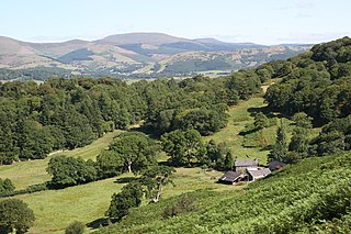
Ceredigion ( ), historically Cardiganshire, is a county in the west of Wales. It borders Gwynedd across the Dyfi estuary to the north, Powys to the east, Carmarthenshire and Pembrokeshire to the south, and the Irish Sea to the west. Aberystwyth is the largest settlement and, together with Aberaeron, is an administrative centre of Ceredigion County Council.

Tregaron is an ancient market town in Ceredigion, Wales. It is sited astride the River Brenig, a tributary of the River Teifi, and is 11 miles (18 km) north-east of Lampeter. According to the 2011 Census, the population of the ward of Tregaron was 1,213 and 67% of the population could speak Welsh; Tregaron is a community covering 33 square miles (85 km2); two-thirds of the population were born in Wales.

Ystrad Meurig is a village and community in Ceredigion, Wales. It lies on the B4340 road northwest of the town of Tregaron, on the edge of the Cambrian Mountains.

Comins Coch is a small village in Ceredigion, Wales, to the northeast of Aberystwyth. The village is covered by Faenor community/parish council.

Llanbadarn Fawr is a village and community in Ceredigion, Wales. It is on the outskirts of Aberystwyth next to Penparcau and Southgate. It forms the eastern part of the continually built-up area of Aberystwyth. It holds two electoral wards, Padarn and Sulien which elect a Ceredigion County Councillor each and several Llanbadarn Fawr Community Councillors. At the 2001 census its population as a community was recorded at 2,899, increasing to 3,380 at the 2011 census.

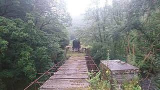
The Carmarthen–Aberystwyth line was originally a standard-gauge branch line of the Great Western Railway (GWR) in Wales, connecting Carmarthen and Aberystwyth.

Llanafan Fawr is a village and community and ecclesiastical parish in Powys, Wales. Located in the former cantref of Buellt (Builth) and historic county of Brecknockshire, the community includes the former parish of Llanfihangel Bryn Pabuan.

Cors Caron is a raised bog in Ceredigion, Wales. Cors is the Welsh word for "bog". Cors Caron covers an area of approximately 349 hectares. Cors Caron represents the most intact surviving example of a raised bog landscape in the United Kingdom. About 44 different species groups inhabit the area including various land and aquatic plants, fish, insects, crustaceans, lichen, fungi, terrestrial mammals and birds.

Afan of Builth was an early 6th-century Welsh bishop, martyr, and saint. His feast day is generally placed on 17 November, although the Demetian Calendar formerly used in southern Wales placed it on the 16th; it is no longer observed by either the Anglican or Catholic church in Wales.
Llan and its variants are a common element of Celtic placenames in the British Isles and Brittany, especially of Welsh toponymy. In Welsh the name of a local saint or a geomorphological description follows the Llan morpheme to form a single word: for example Llanfair is the parish or settlement around the church of St. Mair. Goidelic toponyms end in -lann.

Trawsgoed is both a community and an estate in Ceredigion, Wales. The estate is 8 miles (13 km) southeast of Aberystwyth, and has been in the possession of the Vaughan family since 1200. The Vaughans are descended from Collwyn ap Tangno, founder of the fifth noble tribe of North Wales, Lord of Eifionydd, Ardudwy, and part of Llŷn, who had his residence on the site of Harlech Castle.
Edward Vaughan was a Welsh lawyer and politician who sat in the House of Commons from 1679 to 1681.

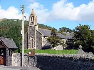
Saint Afan's Church (SN68387192) is located in Llanafan, 8 miles (13 km) east of Aberystwyth, Ceredigion, in Wales.
The first election to the Cardiganshre County Council was held in January 1889. It was followed by the 1892 election. The county was divided into numerous single member wards with two councillors elected to represent Cardigan, Lampeter, New Quay and Llandysul, and four to represent the town of Aberystwyth. 37 Liberals, 10 Conservatives and 1 Unionist were returned.

Trefeurig is a community in Ceredigion, Wales, situated around 4 miles (6.4 km) north-east of Aberystwyth. It is a site of particular prehistoric, Roman, and Iron Age interest, and has a long history as a mining area. In 2011 the local population was estimated at 1,771 people.
Ceredigion District Council was one of six district-level authorities in the county of Dyfed, Wales, from 1974 until 1996. The district had an identical area to the pre-1974 administrative county of Cardiganshire. From its creation in 1974 the district used the name "Ceredigion" rather than "Cardiganshire", which had been used for the former county council. Further local government reorganisation in 1996 saw Dyfed County Council abolished and Ceredigion become a unitary authority, with the district council taking over county-level services to become Ceredigion County Council.

Llanfechan is a small church settlement in the community of Treflys, consisting of a church and a farm, and the surrounding area, it is beside the A483 on the north side of the Irfon Valley near Cilmeri, about 7 kilometers (4.3 mi) west of Builth Wells, Powys, Wales.

The 2022 Ceredigion County Council election took place as of 5 May 2022 to elect 38 members to Ceredigion Council. On the same day, elections were held to the other 21 local authorities and to community councils in Wales as part of the 2022 Welsh local elections. The previous all-council election took place in May 2017 and future elections will take place every five years.

Ceredigion is a county in the west of Wales. It covers an area of 1,785 km2 (689 sq mi) and in 2021 the population was approximately 70,700.


