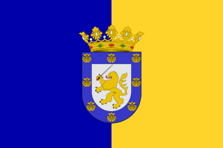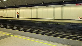
Santiago, also known as Santiago de Chile, is the capital and largest city of Chile as well as one of the largest cities in the Americas. It is the center of Chile's most densely populated region, the Santiago Metropolitan Region, whose total population is 8 million, of which more than 6 million live in the city's continuous urban area. The city is entirely in the country's central valley. Most of the city lies between 500–650 m (1,640–2,133 ft) above mean sea level.

Sanhattan, a portmanteau of Santiago and Manhattan, is the popular ironic sobriquet given to Chile's capital Santiago's high-end financial district. It is located to the northeast of the capital, in the western end of the Las Condes commune between the Mapocho River and the Américo Vespucio avenue, in the barrios known as El Bosque Norte and El Golf. The main street crossing Sanhattan is Avenida Apoquindo. A narrower definition puts Sanhattan between Andrés Bello and Vitacura avenues, from their intersection down to Nueva Los Leones avenue.

Apoquindo is the name of a river and pre-Columbian settlement located east of the city of Santiago de Chile, at the foot of the foothills, in the present town of Las Condes. This settlement later became known as the Pueblo de Indios in place names Apoquindo and transferred to an estate, the Mount Apoquindo, the Apoquindo Waterfall, the Apoquindo Avenue, to the district San Carlos de Apoquindo, the Apoquindo College and other geographical landmarks and urban community.

Apoquindo Avenue is a major thoroughfare in Santiago, Chile. It extends 6.17 km (3.83 mi) through the commune of Las Condes.

Escuela Militar is an underground metro station on the Line 1 of the Santiago Metro, in Santiago, Chile. It is located beneath the cloverleaf-like interchange of Apoquindo Avenue and Américo Vespucio Avenue. The station was opened on 22 August 1980 as part of the extension of the line from Salvador to Escuela Militar. It remained the eastern terminus of the Line 1 until 7 January 2010, when the line was extended to Los Dominicos, and is named for the nearby Escuela Militar del Libertador Bernardo O'Higgins.

Manquehue is an underground metro station on the Line 1 of the Santiago Metro, in Santiago, Chile. It is part of the 3.8 kilometres (2.4 mi) eastern extension of the Line 1. The station was opened on 7 January 2010 as part of the extension of the line from Escuela Militar to Los Dominicos,

Hernando de Magallanes is an underground metro station on the Line 1 of the Santiago Metro, in Santiago, Chile. The station entrance kiosk is on Monsignor Manuel Larraín Square, which was altered due to the construction of the station.

Irarrázaval is a transfer station between the Line 3 and Line 5 of the Santiago Metro. The station is so named due to its location beneath Avenida Irarrázaval, a main road of the commune of Ñuñoa, which in turn was named after the Chilean lawyer and politician Manuel José Yrarrázaval Larraín. The Line 5 station was opened on 5 April 1997 as part of the inaugural section of the line, from Baquedano to Bellavista de La Florida. The Line 3 station was opened on 22 January 2019 as part of the inaugural section of the line, from Los Libertadores to Fernando Castillo Velasco. Construction of the 6.5 km tunnel between Irarrázaval and Fernando Castillo Velasco was completed in 2017 on a budget of 145 million euro.

Santiago Metro Line 1 is the oldest of the seven existing rapid transit lines that make up the Santiago Metro system. Being its busiest, it has a total of 27 stations along its 19.3 kilometre length, constructed almost entirely underground, and is located primarily along the axis formed by the Avenida Libertador General Bernardo O'Higgins, Providencia Avenue and Apoquindo Avenue.

Pueblito Los Dominicos is a crafts market and popular tourist shopping destination in a heritage zone of Santiago, Chile. It is located at the end of Avenida Apoquindo in Los Dominicos Park, to the side of San Vicente Ferrer Church.

Los Dominicos Park is a public park located at the end of Avenida Apoquindo in Santiago, Chile. The park is an access point for the Santiago municipalities of Las Condes, Vitacura and Lo Barnechea and also provides access to some parts of the municipality of La Reina. It is the site of a permanent crafts market at Los Dominicos Village, a popular tourist destination, as well as a regular local food market and Los Dominicos metro station, part of the Santiago Metro network.

Santiago Metro Line 4 is one of the six lines that currently make up the Santiago Metro network in Santiago, Chile. It has 23 stations and 23.9 km of track. The line intersects with Line 1 at Tobalaba, with Line 3 at Plaza Egaña at northeast, and with Line 4A at Vicuña Mackenna and with Line 5 at Vicente Valdés in southeast. It will also intersect with the future Line 8 at Macul. Its distinctive colour on the network line map is blue.

Santiago Metro Line 5 is one of the seven lines that currently make up the Santiago Metro network in Santiago, Chile. It has 30 stations and 30 km of track. The line intersects with Line 1 at Baquedano station and San Pablo station, with Line 2 at Santa Ana station, with the Line 3 at both Plaza de Armas station and Irarrázaval station, with Line 4 at Vicente Valdés station, and with line 6 at Ñuble station. It will also intersect and the future Line 7 at Baquedano station. Its distinctive colour on the network line map is green.

Las Mercedes is an underground metro station located on Line 4 of the Santiago Metro, in Santiago, Chile. It lies opposite Concha y Toro Avenue between Independencia Street and Domingo Tocornal Avenue. The station was opened on 30 November 2005 as part of the inaugural section of the line between Vicente Valdés and Plaza de Puente Alto.

Protectora de la Infancia station is an elevated metro station located on the overhead section of Line 4 of the Santiago Metro, in Santiago, Chile. It named after the Protectora de la Infancia children's charity, whose headquarters are just opposite the station.

Line 3 is a rapid transit line of the Santiago Metro. Traveling from La Reina in the east towards the center, and Quilicura in the North, Line 3 was originally intended to open in the late 1980s, but the 1985 Algarrobo Earthquake hampered its construction, and a subsequent urban explosion in Puente Alto and Maipú further put its construction on hold, until in the early 2010s construction started. The first phase of the project includes 18 stations, which were completed and opened to the public on 22 January 2019. The second phase, composed of a three-station extension towards the main square of Quilicura, should open by 2023. Its color on the map is chocolate.

San Ramón station is a metro station located on Line 4A of the Santiago Metro in Santiago, Chile between Santa Rosa and La Cisterna station. It lies along the Vespucio Sur Freeway, near its junction with Almirante Latorre Street. The station has disabled access. The station was opened on 16 August 2006 as part of the inaugural section of the line between Vicuña Mackenna and La Cisterna.

Laguna Sur station is an underground metro station on the Line 5 of Santiago Metro network, in Santiago, Chile. It is located underneath the junction of Teniente Cruz Avenue with Laguna Sur Street, in the commune of Pudahuel between Las Parcelas station and Barrancas station.

Pudahuel is a rapid transit station on the Line 5. It is located underneath the junction of San Pablo Avenue and Teniente Cruz Avenue, underneath the border of Pudahuel and Lo Prado.

Barrancas is an underground metro station on Line 5 of the Santiago Metro network in Santiago, Chile. It is located underneath the junction of Teniente Cruz Avenue and General Bonilla Avenue on the border of the communes of Pudahuel and Lo Prado, between Laguna Sur station and Pudahuel station. It also lies parallel to the Route 68 highway which connects Santiago with Valparaíso and Viña del Mar, and the highway crosses over the underground metro line. The station has disabled access.


