Contra Costa County is a county located in the U.S. state of California, in the East Bay of the San Francisco Bay Area. As of the 2020 United States Census, the population was 1,165,927. The county seat is Martinez. It occupies the northern portion of the East Bay region of the San Francisco Bay Area and is primarily suburban. The county's name refers to its position on the other side of the bay from San Francisco. Contra Costa County is included in the San Francisco–Oakland–Berkeley, CA Metropolitan Statistical Area.

Marin County is located in the northwestern part of the San Francisco Bay Area of the U.S. state of California. As of the 2020 census, the population was 262,231. Its county seat and largest city is San Rafael. Marin County is across the Golden Gate Bridge from San Francisco, and is included in the San Francisco–Oakland–Berkeley, CA Metropolitan Statistical Area.

Bolinas is an unincorporated coastal community and census-designated place in Marin County, California, United States. As of the 2020 census it had a population of 1,483. It is located on the California coast, approximately 13 miles (21 km) northwest of San Francisco, and 27 miles (43 km) by road.

Novato is a city in Marin County, California, United States, situated in the North Bay region of the Bay Area. At the 2020 census, Novato had a population of 53,225.

Universal City or Universal Studios Complex is an unincorporated area within the San Fernando Valley region of Los Angeles County, California, United States. Approximately 415 acres, within and immediately outside the area is the property of Universal Pictures, one of the five major film studios in the United States: about 70 percent of the studio's property is inside this unincorporated area, while the remaining 30 percent is within the Los Angeles city limits. Universal City is nearly surrounded by Los Angeles, with the area's northeastern corner touching the city of Burbank.

The Verdugo Mountains, also known as the Verdugo Hills or simply The Verdugos, are a small, rugged mountain range of the Transverse Ranges system in Los Angeles County, California. Located just south of the western San Gabriel Mountains, the Verdugo Mountains region incorporates the cities of Burbank, Glendale, Pasadena, and La Cañada Flintridge; the unincorporated communities of Altadena and La Crescenta-Montrose; as well as the City of Los Angeles neighborhood of Sunland-Tujunga.

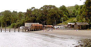
China Camp State Park is a state park in Marin County, California, surrounding a historic Chinese American shrimp-fishing village and a salt marsh. The park is located in San Rafael, California, on the shore of San Pablo Bay. It is known for its hiking and mountain biking trails, scenic views, and open spaces. The 1,514-acre (613 ha) park was established in 1976. A 75-acre (30 ha) district, including the shrimping village and a prehistoric shell midden, were added to the National Register of Historic Places in 1979 for having state-level significance in archaeology, architecture, commerce, settlement, and social history. China Camp State Park, along with the Rush Ranch Open Space Preserve, is part of the San Francisco Bay National Estuarine Research Reserve.

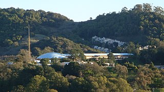
The Marin County Civic Center, designed by Frank Lloyd Wright, is located in San Rafael, California, the county seat of Marin County, California, United States. Groundbreaking for the Civic Center Administration Building took place in 1960, after Wright's death and under the watch of Wright's protégé, Aaron Green; it was completed in 1962. The Hall of Justice was begun in 1966 and completed in 1969. Veterans Memorial Auditorium opened in 1971, and the Exhibit Hall opened in 1976.
Greenbrae is a small unincorporated community in Marin County, California. It is located 1.5 miles (2 km) south-southeast of downtown San Rafael, at an elevation of 33 feet, and adjacent to U.S. Route 101 at the opening of the Ross Valley. Part of Greenbrae is an unincorporated community of the county while the remaining area is inside the city limits of Larkspur. The ZIP code is 94904, and is shared with the neighboring Census-designated place (CDP) of Kentfield. The community is in area codes 415 and 628.
California Park is an unincorporated community in Marin County, California, United States, and a suburb of San Rafael. It lies north of San Quentin State Prison. Marin Sanitary Service is the largest tenant in the area.

Terra Linda is a district of the city of San Rafael, California. It was formerly an unincorporated community within Marin County. It lies at an elevation of 171 feet.

Rancho San Antonio County Park and Rancho San Antonio Open Space Preserve are a conjoined public recreational area in the Santa Cruz Mountains, in the northwest quadrant of Santa Clara County, California. The County Park is bordered by Los Altos with some parts of the eastern part of the County Park in western Cupertino. The Open Space Preserve is on the west side of the County Park, also bordered by Los Altos Hills, Monte Bello Open Space Preserve, and the Permanente Quarry.
San Rafael City Schools is a school district headquartered in San Rafael, California, United States.

West Marin is the largest rural region of Marin County, California.
The Marin County Board of Supervisors is the governing body for the unincorporated areas of Marin County, California in the San Francisco Bay Area's North Bay region. The current board members are Mary Sackett, Katie Rice, Stephanie Moulton-Peters, Dennis Rodoni, and Eric Lucan.

The San Francisco Bay National Estuarine Research Reserve is one of 27 reserves established as part of the United States National Estuarine Research Reserve System. The reserve is used to promote San Francisco Bay wetlands and estuary research, education, and stewardship.

Marin County Free Library is a medium-sized public library system that serves the unincorporated areas of Marin County, as well as municipalities in the County that are not served by a city-run public library. The library administration is located in Room 414 in the Marin County Civic Center at 3501 Civic Center Drive, San Rafael, California, United States.
Tamalpais Valley is an unincorporated community in Marin County, California.
The defunct Boy Scout councils are those which have been closed and merged with other councils.

Aramburu Island is a 17-acre (6.9 ha) island in Richardson Bay, Marin County, California. It, along with Strawberry Spit, came to exist in the 1950s and 1960s as a consequence of dumping dredged material from nearby developments into the bay. In the 1980s, the northern part of the landmass was cut off from Strawberry Spit on the directions of a Marin County supervisor to prevent housing from being constructed there, creating Aramburu Island. While natural erosion processes caused it to shrink slowly over the course of subsequent decades, a 2010s restoration effort added large amounts of material to prevent further erosion, and turned it into "sustainable bird habitat".


