Mankin, Texas | |
|---|---|
 Mankin  Mankin | |
| Coordinates: 32°11′03″N96°06′47.4″W / 32.18417°N 96.113167°W | |
| Country | United States |
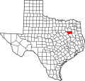
| State | Texas |
| County | Henderson |
| Time zone | UTC-6 (Central (CST)) |
| • Summer (DST) | UTC-5 (CDT) |
| Area codes | 430, 903 |
| GNIS feature ID | 2034052 [1] |
Mankin is an unincorporated community in Henderson County, located in the U.S. state of Texas. [1]