Poynor, Texas

Last updated

Poynor, Texas
TXMap-doton-Poynor.PNG
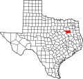
Location of Poynor, Texas
Henderson County Poynor.svg
Coordinates: 32°4′40″N95°35′49″W / 32.07778°N 95.59694°W / 32.07778; -95.59694
Country United States
State Texas
County Henderson
Area
[1]
  Total2.36 sq mi (6.11 km2)
  Land2.36 sq mi (6.11 km2)
  Water0.00 sq mi (0.00 km2)
Elevation
[2]
440 ft (130 m)
Population
 (2010)
  Total305
  Estimate 
(2019) [3]
306
  Density129.61/sq mi (50.04/km2)
Time zone UTC-6 (Central (CST))
  Summer (DST) UTC-5 (CDT)
ZIP code
75782
Area code(s) 430, 903
FIPS code 48-59192 [4]
GNIS feature ID1344473 [2]

Poynor is a town in Henderson County, Texas, United States. The population was 305 at the 2010 census. [5]

Contents

Geography

Poynor is located in southeastern Henderson County at 32°4′40″N95°35′49″W / 32.07778°N 95.59694°W / 32.07778; -95.59694 (32.077740, –95.596885), [6] along U.S. Route 175. It is 17 miles (27 km) southeast of Athens, the county seat, and 21 miles (34 km) northwest of Jacksonville.

According to the United States Census Bureau, Poynor has a total area of 2.4 square miles (6.1 km2), all land. [5]

Demographics

Historical population
CensusPop.Note
1980 272
1990 237−12.9%
2000 31432.5%
2010 305−2.9%
2019 (est.)306 [3] 0.3%
U.S. Decennial Census [7]

At the 2000 census there were 314 people, 112 households, and 89 families in the town. The population density was 132.7 inhabitants per square mile (51.2/km2). There were 121 housing units at an average density of 51.1 per square mile (19.7/km2). The racial makeup of the town was 92.68% White, 5.41% African American, 0.96% Native American, 0.32% from other races, and 0.64% from two or more races. Hispanic or Latino of any race were 4.46%. [4]

Of the 112 households 35.7% had children under the age of 18 living with them, 70.5% were married couples living together, 8.0% had a female householder with no husband present, and 20.5% were non-families. 16.1% of households were one person and 11.6% were one person aged 65 or older. The average household size was 2.80 and the average family size was 3.09.

The age distribution was 26.8% under the age of 18, 8.0% from 18 to 24, 27.7% from 25 to 44, 22.6% from 45 to 64, and 15.0% 65 or older. The median age was 36 years. For every 100 females, there were 90.3 males. For every 100 females age 18 and over, there were 87.0 males.

The median household income was $39,375 and the median family income was $38,750. Males had a median income of $33,125 versus $20,278 for females. The per capita income for the town was $14,829. About 13.6% of families and 10.1% of the population were below the poverty line, including 10.0% of those under age 18 and 7.8% of those age 65 or over.

Education

The town is served by the LaPoynor Independent School District.

Related Research Articles

<span class="mw-page-title-main">Summerfield, Illinois</span> Village in Illinois, United States

Summerfield is a village in St. Clair County, Illinois, United States. The population was 451 at the 2010 census.

<span class="mw-page-title-main">Dodson, Louisiana</span> Village in Louisiana, United States

Dodson is a village in Winn Parish, Louisiana, United States. The population was 357 at the 2000 census, which decreased to 337 in 2010.

Lakeville is a town in Penobscot County, Maine, United States. The population was 104 at the 2020 census.

<span class="mw-page-title-main">Wild Peach Village, Texas</span> Census-designated place in Texas, United States

Wild Peach Village is a census-designated place (CDP) in Brazoria County, Texas, United States. The population was 2,329 at the 2020 census.

<span class="mw-page-title-main">Bayview, Texas</span> Town in Texas, United States

Bayview is a town in Cameron County, Texas, United States. The population was 383 at the 2010 census. It is part of the Brownsville–Harlingen–Raymondville and the Matamoros–Brownsville metropolitan areas.

<span class="mw-page-title-main">Berryville, Texas</span> Town in Texas, United States

Berryville is a town in Henderson County, Texas, United States. The population was 824 at the 2020 census, down from 975 at the 2010 census.

<span class="mw-page-title-main">Coffee City, Texas</span> Town in Texas, United States

Coffee City is a small town in southeastern Henderson County, Texas, United States. The population was 278 at the 2010 census, up from 193 at the 2000 census.

<span class="mw-page-title-main">Enchanted Oaks, Texas</span> Town in Texas, United States

Enchanted Oaks is a town in Henderson County, Texas, United States. The population was 326 at the 2010 census, down from 357 at the 2000 census.

<span class="mw-page-title-main">Moore Station, Texas</span> City in Texas, United States

Moore Station is a city in Henderson County, Texas, United States. The population was 160 at the 2020 census. It was founded in 1876 by Anderson Moore, a former "mulatto" slave.

<span class="mw-page-title-main">Murchison, Texas</span> City in Texas, United States

Murchison is a city in Henderson County, Texas, United States. The population was 594 at the 2010 census.

<span class="mw-page-title-main">Payne Springs, Texas</span> Town in Texas, United States

Payne Springs is a town in Henderson County, Texas, United States. The population was 767 at the 2010 census, up from 683 at the 2000 census.

<span class="mw-page-title-main">Malone, Texas</span> Town in Texas, United States

Malone is a town in Hill County, Texas, United States. The population was 237 at the 2020 census.

<span class="mw-page-title-main">Lone Oak, Texas</span> City in Texas, United States

Lone Oak is a city in Hunt County, Texas, United States. The population was 643 at the 2020 census, 598 at the 2010 census, up from 521 at the 2000 census.

<span class="mw-page-title-main">Oak Ridge, Kaufman County, Texas</span> Town in Texas, United States

Oak Ridge is a town in Kaufman County, Texas, United States. The population was 495 at the 2010 census, up from 400 at the 2000 census.

<span class="mw-page-title-main">Eureka, Navarro County, Texas</span> City in Texas, United States

Eureka is a city in Navarro County, Texas, United States. The population was 307 at the 2010 census.

<span class="mw-page-title-main">Oak Valley, Texas</span> Town in Texas, United States

Oak Valley is a town in Navarro County, Texas, United States. The population was 368 at the 2010 census.

<span class="mw-page-title-main">San Isidro, Texas</span> CDP in Texas, United States

San Isidro is a census-designated place (CDP) in Starr County, Texas, United States. The population was 240 at the 2010 census. The town is named for St. Isidore the Laborer, the patron saint of farmers. A large Southwestern Barrel Cactus growing just east of town is said to be the largest in Texas.

<span class="mw-page-title-main">Lakeside, Tarrant County, Texas</span> Place in Texas, United States

Lakeside is a town in Tarrant County, Texas, United States. The population was 1,307 at the 2010 census.

<span class="mw-page-title-main">Danville, West Virginia</span> Town in West Virginia, United States

Danville is a town in Boone County, West Virginia, United States. The population was 660 at the 2020 census. Danville was incorporated in 1911 and named for Dan Rock, the town's first postmaster. Danville was formerly known as Newport and Red House.

<span class="mw-page-title-main">Deaver, Wyoming</span> Town in Wyoming, United States

Deaver is a town in Big Horn County, Wyoming, United States. The population was 178 at the 2010 census.

References

  1. "2019 U.S. Gazetteer Files". United States Census Bureau. Retrieved August 7, 2020.
  2. 1 2 U.S. Geological Survey Geographic Names Information System: Poynor, Texas
  3. 1 2 "Population and Housing Unit Estimates". United States Census Bureau. May 24, 2020. Retrieved May 27, 2020.
  4. 1 2 "U.S. Census website". United States Census Bureau . Retrieved January 31, 2008.
  5. 1 2 "Geographic Identifiers: 2010 Census Summary File 1 (G001): Poynor town, Texas". American Factfinder. U.S. Census Bureau. Archived from the original on February 13, 2020. Retrieved February 14, 2018.
  6. "US Gazetteer files: 2010, 2000, and 1990". United States Census Bureau. February 12, 2011. Retrieved April 23, 2011.
  7. "Census of Population and Housing". Census.gov. Retrieved June 4, 2015.