Ruth Springs, Texas | |
|---|---|
 Ruth Springs  Ruth Springs | |
| Coordinates: 32°12′11.24″N96°05′53.89″W / 32.2031222°N 96.0983028°W | |
| Country | United States |
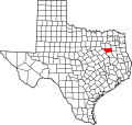
| State | Texas |
| County | Henderson |
| Population (2000) [1] | |
• Total | 15 |
| Time zone | UTC-6 (Central (CST)) |
| • Summer (DST) | UTC-5 (CDT) |
| Area code(s) | 430, 903 |
| GNIS feature ID | 2033846 [2] |
Ruth Springs is an unincorporated community in Henderson County, located in the U.S. state of Texas. [2] As of 2000, its population was 15. [1]