Chandler, Texas

Last updated

Chandler, Texas
Chandler, TX, Library IMG 0558.JPG
Chandler Library
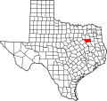
TXMap-doton-Chandler.PNG
Location of Chandler, Texas
Henderson County Chandler.svg
Coordinates: 32°18′23″N95°28′41″W / 32.30639°N 95.47806°W / 32.30639; -95.47806
Country United States
State Texas
County Henderson
Government
  TypeGeneral Law
Area
[1]
  Total6.20 sq mi (16.06 km2)
  Land6.07 sq mi (15.72 km2)
  Water0.13 sq mi (0.34 km2)
Elevation
[2]
394 ft (120 m)
Population
 (2020)
  Total3,275
  Density524.06/sq mi (202.35/km2)
Time zone UTC-6 (Central (CST))
  Summer (DST) UTC-5 (CDT)
ZIP code
75758
Area code(s) 430, 903
FIPS code 48-14224 [3]
GNIS feature ID2409435 [2]
Website www.chandlertx.com

Chandler is a city in Henderson County, Texas, United States, at the northern end of Lake Palestine. Its population was 3,275 at the 2020 census, [4] up from 2,734 at the 2010 census.

Contents

An American flag display at Winchester Park in Chandler American flags at park in Chandler.jpg
An American flag display at Winchester Park in Chandler

Geography

Chandler is located in the northeast corner of Henderson County. Texas State Highway 31 runs through the center of Chandler, leading east 11 miles (18 km) to Tyler and southwest 24 miles (39 km) to Athens, the Henderson County seat.

According to the United States Census Bureau, Chandler has a total area of 6.2 square miles (16.1 km2), of which 0.1 square miles (0.3 km2), or 2.13%, is covered by water. [4] The city sits on high ground between the northern ends of two arms of Lake Palestine: Kickapoo Creek to the west and the Neches River to the east.

Demographics

Historical population
CensusPop.Note
1970 765
1980 1,30871.0%
1990 1,63024.6%
2000 2,09928.8%
2010 2,73430.3%
2020 3,27519.8%
U.S. Decennial Census [5]
Chandler welcome sign Chandler, TX, welcome sign IMG 0556.JPG
Chandler welcome sign
Chandler racial composition as of 2020 [6]
(NH = Non-Hispanic) [lower-alpha 1]
RaceNumberPercentage
White (NH)2,59779.3%
Black or African American (NH)35710.9%
Native American or Alaska Native (NH)60.18%
Asian (NH)471.44%
Some Other Race (NH)80.24%
Mixed/Multi-Racial (NH)902.75%
Hispanic or Latino 1705.19%
Total3,275

As of the 2020 United States census, there were 3,275 people, 1,174 households, and 811 families residing in the city.

As of the census [3] of 2000, 2,099 people, 817 households, and 588 families were residing in the city. The population density was 598.9 people/sq mi (231.6/km2). The 877 housing units averaged 250.2/sq mi (96.7/km2). The racial makeup of the city was 84.18% White, 13.15% African American, 0.29% Native American, 0.76% Asian, 0.29% from other races, and 1.33% from two or more races. Hispanics or Latinos of any race were 0.81% of the population.

Of the 817 households, 31.7% had children under 18 living with them, 56.9% were married couples living together, 12.4% had a female householder with no husband present, and 28.0% were not families. About 25.3% of all households were made up of individuals, and 13.8% had someone living alone who was 65 or older. The average household size was 2.47, and the average family size was 2.96.

In the city, the age distribution was 24.4% under 18, 6.1% from 18 to 24, 28.2% from 25 to 44, 21.2% from 45 to 64, and 20.2% who were 65 or older. The median age was 39 years. For every 100 females, there were 84.1 males. For every 100 females age 18 and over, there were 78.9 males.

The median income for a household in the city was $38,641, and for a family was $50,000. Males had a median income of $36,125 versus $26,615 for females. The per capita income for the city was $19,075. About 8.2% of families and 9.8% of the population were below the poverty line, including 9.7% of those under age 18 and 11.0% of those age 65 or over.

Public amenities

Chandler City Hall Chandler, TX, City Hall IMG 0559.JPG
Chandler City Hall

The city has three public parks: Winchester Park is located on FM 315 South. It boasts five baseball fields, a playground, soccer fields, two pavilions, two concession areas, a pond, and a walking trail. McCain Park, located on Hwy 31 West, is home to the Chandler Historical Museums. This includes the historic Yarborough House and original train depot. River Park, located on Hwy 31 East, provides great opportunities for boating, fishing, and birdwatching on the Neches River.

University of Texas ET Medical Center operates an outpatient treatment/fitness center near the central part of Chandler, and Christus Mother Frances also has a clinic in Chandler. Free Wi-Fi is available at the Chandler Public Library.


Education

Chandler is served by the Brownsboro Independent School District. Two public school campuses are located in the city: Chandler Elementary School and Chandler Intermediate School.

Notable person

See also

Related Research Articles

<span class="mw-page-title-main">Hardin County, Texas</span> County in Texas, United States

Hardin County is a county located in the U.S. state of Texas, United States. As of the 2020 census, its population was 56,231. The county seat is Kountze. The county is named for the family of William Hardin from Liberty County, Texas.

<span class="mw-page-title-main">Chandler, Minnesota</span> City in Minnesota, United States

Chandler is a town in Murray County, Minnesota, United States. The population was 279 at the 2020 census.

<span class="mw-page-title-main">Berkeley, Missouri</span> City in Missouri, United States

Berkeley is an inner-ring suburb of St. Louis, located in St. Louis County, Missouri, United States. The population was 8,228 at the 2020 census. Portions of St. Louis Lambert International Airport are within the city limits.

<span class="mw-page-title-main">Pine Lawn, Missouri</span> City in Missouri, United States

Pine Lawn is a city in St. Louis County, Missouri, United States. The population was 3,275 at the 2010 census.

<span class="mw-page-title-main">Neche, North Dakota</span> City in North Dakota, United States

Neche is a city in Pembina County, North Dakota, United States. It sits on the banks of the Pembina River. The population was 344 at the 2020 census.

<span class="mw-page-title-main">Port Lavaca, Texas</span> City in Texas, United States

Port Lavaca is a city in Calhoun County, located in the U.S. state of Texas. The population was 12,248 at the 2010 census and 11,557 at the 2020 census. It is the county seat of Calhoun County and part of the Port Lavaca, Texas micropolitan statistical area. Port Lavaca is 130 miles (210 km) southwest of Houston.

<span class="mw-page-title-main">Fairfield, Texas</span> City in Texas, United States

Fairfield is a city and county seat of Freestone County, Texas, United States. The population was 2,850 at the 2020 census, down from 3,094 at the 2000 census. It was founded in 1851.

<span class="mw-page-title-main">Hamilton, Texas</span> City in Texas, United States

Hamilton is a city in and the county seat of Hamilton County, Texas, United States, located in the state's central region. Its population was 2,895 at the 2020 census.

Berryville is a town in Henderson County, Texas, United States. The population was 824 at the 2020 census, down from 975 at the 2010 census.

<span class="mw-page-title-main">Brownsboro, Texas</span> City in Texas, United States

Brownsboro is a city in Henderson County, Texas, United States. The population was 1,212 at the 2020 census, up from 1,039 at the 2010 census. The city is on Texas State Highway 31.

<span class="mw-page-title-main">Log Cabin, Texas</span> City in Texas, United States

Log Cabin is a city in Henderson County, Texas, United States. The population was 678 at the 2020 census.

<span class="mw-page-title-main">Malakoff, Texas</span> City in Texas, United States

Malakoff is a city in Henderson County, Texas, United States. The population was 2,179 at the 2020 census. The city is named after a Russian fort of Malakoff, which played a pivotal role during the siege of Sevastopol during the Crimean War.

<span class="mw-page-title-main">Star Harbor, Texas</span> City in Texas, United States

Star Harbor is a city in Henderson County, Texas, United States. The population was 482 at the 2020 census.

<span class="mw-page-title-main">Tool, Texas</span> City in Texas, United States

Tool is a city in Henderson County, Texas, United States. The population was 2,175 at the 2020 census. Located on the west side of Cedar Creek Lake, it is a popular second home and retiree destination.

<span class="mw-page-title-main">Trinidad, Texas</span> City in Texas, United States

Trinidad is a city in Henderson County, Texas, United States, near the Trinity River from which the town's name was derived. The population was 860 at the 2020 census, down from 886 at the 2010 census.

<span class="mw-page-title-main">Progreso, Texas</span> City in Texas, United States

Progreso is a city in Hidalgo County, Texas, United States. The population was 5,507 at the time of the 2010 United States Census. It is part of the McAllen–Edinburg–Mission and Reynosa–McAllen metropolitan areas.

<span class="mw-page-title-main">Buna, Texas</span> Census-designated place in Texas, United States

Buna is an unincorporated community and census-designated place (CDP) in Jasper County, Texas, United States. The population was 2,137 at the 2020 census.

<span class="mw-page-title-main">Goldthwaite, Texas</span> City in Texas, United States

Goldthwaite is a town and the county seat of Mills County, Texas, United States. The population was 1,738 at the 2020 census, down from 1,878 at the 2010 census.

<span class="mw-page-title-main">San Augustine, Texas</span> City in and county seat of San Augustine County, Texas, United States

San Augustine is the county seat city of San Augustine County, Texas, in East Texas, United States. The population was 1,920 at the 2020 census.

<span class="mw-page-title-main">La Rosita, Texas</span> CDP in Texas, United States

La Rosita is a census-designated place (CDP) in Starr County, Texas, United States. The population was 85 at the 2010 census, a decline from the figure of 1,729 tabulated in 2000 due to the Census Bureau redefining the CDP. By the 2020 census, the population further decreased to 82.

References

  1. "2019 U.S. Gazetteer Files". United States Census Bureau. Retrieved August 7, 2020.
  2. 1 2 U.S. Geological Survey Geographic Names Information System: Chandler, Texas
  3. 1 2 "U.S. Census website". United States Census Bureau . Retrieved January 31, 2008.
  4. 1 2 "Geographic Identifiers: 2010 Census Summary File 1 (G001): Chandler city, Texas". American Factfinder. U.S. Census Bureau. Archived from the original on February 13, 2020. Retrieved February 12, 2018.
  5. "Census of Population and Housing". Census.gov. Retrieved June 4, 2015.
  6. "Explore Census Data". data.census.gov. Retrieved May 24, 2022.
  7. "About the Hispanic Population and its Origin". www.census.gov. Retrieved May 18, 2022.
  1. Note: the US Census treats Hispanic/Latino as an ethnic category. This table excludes Latinos from the racial categories and assigns them to a separate category. Hispanics/Latinos can be of any race. [7]