Saskatoon John G. Diefenbaker International Airport is an international airport located 3 nautical miles northwest of downtown Saskatoon, Saskatchewan, Canada. The airport is served by passenger, courier and air freight operators. It is named for John Diefenbaker, the 13th Prime Minister of Canada.

Elliot Lake Municipal Airport,, is a registered aerodrome located 4 nautical miles southeast of the city of Elliot Lake, Ontario, Canada.

Timmins Victor M. Power Airport,, is located 6 nautical miles north-northwest of Timmins, Ontario, Canada. The airport serves both scheduled passenger and cargo flights and general aviation, including air ambulance (MEDEVAC), forest-fire fighting, and flight training.

Rimouski Aerodrome,, is a registered aerodrome located 1.8 nautical miles northeast of Rimouski, Quebec, Canada. It only handles general aviation and cargo flights.

Attawapiskat Airport is an airport adjacent to the Attawapiskat First Nation in Ontario, Canada.

Guelph Airport is located 1.3 nautical miles northeast of Guelph, Ontario, Canada. It consists of two runways, 14/32 and 06/24. Although known to residents as the "Guelph Airport" or "Guelph Airpark", it is actually an aerodrome, being registered, and not certified, by Transport Canada.

Pukatawagan Airport,, is located 2.5 nautical miles east of Pukatawagan, Manitoba, Canada.

Coronach/Scobey Border Station Airport is located 8 nautical miles southeast of Coronach, Saskatchewan, Canada and 13 mi (21 km) north of Scobey, Montana, United States. In the United States, the airport is known by the names Scobey Border Station Airport and East Poplar International Airport. It is owned by the U.S. and Canadian governments.

Frontier Airport is located 2 nautical miles south of Frontier, Saskatchewan, Canada.
Loon Lake Airport is located adjacent to Loon Lake, Saskatchewan, Canada. The airstrip is a grass runway suitable for small planes only, but the Saskatchewan Air Ambulance can land and take off there.

Peace River Airport is a municipally owned airport located 5 nautical miles west of the Town of Peace River, Alberta, Canada. The airport has one runway, which is 5,000 ft × 150 ft, and a terminal building, which is 21,000 sq ft (2,000 m2).
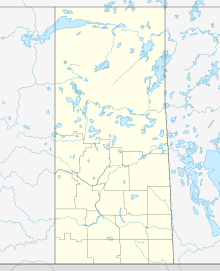
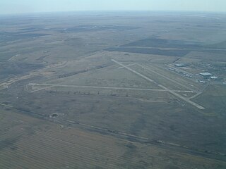
Moose Jaw Municipal Airport is a general aviation facility located 7 nautical miles east northeast of Moose Jaw, Saskatchewan, Canada.

North Battleford Airport is located 1.5 nautical miles east of North Battleford, Saskatchewan, Canada.
North Battleford/Hamlin Airport(TC LID: CJD4) was located 1 nautical mile northeast of Hamlin, Saskatchewan, Canada.
Weyburn Airport is located 2.2 nautical miles northeast of Weyburn, Saskatchewan, Canada.
Wollaston Lake Airport is located adjacent to Wollaston Lake, Saskatchewan, Canada.

Maple Creek is a town in the Cypress Hills of southwest Saskatchewan, Canada. It is surrounded by the Rural Municipality of Maple Creek No. 111. The population was 2,084 at the 2016 Census.
Central Butte is a town in Saskatchewan, Canada, approximately 200 kilometres (120 mi) from Saskatoon, Regina and Swift Current and 100 kilometres (62 mi) from Moose Jaw. Thunder Creek, a river that flows into Moose Jaw, begins south of the community. The town is served by the Central Butte Airport.
Saskatchewan Air Ambulance is the air ambulance service for the province of Saskatchewan and for the Ministry of Health (Saskatchewan).