Cape Town is one of South Africa's three capital cities, serving as the seat of the Parliament of South Africa. It is the legislative capital of the country, the oldest city in the country, and the second largest. Colloquially named the Mother City, it is the largest city of the Western Cape province, and is managed by the City of Cape Town metropolitan municipality. The other two capitals are Pretoria, the executive capital, located in Gauteng, where the Presidency is based, and Bloemfontein, the judicial capital in the Free State, where the Supreme Court of Appeal is located.

The Fashoda Incident, also known as the Fashoda Crisis, was an international incident and the climax of imperialist territorial disputes between Britain and France in East Africa, occurring in 1898. A French expedition to Fashoda on the White Nile river sought to gain control of the Upper Nile river basin and thereby exclude Britain from the Sudan. The French party and a British-Egyptian force met on friendly terms, but back in Europe, it became a war scare. The British held firm as both empires stood on the verge of war with heated rhetoric on both sides. Under heavy pressure, the French withdrew, ensuring Anglo-Egyptian control over the area.

Events from the year 1900 in Canada.

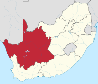
The Northern Cape is the largest and most sparsely populated province of South Africa. It was created in 1994 when the Cape Province was split up. Its capital is Kimberley. It includes the Kalahari Gemsbok National Park, part of the Kgalagadi Transfrontier Park and an international park shared with Botswana. It also includes the Augrabies Falls and the diamond mining regions in Kimberley and Alexander Bay.
The R359 is a regional route in the Northern Cape province of South Africa that runs along the south bank of the Orange River from Augrabies Falls through Augrabies and Kakamas to Upington.

Kraaifontein is a town in the Western Cape province of South Africa. Organisationally and administratively it is included in the City of Cape Town Metropolitan Municipality as a Northern Suburb. The name originated from large number of crows that nest in the region.

Rondebosch Boys' High School is a public English medium high school for boys situated in the suburb of Rondebosch in Cape Town in the Western Cape province of South Africa. It is one of the topmost academic schools in South Africa and one of the oldest schools in the country, having been established in 1897. Rondebosch is the only school in the Western Cape to have a Nobel Prize laureate, Allan M. Cormack in Physiology and Medicine.

Durbanville is a town in the Western Cape province of South Africa, part of the greater Cape Town metropolitan area. Durbanville is a semi-rural residential suburb on the north-eastern outskirts of the metropolis and is surrounded by farms producing wine and wheat.

The Southern Suburbs are a group of suburbs in Cape Town, Western Cape, South Africa. This group includes, among others, Observatory, Mowbray, Pinelands, Thornton, Rosebank, Rondebosch, Rondebosch East, Newlands, Claremont, Lansdowne, Kenilworth, Bishopscourt, Constantia, Wynberg, Ottery, Plumstead, Diep River, Bergvliet and Tokai.
Dessalines wrongly referred to as Marchand-Dessalines, is a commune in the Artibonite department of Haiti. It is named after Jean-Jacques Dessalines, a leader of the Haitian Revolution and the first ruler of independent Haiti. It is known as the First Black Capital of the New World.
Marchand is a frequent surname in France, in Quebec, and in Louisiana.. It is sometimes anglicized to "Merchant", "Marchant", or "Merchand", all with similar pronunciations to Marchand.

Fairbairn College is a public, co-educational high school in Goodwood near Cape Town, Western Cape, South Africa.

Bellville mainline railway station is a railway station in the town of Bellville, Western Cape, South Africa. It is the second-biggest station in the Metrorail Western Cape railway network, after the Cape Town terminus. All trains on Metrorail's Northern Line pass through Bellville, and one branch of the Central Line also terminates there. It is also a stop for Shosholoza Meyl trains that terminate in Cape Town.
Rommani is a Moroccan town in the region of Rabat-Salé-Kénitra. It is situated at approximately 60 km southeast of Morocco's capital of Rabat and 100 km east of its economic and cultural hub of Casablanca (ad-Dar-al-Bayda).
La Broquerie is a rural municipality in the province of Manitoba in Western Canada, located in the southeastern part of the province, just south and east of the city of Steinbach.
Mutual railway station is a Metrorail commuter rail station located between the suburbs of Maitland and Pinelands in Cape Town, South Africa. It is situated next to the South African headquarters of the Old Mutual, from which it takes its name. Mutual is a particularly busy station because it is the junction at which the Central Line towards Mitchell's Plain and Khayelitsha diverges from the Northern Line main line to Bellville.
The Northern Line is a commuter rail service in South Africa that in the Cape Town metropolitan area and its surroundings and is operated by Metrorail Western Cape. Northern Line services operate from central Cape Town to Bellville, and then from Bellville along three different routes. The first route runs along the main Cape Town–De Aar railway line to Paarl and Wellington. The second route passes through Stellenbosch to terminate at Muldersvlei station on the main line, while the third also passes through Somerset West to terminate in Strand.

Peninsula Granite Fynbos is an endangered Fynbos vegetation type which is endemic to the city of Cape Town and occurs nowhere else. It is a unique type of tall, dense and diverse scrubland, scattered with trees. It can be found all along the belt of granite that encircles Table Mountain.
Witzands Aquifer Nature Reserve is a 3,000-hectare (7,400-acre) protected natural area in Cape Town, South Africa, located on the city’s northern outskirts. This reserve protects an important part of Cape Town’s natural and cultural heritage, including the Atlantis Aquifer.

The following outline is provided as an overview of and topical guide to Cape Town:


