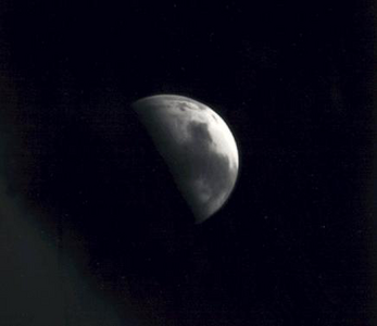
The Mars Orbiter Camera and Mars Observer Camera (MOC) were scientific instruments on board the Mars Observer and Mars Global Surveyor spacecraft. The camera was built by Malin Space Science Systems (MSSS) for NASA and the cost of the whole MOC scientific investigation project was about US$44 million, higher than anticipated in the budget. [1]
Originally named Mars Observer Camera, it was selected by NASA in 1986 for the Mars Observer mission, but it returned only three images of planet Mars before the loss of the spacecraft in 1993. A second camera of the same specifications, renamed to Mars Orbiter Camera (MOC), was built (with assistance by California Institute of Technology) and launched on board the Mars Global Surveyor (MGS) spacecraft in 1996. The camera returned 243,668 images while in orbit around Mars, before the loss of the MGS spacecraft in 2006. [1] Mars Orbiter Camera was operated by its manufacturer, Malin Space Science Systems, from its facilities in San Diego, California. [2]
The scientific instrument consisted of three elements: a black-and-white narrow-angle camera with a spatial resolution of 1.4 metres per pixel (from an altitude of 378 km), and two pushbroom wide-angle cameras [3] (one red, the other blue) with resolution capabilities spanning 230 m per pixel to 7.5 km/pixel. The narrow-angle camera provided 97,097 (roughly 40%) of the 243,668 images returned by Mars Orbiter Camera. [1]
The narrow-angle camera was placed inside an 80 cm-long cylinder with a diameter of 40 cm, and the two wide-angle cameras were attached above the cylinder's front area. All cameras were based on CCD technology and were supported by state-of-the-art 1980s electronics, including a 32-bit radiation-hardened 10 MHz processor (capable of 1 million instructions per second) and 12 MB of DRAM memory buffer. [1]
In addition to taking images, the MOC instrument's 12 MB memory buffer serviced the Mars Global Surveyor's Mars Relay antenna as temporary data storage for communications between Earth and landed spacecraft on Mars. For example, more than 7.6 terabits of data were transferred to and from the Mars Exploration Rovers (Spirit and Opportunity). The camera also enabled NASA scientists to choose suitable landing sites for other exploration missions. [1]
Malin also built and operated other cameras for NASA, including:
Mars Global Surveyor (MGS) was an American robotic space probe developed by NASA's Jet Propulsion Laboratory and launched November 1996. MGS was a global mapping mission that examined the entire planet, from the ionosphere down through the atmosphere to the surface. As part of the larger Mars Exploration Program, Mars Global Surveyor performed atmospheric monitoring for sister orbiters during aerobraking, and helped Mars rovers and lander missions by identifying potential landing sites and relaying surface telemetry.
The Mars Reconnaissance Orbiter (MRO) is a spacecraft designed to search for the existence of water on Mars and provide support for missions to Mars, as part of NASA's Mars Exploration Program. It was launched from Cape Canaveral on August 12, 2005, at 11:43 UTC and reached Mars on March 10, 2006, at 21:24 UTC. In November 2006, after six months of aerobraking, it entered its final science orbit and began its primary science phase.
Malin Space Science Systems (MSSS) is a San Diego, California-based private technology company that designs, develops, and operates instruments and technical equipment to fly on uncrewed spacecraft. MSSS is headed by chief scientist and CEO Michael C. Malin.
High Resolution Imaging Science Experiment is a camera on board the Mars Reconnaissance Orbiter which has been orbiting and studying Mars since 2006. The 65 kg (143 lb), US$40 million instrument was built under the direction of the University of Arizona's Lunar and Planetary Laboratory by Ball Aerospace & Technologies Corp. It consists of a 0.5 m (19.7 in) aperture reflecting telescope, the largest so far of any deep space mission, which allows it to take pictures of Mars with resolutions of 0.3 m/pixel, resolving objects below a meter across.
Michael C. Malin is an American astronomer, space scientist, and CEO of Malin Space Science Systems. His cameras have been important scientific instruments in the exploration of Mars.
Zunil is an impact crater near the Cerberus Fossae on Mars, with a diameter of 10.26 kilometres. It is named after the town of Zunil in Guatemala. The crater is located in the Elysium quadrangle. Visible in images from the Viking 1 and Viking 2 Mars orbiters in the 1970s, Zunil was subsequently imaged at higher resolution for the first time by the Mars Global Surveyor (MGS) Mars Orbiter Camera (MOC) in 2000.
The Noachis quadrangle is one of a series of 30 quadrangle maps of Mars used by the United States Geological Survey (USGS) Astrogeology Research Program. The Noachis quadrangle is also referred to as MC-27.
The Diacria quadrangle is one of a series of 30 quadrangle maps of Mars used by the United States Geological Survey (USGS) Astrogeology Research Program. The quadrangle is located in the northwestern portion of Mars’ western hemisphere and covers 180° to 240° east longitude and 30° to 65° north latitude. The quadrangle uses a Lambert conformal conic projection at a nominal scale of 1:5,000,000 (1:5M). The Diacria quadrangle is also referred to as MC-2. The Diacria quadrangle covers parts of Arcadia Planitia and Amazonis Planitia.
The Elysium quadrangle is one of a series of 30 quadrangle maps of Mars used by the United States Geological Survey (USGS) Astrogeology Research Program. The Elysium quadrangle is also referred to as MC-15.
The Phoenicis Lacus quadrangle is one of a series of 30 quadrangle maps of Mars used by the United States Geological Survey (USGS) Astrogeology Research Program. The Phoenicis Lacus quadrangle is also referred to as MC-17. Parts of Daedalia Planum, Sinai Planum, and Solis Planum are found in this quadrangle. Phoenicis Lacus is named after the phoenix which according to myth burns itself up every 500 years and then is reborn.
The Eridania quadrangle is one of a series of 30 quadrangle maps of Mars used by the United States Geological Survey (USGS) Astrogeology Research Program. The Eridania quadrangle is also referred to as MC-29.
The Phaethontis quadrangle is one of a series of 30 quadrangle maps of Mars used by the United States Geological Survey (USGS) Astrogeology Research Program. The Phaethontis quadrangle is also referred to as MC-24.
The Thaumasia quadrangle is one of a series of 30 quadrangle maps of Mars used by the United States Geological Survey (USGS) Astrogeology Research Program. The Thaumasia quadrangle is also referred to as MC-25 . The name comes from Thaumas, the god of the clouds and celestial apparitions.
The Mare Australe quadrangle is one of a series of 30 quadrangle maps of Mars used by the United States Geological Survey (USGS) Astrogeology Research Program. The Mare Australe quadrangle is also referred to as MC-30. The quadrangle covers all the area of Mars south of 65°, including the South polar ice cap, and its surrounding area. The quadrangle's name derives from an older name for a feature that is now called Planum Australe, a large plain surrounding the polar cap. The Mars polar lander crash landed in this region.
Sirenum Fossae is a long trough in several quadrangles including Memnonia quadrangle and Phaethontis quadrangle of Mars, centered at 35.57° south latitude and 197.26° west longitude. Sirenum Fossae is 2,735 km long and was named after a classical albedo feature name. Troughs on Mars like this one are called Fossae. Sirenum Fossae is believed to have formed by movement along a pair of faults causing a center section to drop down. This kind of feature is called a graben.
The MOC Public Targeting Program was a very popular program that followed the Mars Global Surveyor's pictures of Mars. A total of 4,636 requests came in from the general public. Of these, 1,086 were photographed by the Mars Observer Camera. Many of the requests eventually resulted in publications. A little more than half of the requests came from a single member of the general public. One of the people wrote in the Planetary Report that working with MGS was as exciting as being a football fan able to run a few plays in the Super Bowl. Images from the Public Target program can be found at http://www.msss.com/moc_gallery/
Gasa is an impact rayed crater in the Eridania quadrangle on Mars at 35.68° S and 230.72° W. and is 6.5 km in diameter. Its name was approved in 2009, and it was named after a place in Bhutan. Gullies are evident in the images. It is now believed that the impact that created Gasa happened in a larger crater whose floor was covered with debris-covered glaciers. The larger crater is known as Cilaos, it is located at 35.71° S and 230.52° W. and is 21.4 km in diameter. Its name was approved on 15 August 2016, and it was named after a place in the island of Réunion.
Copernicus is a large crater on Mars, with a diameter close to 300 km. It is located south of the planet's equator in the heavily cratered highlands of Terra Sirenum in the Phaethontis quadrangle at 48.8°S and 191.2°E. Its name was approved in 1973, and it was named after Nicolaus Copernicus.
Slipher is an impact crater in the Thaumasia quadrangle of Mars, located at 47.3°S latitude and 84.6°W longitude. It measures 127 kilometres (79 mi) in diameter and was named after American astronomers Vesto and Earl Slipher. The naming was approved by IAU's Working Group for Planetary System Nomenclature in 1973.
The following outline is provided as an overview of and topical guide to Mars: