Related Research Articles

Veregin is a special service area in Saskatchewan, Canada. It is located 50 kilometres northeast of Yorkton, and 10 km to the west of Kamsack.

Gimli was a provincial electoral division in the Canadian province of Manitoba. It was created by redistribution in 1899, and existed continuously until the 2019 election. Following this, it was redistributed into the Interlake-Gimli electoral district.

Selkirk is a provincial electoral division in the Canadian province of Manitoba. It was created by redistribution in 1957 from part of St. Andrews, and has formally existed since the provincial election of 1958. It is named after the city of Selkirk, which in turn was named for Thomas Douglas, 5th Earl of Selkirk, who set up the Red River Colony colonization project in 1811.

Northern Manitoba is a geographic and cultural region of the Canadian province of Manitoba. Originally encompassing a small square around the Red River Colony, the province was extended north to the 60th parallel in 1912. The region's specific boundaries vary, as "northern" communities are considered to share certain social and geographic characteristics, regardless of latitude.

The Winnipeg Metropolitan Region is a metropolitan area in the Canadian province of Manitoba located in the Red River Valley in the southeast portion of the province of Manitoba, Canada. It contains the provincial capital of Winnipeg and 17 surrounding rural municipalities, cities, and towns.
Roseau River Anishinabe First Nation is an Ojibway First Nation in southern Manitoba, Canada, situated around the Roseau River.
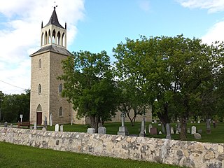
St. Andrews is a rural municipality (RM) in Manitoba, Canada. It lies west of the Red River; its southern border is approximately 8 kilometres (5.0 mi) north of Winnipeg.
Provincial Trunk Highway 9 is a provincial primary highway located in the Canadian province of Manitoba. It runs from Winnipeg north to Gimli.

The Interlake Region is an informal geographic region of the Canadian province of Manitoba that lies roughly between Lake Winnipeg and Lake Manitoba in the Canadian province of Manitoba.
Bowsman is an unincorporated urban community in the Municipality of Minitonas – Bowsman, Manitoba, Canada.

Winnipeg Beach is a town in the Interlake Region, in the Canadian province of Manitoba. The town was founded in 1900 by Sir William Whyte and is located at the junction of Highway 9 and Highway 229 on the southwestern shore of Lake Winnipeg, about 56 kilometres (35 mi) north of Winnipeg. It is bordered by the Rural Municipality of Gimli, the Rural Municipality of St. Andrews, and Dunnottar as well as Lake Winnipeg. Nearby towns are Ponemah, Whytewold, and Matlock, Gimli, and Sandy Hook,, as well as Teulon, and Selkirk. Its permanent population is 1,439
Powerview-Pine Falls is a town in the Canadian province of Manitoba, with a population of 1,314 at the 2011 census, up 1.54% from 1,294 at the 2006 census and down 7.57% from 1,400 during the 2001 census.
Auburn Bay is a suburban residential neighbourhood in the southeast quadrant of Calgary, Alberta. It is located at the southeastern edge of the city, and is bounded by Seton Boulevard to the south, Deerfoot Trail to the west, 52 Street E to the east and Stoney Trail to the north. It was established in 2005.

The Village of Dunnottar is a village in the Canadian province of Manitoba. As part of the Interlake and Metro regions, the municipality is located on the shores of Lake Winnipeg, just off Highway 9, south of Winnipeg Beach.

Census Division No. 12 is a census division located within the Eastman Region of the province of Manitoba, Canada. Unlike in some other provinces, census divisions do not reflect the organization of local government in Manitoba. These areas exist solely for the purposes of statistical analysis and presentation; they have no government of their own.
Census Division No. 13 is a census division located within the Interlake Region of the province of Manitoba, Canada. Unlike in some other provinces, census divisions do not reflect the organization of local government in Manitoba. These areas exist solely for the purposes of statistical analysis and presentation; they have no government of their own.

Ste. Anne is a rural municipality (RM) in the Eastman Region of Manitoba, Canada, lying southeast of Winnipeg. The separately-administered town of Ste. Anne lies within the geographic borders of the municipality, in its northwestern part.
Gambler First Nation is an Ojibway First Nations community in Manitoba. With a population of 334 members, it is one of the smallest indigenous communities in Manitoba.
Petersfield is located in the Rural Municipality of St. Andrews in Manitoba, Canada. It was the birthplace of First Nation war hero and community activist Tommy Prince. In Summer, Petersfield plays host to the Petersfield Community Club Mallard Park Market, a popular local destination for locally handmade crafts, baking, vegetables, etc.
References
- ↑ "The Dunnottar Station Museum". dunnottarstation.org. Retrieved August 16, 2024.
- ↑ Geographic Board of Canada (1933). Place-names of Manitoba. Ottawa: J. O. Patenaude, acting King's printer. p. 55. hdl:2027/mdp.39015027929515 . Retrieved October 11, 2017.
50°26′02″N96°57′50″W / 50.43389°N 96.96389°W
| | This Manitoba location article is a stub. You can help Wikipedia by expanding it. |