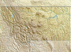
The Rocky Mountains, also known as the Rockies, are a major mountain range in western North America. The Rocky Mountains stretch more than 4,800 kilometers (3,000 mi) from the northernmost part of British Columbia, in western Canada, to New Mexico in the Southwestern United States. Located within the North American Cordillera, the Rockies are somewhat distinct from the Pacific Coast Ranges, Cascade Range, and the Sierra Nevada, which all lie farther to the west.

The Absaroka Range is a sub-range of the Rocky Mountains in the United States. The range stretches about 150 mi (240 km) across the Montana-Wyoming border, and 75 miles at its widest, forming the eastern boundary of Yellowstone National Park along Paradise Valley (Montana), and the western side of the Bighorn Basin. The range borders the Beartooth Mountains to the north and the Wind River Range to the south. The northern edge of the range rests along I-90 and Livingston, Montana. The highest peak in the range is Francs Peak, located in Wyoming at 13,153 ft (4,009 m). There are 46 other peaks over 12,000 ft (3,700 m).

The following articles relate to the history, geography, geology, flora, fauna, structures and recreation in Yellowstone National Park.

Mount Haynes el. 8,218 feet (2,505 m) is a prominent peak adjacent to the Madison River in Yellowstone National Park. The peak was named by then Yellowstone superintendent Horace Albright to honor Frank Jay Haynes (1853–1921), the first official photographer of the park. Prior to being named Mount Haynes, the peak was unofficially called Mount Burley for D. E. Burley of the Union Pacific Railroad. Today there is an interpretive overlook along the Madison River just opposite the peak.
Sepulcher Mountain el. 9,642 feet (2,939 m) is a moderate mountain peak in northwest Yellowstone National Park halfway between the summit of Electric Peak and Mammoth Hot Springs. The peak was named Sepulcher by Captain John W. Barlow, U.S. Army in 1871 because of its resemblance to a crypt when viewed from Gardiner, Montana.

Judge John W. Meldrum was a carpenter, a Wyoming politician and the first U.S. Commissioner in Yellowstone National Park, a position he held for 41 years (1894–1935).

Mount Schurz el. 11,007 feet (3,355 m) is a mountain peak in the Absaroka Range in Yellowstone National Park. Mount Schurz is the second highest peak in Yellowstone. The mountain was originally named Mount Doane by Henry D. Washburn during the Washburn–Langford–Doane Expedition in 1871. Later the name Mount Doane was given to another peak in the Absaroka Range by geologist Arnold Hague. In 1885, Hague named the mountain for the 13th U.S. Secretary of the Interior, Carl Schurz (1877–1881). Schurz was the first Secretary of the Interior to visit Yellowstone and a strong supporter of the national park movement.

Mount Hornaday el. 10,003 feet (3,049 m) is a mountain peak in the northeast section of Yellowstone National Park in the Absaroka Range, Wyoming. The peak was named in 1938 for naturalist William Temple Hornaday, a former director of the New York Zoological Gardens who championed the cause of saving the American Bison from extinction.

Mount Norris el. 9,842 feet (3,000 m) is a mountain peak in the northeast section of Yellowstone National Park in the Absaroka Range. In 1875, the peak was named for and named by Philetus Norris, the second park superintendent (1877–1882). Norris was on a visit to the park with several mountain guides, including Collins Jack Yellowstone Jack Baronette. They ascended the peak at the head of the Lamar Valley and presumed they were the first white men to do so, thus naming it Mount Norris.

Mount Chittenden el. 10,182 feet (3,103 m) is a mountain peak in the Absaroka Range in Yellowstone National Park. The peak was named by Henry Gannett of the Hayden Geological Survey of 1878 for George B. Chittenden. Chittenden was a Geological Survey member who had worked with Gannett, Hayden and others in surveys in Montana, Idaho and Wyoming. Chittenden never participated in any of the Yellowstone surveys.
Cook Peak el. 9,754 feet (2,973 m) is a mountain peak in the Washburn Range of Yellowstone National Park. The peak was named in 1922 by then superintendent Horace Albright to honor of Charles W. Cook, a member of the 1869 Cook–Folsom–Peterson Expedition which explored the Yellowstone park region. 1922 was the 50th anniversary of the park's creation, and Charles Cook, still living in Montana, attended ceremonies in the park. Prior to 1922, the peak had been named Thompson Peak by Philetus Norris in 1880 and Storm Peak by members of the Arnold Hague Geological Surveys in 1885.

Dunraven Peak el. 9,869 feet (3,008 m) is a mountain peak in the Washburn Range of Yellowstone National Park. In 1874, just two years after the park's creation, the Earl of Dunraven, a titled Englishman made a visit to Yellowstone in conjunction with a hunting expedition led by Texas Jack Omohundro to the Northern Rockies. He was so impressed with the park, that he devoted well over 150 pages to Yellowstone in his The Great Divide, published in London in 1874. The Great Divide was one of the earliest works to praise and publicize the park.
Hedges Peak el. 9,669 feet (2,947 m) is a mountain peak in the Washburn Range in Yellowstone National Park. The peak was named in 1895 by geologist Arnold Hague to honor Cornelius Hedges (1837–1907), a member of the Washburn–Langford–Doane Expedition of 1871 and prominent Montana lawyer. Hedges accounts of the expedition in Helena Daily Herald newspaper contributed to the campaign to create Yellowstone National Park. Prior to 1895 the peak had been named Surprise Peak by geologist J.P. Iddings in 1883.

Terrace Mountain is a mountain peak in the Gallatin Range in Yellowstone National Park, Wyoming, United States. The mountain is located 2.2 miles (3.5 km) southwest of Mammoth Hot Springs. Terrace Mountain was named by the 1878 Hayden Geological Survey because of its proximity to the travertine terraces at Mammoth and because it too is an ancient travertine terrace. The mountain has also been known as "Soda Mountain" and "White Mountain".
Dome Mountain el. 9,826 feet (2,995 m) is a mountain peak in the southern section of the Gallatin Range in Yellowstone National Park.

Quadrant Mountain el. 9,954 feet (3,034 m) is a mountain peak in the southern section of the Gallatin Range in Yellowstone National Park.

The ecology of the Rocky Mountains is diverse due to the effects of a variety of environmental factors. The Rocky Mountains are the major mountain range in western North America, running from the far north of British Columbia in Canada to New Mexico in the southwestern United States, climbing from the Great Plains at or below 1,800 feet (550 m) to peaks of over 14,000 feet (4,300 m). Temperature and rainfall varies greatly also and thus the Rockies are home to a mixture of habitats including the alpine, subalpine and boreal habitats of the Northern Rocky Mountains in British Columbia and Alberta, the coniferous forests of Montana and Idaho, the wetlands and prairie where the Rockies meet the plains, a different mix of conifers on the Yellowstone Plateau in Wyoming and in the high Rockies of Colorado and New Mexico, and finally the alpine tundra of the highest elevations.
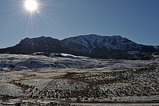
Amethyst Mountain, el. 9,609 feet (2,929 m) is the highest peak and central part of a northwest – southeast trending ridge that lies between the Lamar River to the northeast and Deep Creek to the southwest within Park County, Wyoming. From northwest to southeast, this ridge consists of Specimen Ridge, Amethyst Mountain, and the Mirror Plateau in Yellowstone National Park. The nearest town is Silver Gate, Montana, which is 19.2 miles away.