
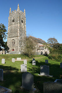
Mount Hawke is a village in Cornwall, United Kingdom. It is situated approximately eight miles (13 km) west-northwest of Truro, five miles (8.0 km) north-northeast of Redruth, and two and a half miles (4.0 km) south of St Agnes.
North Petherwin is a civil parish and village in east Cornwall, England, United Kingdom. The village is situated five miles (8 km) northwest of Launceston on a ridge above the River Ottery valley.

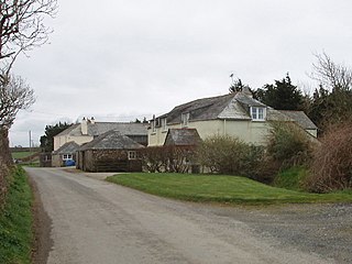
Virginstow is a village and civil parish in the Torridge district of Devon, England. It is situated about 7 miles north of Launceston in Cornwall. According to the 2001 census it had a population of 115.

Perranzabuloe is a coastal civil parish and a hamlet in Cornwall, England, United Kingdom. Perranzabuloe parish is bordered to the west by the Atlantic coast and St Agnes parish, to the north by Cubert parish, to the east by St Newlyn East and St Allen parishes and to the south by Kenwyn parish. The hamlet is situated just over a mile (2 km) south of the principal settlement of the parish, Perranporth; the hamlet is also seven miles (11 km) south-southwest of Newquay. Other settlements in the parish include Perrancoombe, Goonhavern, Mount and Callestick. The parish population was 5,382 in the 2001 census, increasing to 5,486 at the 2011 census.
Bradford is a hamlet in the county of Cornwall, England, UK, 10.3 km north-northeast of the town of Bodmin, north of the A30 road. Bradford is in the valley of the De Lank River on Bodmin Moor. According to the Post Office the 2011 census population was included in the civil parish of Blisland.
Bottoms is a hamlet in west Cornwall, England, UK. It is located within the civil parish of St Levan, 5 miles (8.0 km) south-west of the town of Penzance. The hamlet of Trebehor lies further west. It contains St Levan CP School, St Levan's community primary school.

Coad's Green is a village in Cornwall, England, United Kingdom, located on the B3257 in a rural area to the east of Bodmin Moor, about 7 miles (11 km) from the nearest town of Launceston. It is within the parish of North Hill,. It has a primary school, a Methodist church and a village hall. Historically, it has also been referred to as Coades Green. The Hocking's Green apple variety originated in Coad's Green. Group Travel's Launceston to Liskeard service passes through the village.

Coxpark is a hamlet in the parish of Calstock, Cornwall, England.
Curgurrell is a hamlet on the Roseland Peninsula north of Portscatho in Cornwall, England. Dingerein Castle, an Iron Age, fort is nearby. At the 2011 census the population was included in the civil parish of Gerrans

Degibna is a hamlet in the parish of Helston, Cornwall, England, UK. It lies on the eastern bank of the largest natural freshwater lake in Cornwall, The Loe, and forms part of the Penrose Estate.

Goonvrea is a hamlet in the parish of St Agnes, Cornwall, England.
Herniss is a hamlet in the civil parish of Mabe in west Cornwall, England. Herniss is on the A394 main road. It is in the civil parish of Stithians

Hersham is a hamlet south of Kilkhampton in Cornwall, England. Hersham is near Grimscott. According to the Post Office the population at 2011 census was included in the civil parish of Launcells
Higher Bal is a hamlet in the parish of St Agnes, Cornwall, England.
Maxworthy is a hamlet north of North Petherwin in east Cornwall, England.

North Beer is a hamlet in the parish of Boyton in north Cornwall, England. North Beer is west of Boyton.

Penhallick is a hamlet near Pool in Cornwall, England, UK. Penhallick House was built in 1892 by Richard Cowlin the local miller and grocer who owned Cowlin Mill. The mill was converted in the 1980s by Kerrier Groundwork and is now offices for Cornwall Council.
Rosecare is a hamlet in the parish of St Gennys, Cornwall, England. Rosecare is east of Higher Crackington.
St Ann's Chapel is a hamlet in the parish of Calstock, Cornwall, England, United Kingdom. It is west of Gunnislake on the A390 between Tavistock and Liskeard.

Trencreek is a hamlet in the parish of Jacobstow, north Cornwall, England, United Kingdom.

