Meru District, Arusha

Last updated
Meru District
Wilaya ya Meru (Swahili)
Meru Ashcone.jpg
Lake Duluti, Akheri.jpg
Momella lakes.jpg
From top to bottom:
Mount Meru Ashcone, Lake Duluti and the Momella lakes
Nickname: 
The lakes district
Meru District in Arusha 2022.svg
Meru District in Arusha
Coordinates: 03°22′17.4″S36°53′47.76″E / 3.371500°S 36.8966000°E / -3.371500; 36.8966000
CountryFlag of Tanzania.svg  Tanzania
Region Arusha Region
District1 July 2007 [1]
Named for Rwa people
Capital Usa River
Area
  Total1,266 km2 (489 sq mi)
  Rank 5th in Arusha
Elevation
1,387 m (4,551 ft)
Highest elevation
(Rhino Point on Mount Meru)
3,800 m (12,500 ft)
Population
 (2022 census)
  Total331,603
  Rank 3rd in Arusha
  Density260/km2 (680/sq mi)
Demonym Meruan
Ethnic groups
  Settler Swahili, Chaga & Pare,
  Native Rwa
Time zone UTC+3 (EAT)
Tanzanian Postcode
233xx
Website Official website
SymbolsofTanzania
Bird
DrepanoplectesJacksoniKeulemans.jpg
Jackson's widowbird
Mammal
Colobus guereza Lagos Zoo Portugal.jpg
Guereza colobus

Meru District, officially the Meru District Council (Wilaya ya Meru, in Swahili) is one of seven districts of the Arusha Region of Tanzania.The District is bordered to the north by Longido District, to the east by Siha and Hai Districts of Kilimanjaro Region, to the south by Simanjiro District of Manyara Region, and to the west by Arusha Rural District and Arusha Urban District. It covers an area of 1,266 km2 (489 sq mi). [2] The district is comparable in size to the land area of Faroe Islands. [3] Meru District has an max elevation of 3,800 m (12,500 ft) at Rhino Point on Mount Meru. [4] The administrative capital of the district is Usa River. According to the 2022 Tanzania National Census, the population of Meru District council was 331,603. [5] [6]

Contents

Etymology

The district is named after Mount Meru, which is named after the Rwa people.

History

First communities

The first communities in what would be the Meru District were the now extinct Koningo people, a hunter gatherer group that lived around the slopes of Mount Meru for centuries. The second community to settle in the area is the Meru People, who immigrated there from the Usambara Mountains in Tanga Region, they are the majority of residents in the district. [7] They settled on the southeastern slopes of the mountain and started to farm the land.

Geography

Meru District has a total size of 1,268.2 square kilometers, with forest reserves covering around 13% (163.7 km2). An area of approximately 813.5 km2 (64.1%) is used for agricultural activities, 37.05 km2 (3%) for grazing, 15 km2 (0.001%) for pasture/fodder, 203.7 km2 (16%) is in Arusha National Park, 5.7 km2 (0.4%) is water bodies, and the remaining area of 44.39 km2 (3.6%) is settlement and unspecified land. [8]

Climate

The major climate in Meru District is tropical savanna, with distinct rainy and dry seasons. The average annual rainfall is 500 mm to 1200 mm, and it usually rains between mid-October and December, February, and May. The distribution of these rains is completely improper for agricultural and livestock rearing activities in the District. Meru district's soil is relatively fertile due to its volcanic origins. They are well-drained dark sandy loams with good moisture retention. However, soil erosion occurs in agro-pastoral areas, particularly in King'ori Ward of eastern Meru District. [9]

The district has bimodal rainfall, with short rains (Vuli) falling from November to January and long rains (Masika) falling from March to June, resulting in two agricultural seasons with annual rainfall ranging between 500 and 1200 mm and average temperatures of about 25 °C (January–February) and 22 °C (March–August).[ citation needed ] The district features 11 perennial rivers and 143 springs, some of which serve as irrigation, residential, and cattle water sources. [10]

Economy

Infrastructure

Meru district is home to Kilimanjaro International Airport (JRO) which is also shared by Hai District in Kilimanjaro Region. As for water infrastructure, the water need in Meru district as of 2017 is 18,381.12 m3/day. The water supply was 11,580 m3/day, approximately 64.5% of the total requirement. The percentage of persons that have access to clean and safe water is 64.5%. The percentage of persons that get water within 400 meters is 41%. Deep and shallow wells are the district's primary source of drinking water. However, the situation is significantly better in urban areas, where 67% of all homes have piped water. All of these water sources are held by the village government, community water groups, or individuals. [11] The paved trunk road T2 from Arusha to Moshi passes through the district. [12] There is 146 kilometers of road in Meru District. Only 67.2 km are passable all year, with 32.8 km only usable during the dry seasons. [13]

Electricity, the district is linked to the national grid, and commerce centers such as Usa River, Arusha, and Moshi are linked. The primary source of energy for cooking is wood, which accounts for 90% of the total, with gas stoves accounting for the remaining 0.5%.The most common source of lightning is kerosene, which is used by 90% of all private households, followed by electricity (biogas, fuel wood,) at 5%. Trade centers such as Usa River fuel wood, including charcoal, is the primary source of energy for cooking in 90% of households, followed by kerosene at 5%. [14]

Agriculture

Agriculture is the most important economic activity in Meru District. Coffee, bananas, maize, and sunflowers are among the crops farmed. Cattle, goats, and poultry are examples of livestock. The district is also one of Tanzania's horticultural capitals. Hortanzania Ltd in Maji ya Chai, Kiliflora Ltd in Usa River, Tengeru Flowers in Maji ya Chai, Tanzania Flowers in Maji ya Chai, Kilimanjaro Dekker Bruins and Mount Meru Flowers both in Akheri Ward are flower companies situated in Meru District. [15]

Industry and Trade

The majority of the Meru district is occupied by small and medium-sized businesses. In 2017, the district had 2,200 stores, 296 barbershops, 23 hotels, 95 guesthouses, and 264 bars. To name a few, important industries situated there include Jumbo Textile Ltd, Tanzania Poultry Farm Ltd, Hughes Motors Ltd, and Maji Tech. [16]

Tourism

Meru District is home to tourist attractions such as the Arusha National Park, the Momella Lakes, Lake Duluti, Kalanga Forest Reserve in Nkoanenkoli, NAIC Forest Reserve in Nshapu, Sakila Hill in Sakila, Shumbumbu Hills Caves in Akheri Ward, Mringaringa in Poli Ward, and Usa River Springs Forest Reserve. Ulon'ga Falls are the District's tallest waterfall. [17]

Demographics

Meru District Council has a total population of 268,144 persons according to the Population and Housing Census of 2012. There are 131,264 men (49%) and 136,880 women (51%) among them. Meru District Council is predicted to have a population of 306,352 in 2017, with 149,968 (49%) males and 156,384 (51%) females. The average household size is projected to be 5 people. According to the Population of 2012, Meru District Council has an annual population growth rate of 2.7%. [18]

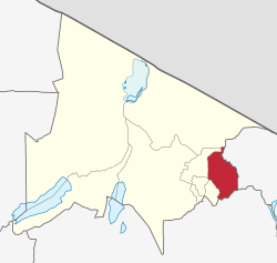
Administrative subdivisions

According to the legislation, Meru District Council has a standard administrative structure that extends to all levels, namely the council, the Ward, the Village, and the Sub Village. The district is divided into three divisions, twenty-six wards, 90 villages, and 337 sub-villages. [19]

Wards

As of 2012, Meru District was administratively divided into 17 wards: [6]

The 9 added wards as of 2017: [20]

Health and Education

Education

In 2007, there were only 38 secondary schools in the district, 21 of which were government-owned and 17 of which were private. In 2017, the district had 113 public elementary schools and 48 private primary schools. There were 29 state secondary schools and 28 private secondary schools in the same year. Meru District Council is home to five higher learning institutions: Makumira University College, Patadi Teacher's College, The University of Arusha, The Institute of Community Development, Tengeru, National Artificial Insemination Centre (NAIC) and Nelson Mandela University, and The Institute of Livestock Development, Tengeru. [21]

Health

The council has two hospitals. 1 government hospital and 1 faith-based hospital that operates under a Public-Private Partnership. Council has 8 health centers, 6 of which are government, 2 of which are faith-based, and 50 dispensaries, 29 of which are government, 12 of which are faith-based, and 9 of which are private. There are three dispensaries operating under temporary structures (shistoni, Kitefu and Kisimiri chini). [22]

Epidimiology and mortality

Meru District's Maternal death rate of 26/100,000; neonatal mortality rate of 6/1000. In general, females are more afflicted than men over the age of five, whereas males under the age of five are more affected than females. This is also reflected in total admissions, where females outnumber males. Clinical AIDS is the primary cause of death in younger children, while Pneumonia is the top cause of death in adults, with a case fatality rate (CFR) of 27. Rabies is the main cause of morbidity and mortality among notifiable diseases, with a CFR of 100%, followed by Malaria in terms of morbidity, with a CFR of 0.23. By June 2017, the prevalence of severe malaria had dropped from 10.91% to 5% and the HIV prevalence had dropped from 1.6% to 1.5%. [23]

Notable persons from Meru District

Related Research Articles

<span class="mw-page-title-main">Arusha</span> City of Arusha Region in Tanzania

Arusha City is a Tanzanian city, with a population of 617,631, and the regional capital of the Arusha Region, with a population of 2,356,255.

<span class="mw-page-title-main">Kilwa District, Lindi</span> District of Lindi Region, Tanzania

Kilwa District is one of six administrative districts of Lindi Region in Tanzania. The District covers an area of 15,000 km2 (5,800 sq mi). The district is comparable in size to the land area of the nation state of East Timor. Kilwa district is bordered to the north by Rufiji District in Pwani Region, to the east by the Indian Ocean, to the south by the Lindi District, Nachingwea District together with Ruangwa District, and to the west by the Liwale District. The district borders every other district in Lindi Region except Lindi Municipal District. The district seat (capital) is the town of Kilwa Masoko. The district is named after the medieval Swahili city state of Kilwa Kisiwani. According to the 2012 census, the district has a total population of 190,744.

<span class="mw-page-title-main">Kilimanjaro Region</span> Region of Tanzania

Kilimanjaro Region is one of Tanzania's 31 administrative regions. The regional capital and largest city is the municipality of Moshi. With the 3rd highest HDI of 0.640 in the country, Kilimanjaro is one among the top five most developed regions of Tanzania. According to the 2012 national census, the region had a population of 1,640,087, which was lower than the pre-census projection of 1,702,207. For 2002–2012, the region's 1.8 percent average annual population growth rate was the 24th highest in the country. It was also the eighth most densely populated region with 124 people per square kilometer. The most well-known tribes in the Kilimanjaro region are the chagga, rombos, and pare.

<span class="mw-page-title-main">Arusha Region</span> Region of Tanzania

Arusha Region is one of Tanzania's 31 administrative regions and is located in the north of the country. The region's capital and largest city is the city of Arusha. The region is bordered by Kajiado County and Narok County in Kenya to the north, the Kilimanjaro Region to the east, the Manyara and Singida Regions to the south, and the Mara and Simiyu regions to the west. Arusha Region is home to Ngorongoro Conservation Area, a UNESCO World Heritage Site. The region is comparable in size to the combined land and water areas of the state of Maryland in the United States.

<span class="mw-page-title-main">Ilala District, Dar es Salaam</span> District of Dar es Salaam Region, Tanzania


Ilala District, officially the Ilala Municipal Council is one of five districts of the Dar es Salaam Region of Tanzania. The district is bordered to the north and northeast by Kinondoni District and Ubungo District, to the east by the Zanzibar Channel, the west by Pwani Region, and to the south by the Temeke District. It covers an area of 364.9 km2 (140.9 sq mi). The district is comparable in size to the land area of U.S Virgin Islands. The administrative seat is Mchafukoge. The 2012 National Tanzania Census states the population for Ilala as 1,220,611.

<span class="mw-page-title-main">Karatu District, Arusha</span> District in Arusha Region, Tanzania

Karatu District is one of seven districts of the Arusha Region of Tanzania. The district is bordered to the north by the Ngorongoro District and to the west by the Meatu District in the Simiyu Region. The district is bordered to the east by the Monduli District, and to the south and southeast by the Mbulu District and the Babati District. The district covers an area of 3,207 km2 (1,238 sq mi). The district is comparable in size to the land area of Samoa. The district has an max elevation of 1,739 m (5,705 ft) on Oldeani Peak. Karatu district is home to the hunter-gatherer community of the Hadza people. Also Karatu is known agriculturally as the onion capital of Tanzania. The district capital is the town of Karatu. According to the 2022 census, the population of the district was 280,454.

<span class="mw-page-title-main">Arusha City Council, Arusha</span> District of Arusha Region, Tanzania

Arusha City Council is one of seven administrative districts of Arusha Region in Tanzania. It is surrounded to the south, west and north by Arusha Rural District and to east by Meru District. The district covers an area of 267.0 km2 (103.1 sq mi). The district is comparable in size to the land area of Cayman Islands. The district capital is the city of Arusha. As of 1994, Arusha District was the wealthiest district in Tanzania. According to the 2022 Tanzania National Census, the population of Arusha Urban District was 617,631.

<span class="mw-page-title-main">Arumeru District</span> Former District in Arusha Region, Tanzania

Arumeru District is a former district in the Arusha Region of Tanzania. It was bordered to the north, west, and southwest by Monduli District, to the southeast by the city of Arusha, and to the east by the Kilimanjaro Region.

<span class="mw-page-title-main">Hai District, Kilimanjaro</span> District of Kilimanjaro Region, Tanzania

Hai is one of the seven districts of the Kilimanjaro Region of Tanzania.The district covers approximately 1,217 square kilometres (470 sq mi). It is bordered to the southwest by the Meru District of Arusha Region, to the west by the Siha District, and to the east by the Moshi Urban District and Moshi Rural District and the Rombo District to the far north. The western breach part of Mount Kilimanjaro is located in the Hai District. According to the 2022 census, the population of the Hai District was 240,999.

<span class="mw-page-title-main">Usa River, Meru District, Arusha</span> Ward of Meru District, Arusha Region

Usa River also known locally as Ussa is an administrative ward of the Meru District in the Arusha Region of Tanzania. It is the seat of Meru District. To the north and west, the ward is surrounded by the wards of Nkoaranga, Poli, and Seela Sing'isi. To the south and east, respectively, are the wards of Kikwe and Maroroni, and Maji ya Chai. As of 2012, Usa River ward had a population of 23,437.

Makumira is a small town located in Poli ward of Meru District in Arusha Region of northern Tanzania. It lies on the slope of Mount Meru, the fifth-highest mountain in Africa. Makumira is about 16 kilometres from the city of Arusha on the main road, A23. The neighboring villages are Tengeru and Usa River.

Leguruki is an administrative ward in the Meru District of the Arusha Region of Tanzania. The ward is home to ober 60 small lakes and is the lake ward of Meru district and also home to the eastern section of Arusha National Park. The ward is bordered to the east by Siha Distric of Kilimanjaro Region. According to the 2002 census, the ward has a total population of 15,678.

Maji ya Chai is an administrative ward in the Meru District of the Arusha Region of Tanzania. The ward is home to the University of Arusha is also where the gate of Arusha National Park is located. According to the 2012 census, the ward has a total population of 29,313. Thus making the ward the most populous in Meru district.

Maroroni is an administrative ward in the Meru District of the Arusha Region of Tanzania. The ward is home to the privately owned Kilimanjaro Golf and Wildlife sanctuary. According to the 2002 census, the ward has a total population of 12,001.

<span class="mw-page-title-main">Sekei, Arusha</span> Ward and district capital of the Arusha City Council in the Arusha Region of Tanzania

Sekei is an administrative ward and district capital located in the Arusha City Council of Arusha Region in Tanzania. The ward is bordered by Kaloleni ward to the west, Sokon II ward to the north, Kimandolu ward to the east, Themi to the south and, a tiny portion of Kati ward to the southeast. The name sekei comes from the Masai word seki which is a type of tree that grew there before settlement. Sekei ward was officially established in 1969 and is the location of the headquarters of Arusha City Council.

<span class="mw-page-title-main">Dodoma Municipal Council</span> District of Dodoma Region, Tanzania

Dodoma City District, officially the Dodoma Municipal Council is one of seven districts of the Dodoma Region of Tanzania. It is bordered to the west by Bahi District, and to the east by Chamwino District. It covers an area of 2,607 km2 (1,007 sq mi). The district is comparable in size to the land area of Luxembourg. Its administrative seat is the city of Dodoma, also the legislative capital of Tanzania. The 2012 National Tanzania Census states the population for the district as 410,956.

<span class="mw-page-title-main">Longido District, Arusha</span> District of Arusha Region, Tanzania

Longido District is one of seven districts of the Arusha Region of Tanzania. The district is bordered to the east by the Ngorongoro District, to the south west by the Monduli District and southeast by the Arusha Rural District and Meru District. To the far east by Siha District of Kilimanjaro Region and the north by Kenya. It covers an area of 7,885 km2 (3,044 sq mi). The district is comparable in size to the land area of Puerto Rico.Longido District was created in 2007 from Monduli District. Mount Longido, Gelai and Kitumbeine volcano are all located within the boundaries of the district. The administrative seat is the town of Longido. According to the 2022 census, the population of the district was 175,915. Longido District is known as Arusha's gem district as its home to Anyolite and Rubies.

<span class="mw-page-title-main">Arusha District Council, Arusha</span> District of Arusha in Arusha Region, Tanzania

Arusha District or Arusha District Council is one of the seven districts of the Arusha Region of Tanzania. The district is bordered to the north by Longido District, to the east by Meru District, to the south by Kilimanjaro Region, and to the west by Monduli District. the district surrounds Arusha City on all three sides. The district covers an area of 1,547.6 km2 (597.5 sq mi). The district is comparable in size to the land area of Guadeloupe. The district capital is located in Sokon II. According to the 2022 Tanzania National Census, the population of Arusha District was 449,518.

<span class="mw-page-title-main">Sokon II, Arusha District</span> Ward in Arusha District of the Arusha Region of Tanzania

Sokon II is one of the 27 administrative wards of the Arusha District Council located in the Arusha Region of Tanzania. The name Sokon comes from the Swahili word for market, sokoni. The ward shares a similar name with another ward located in Arusha Urban District called Sokon I and the former is one of 27 rural administrative wards in the district as of 2012. Sokon II ward is bordered by Oltoroto and Moivo ward in the west, Ilkiding'a ward to the north, Bangata ward to the east. On the southern border Sokon II is bordered by Baraa, Kimandolu and Sekei wards. According to the 2012 census, the ward has a total population of 32,073. Thus, Sokon II is the most populous ward in Arusha District. Also the ward headquarters are Oldadai village. In addition, the Arusha District Administration building is located in Sokon II ward.

Songoro is an administrative ward in the Meru District of the Arusha Region of Tanzania. The ward covers an area of 114.0 km2 (44.0 sq mi), and has an average elevation of 1,285 m (4,216 ft). The ward is the source of the Kikuletwa River through the Tengeru River as a tributary which eventually leads to the Pangani River. According to the 2012 census, the ward has a total population of 11,139.

References

  1. "Longido District Profile" (PDF). Retrieved 2023-03-05.
  2. "Tanzania: Northern Zone(Districts and Wards) - Population Statistics, Charts and Map".
  3. 1,393 km2 (538 sq mi) for Faroes Islands at "Area size comparison". Nation master. 2022. Retrieved 5 March 2023.
  4. "Rhino Point Elevation".
  5. "Tanzania: Administrative Division (Regions and Districts) - Population Statistics, Charts and Map". www.citypopulation.de. Retrieved 2024-02-10.
  6. 1 2 "2012 Population and Housing Census" (PDF). Development Partners Group Tanzania. Retrieved 7 August 2019.
  7. "Meru and Machame Migrations to Arusha Region" . Retrieved 17 October 2021.
  8. "Meru District Council Socio Economic Profile" (PDF). Office of the District Executive Director, Meru District. 2017. Retrieved 2023-03-05.
  9. "Meru District Council Socio Economic Profile" (PDF). Office of the District Executive Director, Meru District. 2017. Retrieved 2023-03-05.
  10. "Meru District Council Socio Economic Profile" (PDF). Office of the District Executive Director, Meru District. 2017. Retrieved 2023-03-05.
  11. "Meru District Council Socio Economic Profile" (PDF). Office of the District Executive Director, Meru District. 2017. Retrieved 2023-03-05.
  12. "Arusha Region Roads Network" (PDF). TanRoads. Retrieved 20 August 2019.
  13. "Meru District Council Socio Economic Profile" (PDF). Office of the District Executive Director, Meru District. 2017. Retrieved 2023-03-05.
  14. "Meru District Council Socio Economic Profile" (PDF). Office of the District Executive Director, Meru District. 2017. Retrieved 2023-03-05.
  15. "Meru District Council Socio Economic Profile" (PDF). Office of the District Executive Director, Meru District. 2017. Retrieved 2023-03-05.
  16. "Meru District Council Socio Economic Profile" (PDF). Office of the District Executive Director, Meru District. 2017. Retrieved 2023-03-05.
  17. "Meru District Council Socio Economic Profile" (PDF). Office of the District Executive Director, Meru District. 2017. Retrieved 2023-03-05.
  18. "Meru District Council Socio Economic Profile" (PDF). Office of the District Executive Director, Meru District. 2017. Retrieved 2023-03-05.
  19. "Meru District Council Socio Economic Profile" (PDF). Office of the District Executive Director, Meru District. 2017. Retrieved 2023-03-05.
  20. "Meru District Council Socio Economic Profile" (PDF). Office of the District Executive Director, Meru District. 2017. Retrieved 2023-03-05.
  21. "Meru District Council Socio Economic Profile" (PDF). Office of the District Executive Director, Meru District. 2017. Retrieved 2023-03-05.
  22. "Meru District Council Socio Economic Profile" (PDF). Office of the District Executive Director, Meru District. 2017. Retrieved 2023-03-05.
  23. "Meru District Council Socio Economic Profile" (PDF). Office of the District Executive Director, Meru District. 2017. Retrieved 2023-03-05.