Related Research Articles

The Anahim Volcanic Belt (AVB) is a west–east trending chain of volcanoes and related magmatic features in British Columbia, Canada. It extends from Athlone Island on the Central Coast, running eastward through the strongly uplifted and deeply dissected Coast Mountains to near the community of Nazko on the Interior Plateau. The AVB is delineated as three west-to-east segments that differ in age and structure. A wide variety of igneous rocks with differing compositions occur throughout these segments, comprising landforms such as volcanic cones, volcanic plugs, lava domes, shield volcanoes and intrusions.

The Chilcotin Group, also called the Chilcotin Plateau Basalts, is a large area of basaltic lava that forms a volcanic plateau running parallel with the Garibaldi Volcanic Belt in south-central British Columbia, Canada.

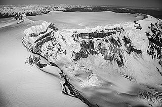
Mount Edziza, sometimes called Edziza Mountain or Edziza Peak, is a stratovolcano in Cassiar Land District of northwestern British Columbia, Canada. It is located on the Big Raven Plateau of the Tahltan Highland which extends along the western side of the Stikine Plateau. The mountain has an elevation of 2,786 metres, making it the highest volcano of the Mount Edziza volcanic complex. However, it had an elevation of at least 3,396 metres before its original summit was likely destroyed by a violent, climactic eruption in the geologic past; its current flat summit contains an ice-filled, 2-kilometre (1.2-mile) in diameter crater. Mount Edziza contains several lava domes, cinder cones and lava fields on its flanks, as well as an ice cap that is characterized by several outlet glaciers stretching out to lower altitudes. All sides of the mountain are drained by tributaries of Mess Creek and Kakiddi Creek which are situated within the Stikine River watershed.

The Spectrum Range, formerly gazetted as the Spectrum Mountains and the Rainbow Mountains, is a small mountain range in Cassiar Land District of northwestern British Columbia, Canada. Located at the southern end of the Tahltan Highland, it borders the Skeena Mountains in the east and the Boundary Ranges of the Coast Mountains in the west. The Spectrum Range is surrounded by the Arctic Lake Plateau in the southwest and the Kitsu Plateau in the northwest, both of which contain volcanic features such as cinder cones. It lies at the southern end of the Mount Edziza volcanic complex which includes the two neighbouring plateaus as well as Mount Edziza and the Big Raven Plateau to the north. The mountain range is drained on all sides by streams within the Stikine River watershed and, unlike Mount Edziza to the north, contains relatively small separate glaciers. Mount Edziza Provincial Park is the main protected area surrounding the Spectrum Range.

The Alligator Lake volcanic complex is a group of basaltic cinder cones and lava flows in south central Yukon. The upper part of the Alligator Lake volcanic complex consists of two well-preserved cinder cones capping a small shield volcano. They probably post-date the local Holocene glaciation. Lava flows from both cinder cones traveled to the north and were erupted simultaneously. Their compositions range from alkali olivine basalt to basanitic. Lava flows from the northeast cone are the largest extending 6 km (4 mi) from the cone and expanding to a width of 10 km (6 mi) at the terminus.
The Atlin Volcanic Field, also called the Llangorse Volcanic Field and the Surprise Lake Volcanic Field, is a group of late-Pleistocene to Holocene cinder cones that lies on the Teslin Plateau east of Atlin Lake, Canada. The largest volcanic feature is the 1880-m-high Ruby Mountain which has been partially dissected by Pleistocene and post-Wisconsin glaciation. Two basaltic cinder cones at the heads of Cracker Creek and Volcanic Creek lie within glacially dissected U-shaped valleys and may be of postglacial age.

Kostal Cone, also called Kostal Volcano and Fire Mountain, is a young cinder cone in Wells Gray Provincial Park in east-central British Columbia, Canada. It rises from the northeast shore of Kostal Lake in the Cariboo Mountains. With an elevation of 1,440 m (4,724 ft), Kostal Cone is one of the lowest volcanoes in the Wells Gray-Clearwater volcanic field.

The Milbanke Sound Group, also called the Milbanke Sound Cones, is an enigmatic group of five small basaltic volcanoes in the Kitimat Ranges of the Coast Mountains in British Columbia, Canada. Named for Milbanke Sound, this volcanic group straddles on at least four small islands, including Swindle, Price, Lady Douglas and Lake Island. Not much is known about this group of volcanoes and they remain undated. However, they all likely formed in the past 10,000 years after the last glacial period as evidenced by a small amount of erosion. The age of the most recent volcanic activity is also unknown. Most of the Milbanke Sound Cones are covered by mature forest. Kitasu Hill and Helmet Peak are the only two cones that are officially named.

Volcanic activity is a major part of the geology of Canada and is characterized by many types of volcanic landform, including lava flows, volcanic plateaus, lava domes, cinder cones, stratovolcanoes, shield volcanoes, submarine volcanoes, calderas, diatremes, and maars, along with less common volcanic forms such as tuyas and subglacial mounds.

The Wells Gray-Clearwater volcanic field, also called the Clearwater Cone Group, is a potentially active monogenetic volcanic field in east-central British Columbia, Canada, located approximately 130 km (81 mi) north of Kamloops. It is situated in the Cariboo Mountains of the Columbia Mountains and on the Quesnel and Shuswap Highlands. As a monogenetic volcanic field, it is a place with numerous small basaltic volcanoes and extensive lava flows.

The Big Raven Plateau is an intermontane plateau in Cassiar Land District of northwestern British Columbia, Canada. It lies on the Tahltan Highland and is surrounded by several valleys, including those of Mess Creek, Kakiddi Creek, Chakima Creek, Walkout Creek and the Klastline River. The plateau is drained by many small streams that flow into these neighbouring valleys and, unlike the valleys, it is relatively barren of vegetation. Stream erosion has resulted in the creation of canyons with intervening ridges on the eastern and western sides of the plateau, resulting in the creation of rugged terrain. The plateau is in Mount Edziza Provincial Park which is one of the largest provincial parks in British Columbia. Access to the Big Raven Plateau is mainly by aircraft or by a network of footpaths from surrounding roads.

The Kitsu Plateau is a small intermontane plateau in Cassiar Land District of northwestern British Columbia, Canada. It lies on the Tahltan Highland and is surrounded by several valleys, including those of Mess Creek, Nagha Creek and Raspberry Creek. The plateau is drained by many small streams that flow into these neighbouring valleys and, unlike the valleys, it is relatively barren of vegetation. Surrounding the Kitsu Plateau is Mount Edziza Provincial Park which is one of the largest provincial parks in British Columbia. Access to this remote plateau is mainly by aircraft since motorized vehicles are prohibited from entering Mount Edziza Provincial Park.

The Mount Edziza volcanic complex is a group of volcanoes and associated lava flows in northwestern British Columbia, Canada. Located on the Tahltan Highland, it is 40 kilometres southeast of Telegraph Creek and 85 kilometres southwest of Dease Lake. The complex encompasses a broad, steep-sided lava plateau that extends over 1,000 square kilometres. Its highest summit is 2,786 metres in elevation, making the MEVC the highest of four large complexes in an extensive north–south trending volcanic region. It is obscured by an ice cap characterized by several outlet glaciers that stretch out to lower altitudes.

Volcanism of Western Canada has produced lava flows, lava plateaus, lava domes, cinder cones, stratovolcanoes, shield volcanoes, greenstone belts, submarine volcanoes, calderas, diatremes and maars, along with examples of more less common volcanic forms such as tuyas and subglacial mounds.

Volcanism in Northern Canada has produced hundreds of volcanic areas and extensive lava formations across Northern Canada. The region's different volcano and lava types originate from different tectonic settings and types of volcanic eruptions, ranging from passive lava eruptions to violent explosive eruptions. Northern Canada has a record of very large volumes of magmatic rock called large igneous provinces. They are represented by deep-level plumbing systems consisting of giant dike swarms, sill provinces and layered intrusions.

The Volcano, also known as Lava Fork volcano, is a small cinder cone in the Boundary Ranges of the Coast Mountains in northwestern British Columbia, Canada. It is located approximately 60 km (40 mi) northwest of the small community of Stewart near the head of Lava Fork. With a summit elevation of 1,656 m (5,433 ft) and a topographic prominence of 311 m (1,020 ft), it rises above the surrounding rugged landscape on a remote mountain ridge that represents the northern flank of a glaciated U-shaped valley.

The volcanic history of the Northern Cordilleran Volcanic Province presents a record of volcanic activity in northwestern British Columbia, central Yukon and the U.S. state of easternmost Alaska. The volcanic activity lies in the northern part of the Western Cordillera of the Pacific Northwest region of North America. Extensional cracking of the North American Plate in this part of North America has existed for millions of years. Continuation of this continental rifting has fed scores of volcanoes throughout the Northern Cordilleran Volcanic Province over at least the past 20 million years and occasionally continued into geologically recent times.

The Canadian Cascade Arc, also called the Canadian Cascades, is the Canadian segment of the North American Cascade Volcanic Arc. Located entirely within the Canadian province of British Columbia, it extends from the Cascade Mountains in the south to the Coast Mountains in the north. Specifically, the southern end of the Canadian Cascades begin at the Canada–United States border. However, the specific boundaries of the northern end are not precisely known and the geology in this part of the volcanic arc is poorly understood. It is widely accepted by geologists that the Canadian Cascade Arc extends through the Pacific Ranges of the Coast Mountains. However, others have expressed concern that the volcanic arc possibly extends further north into the Kitimat Ranges, another subdivision of the Coast Mountains, and even as far north as Haida Gwaii.
The Satah Mountain volcanic field (SMVF) is an extensive north-south trending volcanic chain in the Central Interior of British Columbia that stretches south of the Itcha Range shield volcano to northeast of Nimpo Lake. The chain is located on the Chilcotin Plateau, a major subdivision of the Interior Plateau that includes other nearby volcanic features. It forms a segment of the east-west trending Anahim Volcanic Belt, whose volcanic activity ranges in age from Miocene-to-Holocene.

The Mount Edziza volcanic complex (MEVC) in British Columbia, Canada, has a history of volcanism that spans more than 7 million years. It has taken place during five cycles of magmatic activity, each producing less volcanic material than the previous one. Volcanism during these cycles has created several types of volcanoes, including cinder cones, stratovolcanoes, subglacial volcanoes, shield volcanoes and lava domes. The approximately 1,000-square-kilometre (400-square-mile) volcanic plateau forming the base of the MEVC originated from the successive eruptions of highly mobile lava flows. Volcanic rocks such as basalt, trachybasalt, benmoreite, tristanite, mugearite, trachyte and rhyolite were deposited by multiple eruptions of the MEVC; the latter six rock types are products of varying degrees of magmatic differentiation in underground magma reservoirs. At least 10 distinct flows of obsidian were produced by volcanism of the MEVC, some of which were exploited by indigenous peoples in prehistoric times to make tools and weaponry. Renewed volcanism could produce explosive eruptions and block local streams with lava flows.
References
- ↑ Catalogue of Canadian volcanoes: Mess Lake Archived 2011-07-06 at the Wayback Machine