Mhluzi | |
|---|---|
 Mhluzi  Mhluzi | |
| Coordinates: 25°45′32″S29°25′47″E / 25.75889°S 29.42972°E | |
| Country | South Africa |
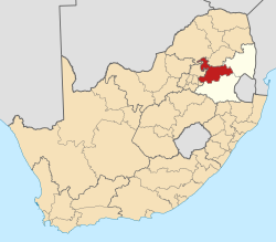
| Province | Mpumalanga |
| District | Nkangala |
| Municipality | Steve Tshwete |
| Area | |
• Total | 10.29 km2 (3.97 sq mi) |
| Elevation | 1,490 m (4,890 ft) |
| Population (2011) [1] | |
• Total | 76,462 |
| • Density | 7,400/km2 (19,000/sq mi) |
| Racial makeup (2011) | |
| • Black African | 98.5% |
| • Coloured | 0.7% |
| • Indian/Asian | 0.2% |
| • White | 0.2% |
| • Other | 0.4% |
| First languages (2011) | |
| • Zulu | 43.0% |
| • S. Ndebele | 18.0% |
| • Northern Sotho | 16.7% |
| • Swazi | 6.6% |
| • Other | 15.7% |
| Time zone | UTC+2 (SAST) |
| Postal code (street) | 1050 |
| PO box | 1055 |
Mhluzi is a township just west of the large farming and industrial town Middelburg in the South African province of Mpumalanga.
Contents
It has 8 primary schools and 6 secondary.