Klarinet | |
|---|---|
 Klarinet  Klarinet  Klarinet | |
| Coordinates: 25°58′08″S29°16′23″E / 25.969°S 29.273°E | |
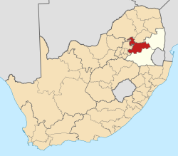
| Country | South Africa |
| Province | Mpumalanga |
| District | Nkangala |
| Municipality | Emalahleni |
| Area | |
• Total | 3.12 km2 (1.20 sq mi) |
| Population (2011) [1] | |
• Total | 9,822 |
| • Density | 3,100/km2 (8,200/sq mi) |
| Racial makeup (2011) | |
| • Black African | 98.0% |
| • Coloured | 1.4% |
| • Indian/Asian | 0.2% |
| • White | 0.1% |
| • Other | 0.3% |
| First languages (2011) | |
| • Zulu | 44.5% |
| • Northern Sotho | 22.2% |
| • Southern Ndebele | 8.5% |
| • Swazi | 5.5% |
| • Other | 19.2% |
| Time zone | UTC+2 (SAST) |
Klarinet is a town north of the city centre of eMalahleni (previously known as Witbank).