
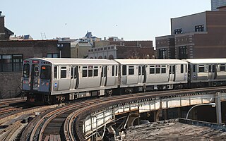
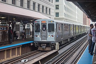
The Chicago "L" is the rapid transit system serving the city of Chicago and some of its surrounding suburbs in the U.S. state of Illinois. Operated by the Chicago Transit Authority (CTA), it is the fourth-largest rapid transit system in the United States in terms of total route length, at 102.8 miles (165.4 km) long as of 2014, and the third-busiest rail mass transit system in the United States, after the New York City Subway and the Washington Metro. In 2016, the "L" had 1,492 rail cars, eight different routes, and 145 train stations; average weekday ridership was 759,866.

The Chicago Transit Authority (CTA) is the operator of mass transit in Chicago, Illinois, and some of its surrounding suburbs, including the trains of the Chicago 'L' and CTA bus service.

The Yellow Line, alternatively known as the Skokie Swift, is a branch of the Chicago "L" in Chicago, Illinois. The 4.7-mile (7.6 km) route runs from the Howard Terminal on the north side of Chicago, through the southern part of Evanston and to the Dempster Terminal in Skokie, Illinois, making one intermediate stop at Oakton Street in Skokie.
The Red Line, sometimes known as the Howard–Dan Ryan Line or the North–South Line, is a rapid transit line in Chicago, run by the Chicago Transit Authority (CTA) as part of the Chicago "L" system. It is the busiest line on the "L" system, with an average of 209,085 passengers boarding each weekday in 2019. The route is 26 miles (42 km) long with a total of 33 stations, from Howard station in Rogers Park on the north side, through the State Street subway and to 95th/Dan Ryan in Roseland on the south side. Like the Blue Line, the Red Line runs 24 hours a day, 365 days a year. A proposed extension adding four new stations would extend the Red Line south from 95th/Dan Ryan to 130th Street.
The Orange Line is a rapid transit line in Chicago, Illinois, operated by the Chicago Transit Authority as part of the Chicago "L" system. It is approximately 13 miles (21 km) long and runs on elevated and at grade tracks and serves the Southwest Side, running from the Loop to Midway International Airport. As of 2019, an average of 27,230 riders board Orange Line trains on weekdays.

The Blue Line is a 26.93-mile-long (43.34 km) Chicago "L" line which extends through The Loop from O'Hare International Airport at the far northwest end of the city, through downtown via the Milwaukee–Dearborn subway and across the West Side to its southwest end at Forest Park, with a total of 33 stations. It is the longest line on the "L" system and second busiest, with an average of 143,178 passengers boarding each weekday in 2019.

The Green Line is a rapid transit line on the Chicago Transit Authority's "L" system. It is the only completely elevated route in the entire system; all other routes either have underground sections or sections at grade. It utilizes the system's oldest segments, extending 20.695 miles (33.305 km) with 30 stops between Oak Park (Harlem/Lake) and Chicago's West Side, to the Loop, and then to the South Side and West Englewood (Ashland/63rd) and Woodlawn. As of 2019, an average of 38,755 passengers board each weekday.

The Transitway is a bus rapid transit (BRT) network operated by OC Transpo in Ottawa, Ontario, Canada. It comprises a series of bus-only roadways and reserved lanes on city streets and highways. The dedicated busways ensure that buses and emergency vehicles on the Transitway rarely intersect directly with the regular traffic, and make it possible for them to continue at full speed even during rush hour. OC Transpo operates a network of rapid routes which use the Transitway to connect communities with the O-Train light rail system. Additional bus routes also use segments of the Transitway.
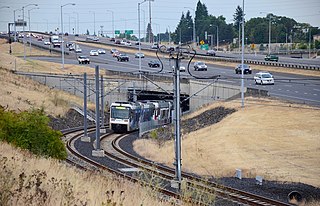
The I-205 busway was a partially built busway along the right-of-way of the Interstate 205 freeway in Portland, Oregon. Although it never opened as a busway, its right-of-way has been in use by light rail lines partially since 2001 and fully since 2009.
The Chicago Central Area Transit Plan, generally referred to as the Chicago Central Area Transit Project (CCATP) in the 1970s, was an extensive study of the rapid transit system in downtown Chicago; the study had begun in 1965.

The Pink Line is an 11.2 mi (18.0 km) rapid transit line in Chicago, run by the Chicago Transit Authority (CTA) as part of the Chicago "L" system. It is the CTA's newest rail line and began operation for a 180-day trial period on June 25, 2006, running between 54th/Cermak station in Cicero, Illinois and the Loop in downtown Chicago. The route, as the line is about to enter downtown Chicago, shares tracks with Green Line trains on Lake Street. This connection is handled by the previously non-revenue Paulina Connector set of tracks. In 2019, an average of 15,876 passengers boarded Pink Line trains on weekdays.
The Crosstown Expressway, suggested as Interstate 494 (I-494), was a proposed highway route in Chicago, Illinois. It was originally planned through the 1960s and 1970s.

Sox–35th is an 'L' station on the CTA's Red Line. It is situated at 142 West 35th Street in the Armour Square neighborhood. The station opened on September 28, 1969 along with the other stations on the Dan Ryan branch.
Cermak Road, also known as 22nd Street, is a 19-mile-long, major east–west street on Chicago's near south and west sides and the city's western suburbs. In Chicago's street numbering system, Cermak is 2200 south, or twenty-two blocks south of the baseline, Madison Street (Chicago). Normally, one mile comprises eight Chicago blocks, but the arterial streets Roosevelt Road, formerly named Twelfth Street and at 1200 South, and Cermak Road were platted before the eight-blocks-per-mile plan was implemented. Roosevelt Road is one mile south of Madison Avenue and there are twelve blocks within that mile. Cermak Road is two miles south of Madison Avenue and there are ten blocks within the mile between Roosevelt and Cermak Roads.

The METRO Orange Line is a bus rapid transit line in the Twin Cities, Minnesota operated by Metro Transit. The line operates primarily along Interstate 35W from downtown Minneapolis through Richfield and Bloomington before terminating in Burnsville, Minnesota. The Orange Line provides access to 198,000 jobs with roughly a quarter of them outside downtown Minneapolis. The route serves a mix of stations located in the center of the highway, stations near highway exits, and on-street stations. The line has features typical of bus rapid transit systems with off-board fare payment, articulated buses with extra doors, stations with improved passenger amenities, and transit-only bus lanes on portions of the route.

The Kenwood branch was a rapid transit line which was part of the Chicago 'L' system from 1907 to 1957. The branch served the Kenwood neighborhood of Chicago and consisted of six elevated stations. It opened on September 20, 1907 and closed on December 1, 1957.
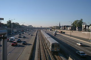
The Dan Ryan branch is a 9.4 mi (15.1 km) long section of the Chicago "L" system located on the South Side of Chicago, Illinois. It is operated by the Chicago Transit Authority, as part of its Red Line service and is normally through-routed downtown towards the North Side via the State Street subway. As of February 2013, the branch serves 45,355 passengers per weekday. As part of the CTA's busiest rapid transit line, it is operated 24 hours a day, 365 days a year. The branch serves the Chinatown, Armour Square, Fuller Park, Englewood, Greater Grand Crossing, Chatham and Roseland neighborhoods.
The Lake–Dan Ryan Line was a rail rapid transit route formerly operated by the Chicago Transit Authority (CTA). The Lake–Dan Ryan Line existed from the opening of the Dan Ryan branch on September 28, 1969 until February 21, 1993. When created, the route united two transit corridors that until 1969 never had through rail service. This routing, which became known as the West-South route, operated from the Harlem terminal in Forest Park on the Lake Street "L" through downtown Chicago along the Union Loop "L", and then via the old South Side "L" and the new Dan Ryan Line to the 95th Street Terminal. The Lake–Dan Ryan service was planned in conjunction with the former Franklin Street Connector and Chicago Central Area Transit Project, both of which were never constructed. The section of the route between the junction with the South Side "L" at 17th and State Streets and the Cermak–Chinatown Station was originally an "interim" or temporary facility, which was to be torn down when the Loop Subway system was completed, but survived after the project was cancelled in 1979. That section was improved in the 1980s and early 1990s and is currently used by the Orange Line. Train transfers are possible by using the two unused tracks.

The Cermak branch, formerly known as the Douglas branch, is a 6.6 mi (10.6 km) long section of the Pink Line of the Chicago "L" system in Chicago, Illinois. It was built by the Metropolitan West Side Elevated west of the Loop. As of February 2013, it serves an average of 17,474 passengers every weekday. The branch serves the Near West Side, Pilsen, Lower West Side, South Lawndale, and North Lawndale neighborhoods of Chicago, and the west suburb Cicero, Illinois. The branch operates from 4:05 a.m. to 1:25 a.m., weekdays, and Saturdays from 5:05 a.m. to 1:25 a.m., and Sundays from 5:00 a.m. to 1:25 a.m., including holidays.