Northwestern Elevated Railroad

Last updated
Northwestern Elevated Railroad
Argyle Station 19160116.jpg
A wooden 'L' train at Argyle on the newly elevated tracks in 1916
Overview
Locale Chicago, Illinois
Service
Type Rapid transit
Operator(s)Northwestern Elevated Railroad Company (1893–1924)
History
OpenedMay 31, 1900 [1]
Closed1924 (merged into Chicago Rapid Transit Company)
Technical
CharacterElevated
Track gauge 4 ft 8+12 in (1,435 mm) standard gauge
Electrification Third rail, Trolley wire 600 V DC
Route map

Contents

BSicon uCONTg.svg
BSicon uKBHF2.svg
BSicon uSTR+c3.svg
Linden
BSicon uSTRc1.svg
BSicon uABZg+4.svg
BSicon uSTR+GRZq.svg
BSicon uBHF.svg
Isabella
BSicon uhbKRZWae.svg
BSicon uLSTR.svg
BSicon uKBHFe.svg
BSicon KSTRa.svg
Central
BSicon uLBHF.svg
BSicon STR.svg
Noyes
BSicon uLBHF.svg
BSicon STR.svg
Foster
BSicon STR.svg
BSicon uLSTR.svg
BSicon lDSTRa.svg
BSicon uLSTR.svg
BSicon uSTRl.svg
BSicon uKBHFeq.svg
Church
Terminal
BSicon uLBHF.svg
BSicon DBHF.svg
Davis
BSicon uLBHF.svg
BSicon DBHF.svg
Dempster
BSicon uLBHF.svg
BSicon DBHF.svg
Main
BSicon uLBHF.svg
BSicon DBHF.svg
Calvary
BSicon uLSTR.svg
BSicon GRZq.svg
BSicon DSTR.svg
Evanston
Chicago
BSicon lDSTRl(l).svg
BSicon ABZgl.svg
BSicon uLABZgl.svg
BSicon lDSTR(r).svg
BSicon STR+r.svg
BSicon uLSTR+r.svg
BSicon lDSTR+r(l).svg
BSicon STR.svg
BSicon uLBHF.svg
BSicon lDBHF(r).svg
BSicon STR.svg
BSicon uLBHF.svg
BSicon lDBHF(l).svg
Howard
BSicon MASKl.svg
BSicon DSTR(r).svg
BSicon uLSTR.svg
BSicon v-NULf.svg
BSicon ulBHF-M.svg
BSicon MASKr.svg
BSicon DSTR(l).svg
BSicon uLSTR.svg
BSicon vNULg-.svg
BSicon ulBHF-M.svg
Jarvis
BSicon MASKl.svg
BSicon DSTR(r).svg
BSicon uLSTR.svg
BSicon v-NULf.svg
BSicon ulBHF-M.svg
BSicon MASKr.svg
BSicon DSTR(l).svg
BSicon uLSTR.svg
BSicon vNULg-.svg
BSicon ulBHF-M.svg
Rogers Park
BSicon MASKl.svg
BSicon DSTR(r).svg
BSicon uLSTR.svg
BSicon v-NULf.svg
BSicon ulBHF-M.svg
BSicon MASKr.svg
BSicon DSTR(l).svg
BSicon uLSTR.svg
BSicon vNULg-.svg
BSicon ulBHF-M.svg
Loyola
BSicon MASKl.svg
BSicon DSTR(r).svg
BSicon uLSTR.svg
BSicon v-NULf.svg
BSicon ulBHF-M.svg
BSicon MASKr.svg
BSicon DSTR(l).svg
BSicon uLSTR.svg
BSicon vNULg-.svg
BSicon ulBHF-M.svg
Granville
BSicon MASKl.svg
BSicon DSTR(r).svg
BSicon uLSTR.svg
BSicon v-NULf.svg
BSicon ulBHF-M.svg
BSicon MASKr.svg
BSicon DSTR(l).svg
BSicon uLSTR.svg
BSicon vNULg-.svg
BSicon ulBHF-M.svg
Thorndale
BSicon MASKl.svg
BSicon DSTR(r).svg
BSicon uLSTR.svg
BSicon v-NULf.svg
BSicon ulBHF-M.svg
BSicon MASKr.svg
BSicon DSTR(l).svg
BSicon uLSTR.svg
BSicon vNULg-.svg
BSicon ulBHF-M.svg
Bryn Mawr
BSicon MASKl.svg
BSicon DSTR(r).svg
BSicon uLSTR.svg
BSicon v-NULf.svg
BSicon ulBHF-M.svg
BSicon MASKr.svg
BSicon DSTR(l).svg
BSicon uLSTR.svg
BSicon vNULg-.svg
BSicon ulBHF-M.svg
Edgewater Beach
Kimball
BSicon uKBHFa.svg
BSicon MASKl.svg
BSicon DSTR(r).svg
BSicon uLSTR.svg
BSicon v-NULf.svg
BSicon ulBHF-M.svg
BSicon MASKr.svg
BSicon DSTR(l).svg
BSicon uLSTR.svg
BSicon vNULg-.svg
BSicon ulBHF-M.svg
Argyle
Kedzie
BSicon uBHF.svg
BSicon MASKl.svg
BSicon DSTR(r).svg
BSicon uLSTR.svg
BSicon v-NULf.svg
BSicon ulBHF-M.svg
BSicon MASKr.svg
BSicon DSTR(l).svg
BSicon uLSTR.svg
BSicon vNULg-.svg
BSicon ulBHF-M.svg
Lawrence
Francisco
BSicon uBHF.svg
BSicon MASKl.svg
BSicon DSTR(r).svg
BSicon uLKRWl.svg
BSicon uhKRWgl.svg
BSicon uhKRWg+r.svg
BSicon uhKRZWae.svg
BSicon DSTRe@f.svg
BSicon uhSTR.svg
Rockwell
BSicon lhSTRa@f.svg
BSicon uBHF.svg
BSicon HUBaq.svg
BSicon eBHF.svg
BSicon HUBq.svg
BSicon uhBHF.svg
BSicon HUBeq.svg
BSicon uKBHFa.svg
Wilson
Western
BSicon uhBHF.svg
BSicon CONTf.svg
BSicon uhSTR.svg
BSicon uhSTRa.svg
Robey
BSicon uhBHF.svg
BSicon uhKRWgl.svg
BSicon uhKRWg+r.svg
Ravenswood
BSicon uhBHF.svg
BSicon uhBHF(R)f.svg
BSicon uhBHF(L)g.svg
Buena
Montrose
BSicon uhBHF.svg
BSicon uhBHF.svg
BSicon uhBHF.svg
Sheridan
Irving Park
BSicon uhBHF.svg
BSicon uhBHF(R)f.svg
BSicon uhBHF(L)g.svg
Grace
Addison
BSicon uhBHF.svg
BSicon uhBHF(R)f.svg
BSicon uhBHF(L)g.svg
Addison
Paulina
BSicon uhBHF.svg
BSicon uhBHF(R)f.svg
BSicon uhBHF(L)g.svg
Clark
Southport
BSicon uhBHFl.svg
BSicon uhSTRq.svg
BSicon lhSTR+r(r).svg
BSicon lhKRZh(r)(g).svg
BSicon lhSTR+l(l).svg
BSicon lhSTRl(l).svg
BSicon uKRZ+r.svg
BSicon uhABZg+r.svg
Clark Junction
BSicon uhBHF.svg
BSicon uhBHF.svg
Belmont
BSicon uhBHF(R)f.svg
BSicon uhBHF(L)g.svg
Wellington
BSicon uhBHF(R)f.svg
BSicon uhBHF(L)g.svg
Diversey
BSicon uhBHF(R)f.svg
BSicon uhBHF(L)g.svg
Wrightwood
BSicon uhBHF.svg
BSicon uhBHF.svg
Fullerton
BSicon uhBHF(R)f.svg
BSicon uhBHF(L)g.svg
Webster
BSicon uhBHF(R)f.svg
BSicon uhBHF(L)g.svg
Center
BSicon uhBHF(R)f.svg
BSicon uhBHF(L)g.svg
Willow
BSicon uBHF(R)f.svg
BSicon uehBHF.svg
BSicon uBHF(L)g.svg
BSicon uehBHF.svg
Halsted
BSicon uhBHF(R)f.svg
BSicon uhBHF(L)g.svg
Larrabee
BSicon uBHF(R)f.svg
BSicon uehBHF.svg
BSicon uBHF(L)g.svg
BSicon uehBHF.svg
Sedgwick
BSicon uhBHF(R)f.svg
BSicon uhBHF(L)g.svg
Schiller
BSicon uhBHF(R)f.svg
BSicon uhBHF(L)g.svg
Division
BSicon uhBHF(R)f.svg
BSicon uhBHF(L)g.svg
Oak
BSicon uhKRWg+l.svg
BSicon uhKRWr.svg
BSicon uhBHF.svg
Chicago
BSicon uhBHF.svg
Grand
Wells Street
Station (C&NW)
BSicon exCONTgq.svg
BSicon HUBaq.svg
BSicon exKBHFeq.svg
BSicon HUBeq.svg
BSicon uehBHF.svg
Kinzie
BSicon uhABZgl.svg
BSicon uhKBHFeq.svg
North Water Terminal
BSicon WASSERq.svg
BSicon uhKRZW.svg
BSicon WASSERq.svg
BSicon uhCONTf.svg

The Northwestern Elevated Railroad was the last of the privately constructed rapid transit lines to be built in Chicago. The line ran from the Loop in downtown Chicago north to Wilson Avenue in Chicago's Uptown neighborhood with a branch to Ravenswood and Albany Park that left the main line at Clark Street. The Ravenswood line is now operated as the Brown Line, while the Main Line is used by the Purple and Red Lines.

History

Beginnings

The Northwestern Elevated Railroad Company was incorporated on October 30, 1893, [2] [3] and on January 8, 1894, it was granted a 50-year franchise by the City of Chicago. [4] The original franchise stipulated that service between a downtown location to the south of the Chicago River and Wilson Avenue was to begin by December 31, 1897. [3] [5] This franchise was altered in 1895 to allow the line to connect to the new Union Loop. [6] The deadline for completion was later extended to May 31, 1899. [7]

Construction of the line started in February 1896. [8] The project experienced financial difficulties and work was paused later in the year and stopped completely in 1897. [9] New financing was found, and construction began again in July 1899. [10] In order to meet the franchise requirements, an inaugural train ran north from the Loop on December 31, 1899. On January 1, 1900, city officials declared that the railroad was unsafe and that the franchise had expired. [11]

Defiantly, the company ran another train the next day. Police stopped the train and arrested the crew, but company officials took the controls and managed to run the train into the Loop. In order to stop its return, police opened the Wells Street bridge and blocked the track with railroad ties, but the officials managed to evade the police by having the train switched on to the Lake Street Elevated Railroad. [12] Eventually the company reached a new agreement with the city, and the first 6.41-mile (10.32 km) section of the railroad was officially opened on May 31, 1900. [1]

Expansion

A preserved Northwestern Elevated Railroad car dating from 1907 CRT1268 20100626.jpg
A preserved Northwestern Elevated Railroad car dating from 1907

In May 1907, the Northwestern opened a branch to Ravenswood. The new branch left the main line just south of Clark Street and operated to Western Avenue. [13] An at-grade extension to the branch's final terminal at Kimball opened in December 1907. [14]

Service was extended 7 miles (11 km) north from the Wilson terminal to Central Street in suburban Evanston in May 1908. [15] [16] This route was over the electrified trackage of the Milwaukee Road's Chicago and Evanston line. Initially the elevated tracks at Wilson were linked to the street level tracks of the Milwaukee Road by a wooden trestle incline. [16]

The Milwaukee Road depots at Argyle Park, Edgewater, North Edgewater, Rogers Park, Birchwood, Calvary, Main, Dempster, Davis, Noyes and Central were demolished and the tracks spread to allow their replacement with new temporary island platform stations. New stations were also added at Hayes Street and Howard Avenue. [17] The section of the line in southern Evanston between Howard Avenue and University Place was elevated onto an embankment by 1910, and the tracks between Lawrence and Howard were elevated between 1914 and 1922.

A short extension from Central to Linden Avenue in Wilmette was built in April 1912. [18]

Consolidation

In 1913, Chicago's four elevated railroad companies came together to form the Chicago Elevated Railways Collateral Trust, establishing crosstown services for the first time. In 1924, all four companies were formally united to form the Chicago Rapid Transit Company. [19] The Chicago Transit Authority took over the assets of the CRT in 1947.

Belmont Belmont Station 19070617.jpg
Belmont
Jarvis Birchwood L station.jpg
Jarvis

Footnotes

Related Research Articles

<span class="mw-page-title-main">Chicago "L"</span> Rapid transit system in Chicago, Illinois, US

The Chicago "L" is the rapid transit system serving the city of Chicago and some of its surrounding suburbs in the U.S. state of Illinois. Operated by the Chicago Transit Authority (CTA), it is the fourth-largest rapid transit system in the United States in terms of total route length, at 102.8 miles (165.4 km) long as of 2014, and the third-busiest rail mass transit system in the United States, after the New York City Subway and Washington Metro. In 2016, the "L" had 1,492 rail cars, eight different routes, and 145 train stations. In 2021, the system had 78,623,200 rides, or about 351,100 per weekday in the third quarter of 2022.

<span class="mw-page-title-main">Purple Line (CTA)</span> Rapid transit line run by the Chicago Transit Authority

The Purple Line of the Chicago "L" is a 3.9-mile (6.3 km) route on the northernmost section of the system. Normally, it extends south from Linden in Wilmette, passing through Evanston to Howard, on Chicago's North Side. In 2021, the average weekday boardings on the Purple Line was 3,382. It is the shortest route in the CTA rail system except during weekday peaks and rush hours.

<span class="mw-page-title-main">Chicago North Shore and Milwaukee Railroad</span>

The Chicago North Shore and Milwaukee Railroad, also known as the North Shore Line, was an interurban railroad that operated passenger and freight service over an 88.9-mile (143.1 km) route between the Chicago Loop and downtown Milwaukee, as well as an 8.6-mile (13.8 km) branch line between the villages of Lake Bluff and Mundelein, Illinois. The North Shore Line also provided streetcar, city bus and motor coach services along its interurban route.

<span class="mw-page-title-main">Howard station (CTA)</span> Chicago "L" station

Howard is an 'L' station in Chicago, Illinois. It is the northern terminus of the Red Line and the southeastern terminus of the Yellow Line; it also serves the Purple Line, for which it is the southern terminus at non-rush hour times on weekdays and all day on weekends. Trains on the Chicago North Shore and Milwaukee Railroad also stopped at Howard from 1926 until that line was abandoned in 1963.

<span class="mw-page-title-main">Argyle station (CTA)</span> Chicago "L" station

Argyle is a station on the Chicago Transit Authority's 'L' system. It is situated between the Berwyn and Lawrence stations on the Red Line, which runs from Rogers Park at Chicago's northern city limits, through downtown Chicago, to Roseland. It is an elevated station with an island platform serving northbound trains and a temporary side platform serving southbound trains located at 1118 West Argyle Street in the West Argyle Street Historic District of Chicago's Uptown community area. Purple Line weekday rush hour express service use the outside tracks but do not stop at this station.

<span class="mw-page-title-main">Wilson station (CTA)</span> Chicago "L" station

Wilson is an 'L' station on the CTA's Red and Purple Lines, located at 4620 North Broadway in the Uptown neighborhood of Chicago, Illinois.

<span class="mw-page-title-main">South Side Elevated Railroad</span>

The South Side Elevated Railroad was the first elevated rapid transit line in Chicago, Illinois. The line ran from downtown Chicago to Jackson Park, with branches to Englewood, Normal Park, Kenwood, and the Union Stock Yards. The first 3.6 miles (5.8 km) of the line opened on June 6, 1892. Much of its route is still used today as part of the Green Line of the Chicago "L" system.

<span class="mw-page-title-main">Lake Street Elevated Railroad</span> Rail company in Chicago

The Lake Street Elevated Railroad was the second permanent elevated rapid transit line to be constructed in Chicago, Illinois. The first section of the line opened in November 1893. Its route is still used today as part of the Green Line route of the Chicago "L" system.

<span class="mw-page-title-main">Kenwood branch</span> Former Chicago "L" line

The Kenwood branch was a rapid transit line which was part of the Chicago 'L' system from 1907 to 1957. The branch served the Kenwood neighborhood of Chicago and consisted of six elevated stations. It opened on September 20, 1907 and closed on December 1, 1957.

<span class="mw-page-title-main">Metropolitan main line</span> Former rapid transit line in Chicago

The Metropolitan main line was a rapid transit line of the Chicago "L" system from 1895 to 1958. It ran west from downtown to a junction at Marshfield station. At this point the Garfield Park branch continued westward, while the Douglas Park branch turned south, and the Logan Square branch turned north with the Humboldt Park branch branching from it. In addition to serving the Chicago "L", its tracks and those of the Garfield Park branch also carried the Chicago Aurora and Elgin Railroad, an interurban that served Chicago's western suburbs, between 1905 and 1953.

<span class="mw-page-title-main">Ravenswood branch</span>

The Ravenswood branch is a 4.7 mi (7.6 km) long branch of the Chicago "L" in Chicago, Illinois. Operated by the Chicago Transit Authority, it carries the Brown Line. As of February 2013, an average of 30,949 passengers are served each weekday on this branch.

<span class="mw-page-title-main">North Side main line</span>

The North Side Main Line is a branch of the Chicago "L" system that is used by Red, Purple, and Brown Line trains. As of 2012, it is the network's busiest rail branch, serving an average of 123,229 passengers each weekday. The branch is 10.3 miles (16.6 km) long with a total of 21 stations, from Howard Street in Rogers Park down to Lake Street in Chicago's Loop. The branch serves the north side of the city 24 hours a day, seven days a week.

<span class="mw-page-title-main">Logan Square branch</span> Rapid transit line in Chicago

The Logan Square branch was an elevated rapid transit line of the Chicago "L", where it was one of the branches of the Metropolitan West Side Elevated Railroad. Diverging north from the Metropolitan's main line west of Marshfield station, it opened in 1895 and served Chicago's Logan Square and West Town neighborhoods. North of Damen station, the Humboldt Park branch diverged from the Logan Square branch, going west to serve Humboldt Park. The original Logan Square branch was separated into several sections in 1951, some of which remain in revenue service as of 2023.

<span class="mw-page-title-main">Franklin Street Terminal</span> Rapid transit station in Chicago, 1895–1897

The Franklin Street Terminal was a rapid transit station on the Chicago "L" that was the eastern terminus of the Metropolitan West Side Elevated Railroad from 1895 to 1897. The Metropolitan had intended to construct its eastern end at Fifth Avenue, a block east of Franklin Street, but right-of-way acquisition costs had proven prohibitive so it settled on Franklin Street to house its terminal and offices. Rather than demolish the buildings on the site, the company opted to gut their second and third floors and run its tracks through them.

<span class="mw-page-title-main">Calvary station (Chicago and North Western Railway)</span> Chicago rail station

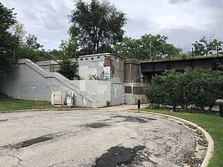
Calvary was a commuter railroad station on the Chicago and North Western Railway's Milwaukee Division, today’s Union Pacific / North Line. The station was located at Mulford Street and Chicago Avenue, in Evanston, Illinois.

<span class="mw-page-title-main">Lake Street Transfer station</span> Rapid transit station in Chicago (1913–1951)

The Lake Street Transfer station was a rapid transit station on the Chicago "L", serving as a transfer station between its Lake Street Elevated Railroad and the Logan Square branch of its Metropolitan West Side Elevated Railroad. Located where the Logan Square branch crossed over the Lake Street Elevated, it was in service from 1913 to 1951, when it was rendered obsolete by the construction of the Dearborn Street subway.

<span class="mw-page-title-main">Madison station (CTA)</span> Rapid transit station in Chicago, 1895–1951

Madison was a rapid transit station on the Chicago "L"'s Metropolitan West Side Elevated Railroad, serving its Logan Square branch from 1895 to 1951. The Metropolitan was one of four founding companies of the "L", and the first of its lines to be powered by electricity. The "L"'s companies merged operations under Chicago Elevated Railways (CER) in 1911 and formally merged into the Chicago Rapid Transit Company (CRT) in 1924. Private ownership of the "L" ended in 1947 when the public Chicago Transit Authority (CTA) assumed operations.

Chicago was a rapid transit station on the Logan Square branch of the Chicago "L", one of the several branches of the Metropolitan West Side Elevated Railroad, between 1895 and 1951. Located on Chicago Avenue, the station was constructed by the Metropolitan in the early 1890s and began service on May 6, 1895.

Grand was a rapid transit station on the Chicago "L"'s Logan Square branch, one of the several branches of the Metropolitan West Side Elevated Railroad. Located on Grand Avenue, the station was constructed by the Metropolitan in the early 1890s and began service on May 6, 1895.

References

  1. 1 2 "New "L" Road is Opened". Chicago Daily Tribune. June 1, 1900. p. 2.
  2. "Another "L" Road Incorporated". Chicago Daily Tribune. October 31, 1893. p. 9.
  3. 1 2 Borzo, The Chicago "L", p. 61.
  4. Poor, H.V.; Poor, H.W. (1900). Poor's Manual of the Railroads of the United States (Volume 33). p. 880.
  5. Wilcox, Municipal Franchises, p. 479.
  6. Wilcox, Municipal Franchises, p. 480.
  7. "Yerkes Wants Time". Chicago Daily Tribune. November 23, 1897. p. 1.
  8. "New North Side "L"". Chicago Daily Tribune. March 8, 1896. p. 25.
  9. Borzo, The Chicago "L", p. 62.
  10. "Rushing North Side "L"". Chicago Daily Tribune. July 28, 1899. p. 1.
  11. "City Stops Work On "L"". Chicago Daily Tribune. January 2, 1900. p. 1.
  12. ""L" Crisis Comes Today". Chicago Daily Tribune. January 3, 1900. p. 5.
  13. "New 'L' Line Operated". Chicago Daily Tribune. May 19, 1907. p. 11.
  14. http://www.chicago-l.org/stations/kimball.html
  15. "Loop Trains to Evanston Will Start Saturday". Chicago Daily Tribune. May 12, 1908. p. 1.
  16. 1 2 "The Northwestern Elevated Extension at Evanston, ILL". The Street Railway Journal. 31 (21): 842–849. May 23, 1908.
  17. "Electrification of the Evanston Suburban Line of the Chicago Milwaukee & St. Paul". The Railway Age. 44 (14): 467. October 4, 1907.
  18. "Night Raid Puts "L" in Wilmette". Chicago Daily Tribune. April 3, 1912. p. 9.
  19. Garfield, Graham. "Unification". Chicago "L".org. Retrieved 2007-12-28.