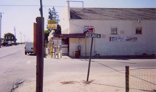
Rolinda is a small unincorporated agricultural community in Fresno County, California, United States. It is located on the Southern Pacific Railroad 10 miles (16 km) west of downtown Fresno, at an elevation of 253 feet. It is located along State Route 180. Official U.S. Geological Survey coordinates for the community are 36°44′07″N119°57′43″W. The community is in area code 559. It does not have its own ZIP code and mail uses the Fresno ZIP code of 93706.

Camden is an unincorporated community in Fresno County, California. It is located 3.5 miles (5.6 km) east of Riverdale, at an elevation of 236 feet.
Cedarbrook is an unincorporated community in Fresno County, California. It is located 6.5 miles (10 km) east-southeast of Dunlap, at an elevation of 4193 feet.
Clotho is an unincorporated community in Fresno County, California. It is located on the Southern Pacific Railroad 3 miles (4.8 km) west-northwest of Sanger, at an elevation of 351 feet.
Crabtree is an unincorporated community in Fresno County, California. It is located 5 miles (8 km) south-southeast of Balch Camp, at an elevation of 1358 feet.
Elm View is an unincorporated community in Fresno County, California. It is located 15 miles (24 km) south of downtown Fresno, at an elevation of 256 feet.
Etheda Springs is an unincorporated community in Fresno County, California. It is located 7 miles (11 km) east-southeast of Dunlap, at an elevation of 4222 feet.
Glorietta is an unincorporated community in Fresno County, California. It is located on the Southern Pacific Railroad 1 mile (1.6 km) north-northwest of Clovis, at an elevation of 367 feet.
Goldleaf is an unincorporated community in Fresno County, California. It is located on the Southern Pacific Railroad 3 miles (4.8 km) north-northeast of Malaga, at an elevation of 312 feet.

Letcher is a former settlement in Fresno County, California. It was located 12 miles (19 km) northeast of Clovis, at an elevation of 610 feet. Letcher still appeared on maps as of 1923.
Muscatel is an unincorporated community in Fresno County, California. It is located on the Southern Pacific Railroad 4.5 miles (7.2 km) west-northwest of downtown Fresno, at an elevation of 299 feet.
Oleander is an unincorporated community in Fresno County, California. It is located 9 miles (14 km) south-southeast of downtown Fresno, at an elevation of 285 feet.
Pinehurst is an unincorporated community in Fresno County, California. It is located 6.5 miles (10 km) east-southeast of Dunlap, at an elevation of 4003 feet.
Pratton is an unincorporated community in Fresno County, California. It is located on the Southern Pacific Railroad 6 miles (9.7 km) west of downtown Fresno, at an elevation of 262 feet.
Raco is an unincorporated community in Fresno County, California. It is located on the Southern Pacific Railroad 4.25 miles (6.8 km) southwest of Herndon, at an elevation of 269 feet.
Sierra Sky Park is a fly-in unincorporated community in Fresno County, California. It is located 7 miles (11 km) northwest of downtown Fresno, at an elevation of 328 feet.
Wildflower is an unincorporated community in Fresno County, California. It is located 6 miles (9.7 km) southwest of Selma, at an elevation of 269 feet.
Whitfield is an unincorporated community in Pittsylvania County, in the U.S. state of Virginia.
Linda is an extinct town in New Madrid County, in the U.S. state of Missouri. The GNIS classifies it as a populated place.
Guiteau is an unincorporated community in Oregon County, in the U.S. state of Missouri.


