Milner, Georgia | |
---|---|
Coordinates: 33°6′47″N84°11′42″W / 33.11306°N 84.19500°W | |
Country | United States |
State | Georgia |
County | Lamar |
Area | |
• Total | 2.12 sq mi (5.48 km2) |
• Land | 2.11 sq mi (5.46 km2) |
• Water | 0.01 sq mi (0.02 km2) |
Elevation | 840 ft (256 m) |
Population (2020) | |
• Total | 772 |
• Density | 366.40/sq mi (141.47/km2) |
Time zone | UTC-5 (Eastern (EST)) |
• Summer (DST) | UTC-4 (EDT) |
ZIP code | 30257 |
Area code | 770 |
FIPS code | 13-51604 [2] |
GNIS feature ID | 0332395 [3] |
Website | milnerga |
Milner is a city in Lamar County, Georgia, United States. The population was 610 at the 2010 census, [4] up from 522 at the 2000 census. Milner is part of Metro Atlanta.
The community founded in 1912 and was named after Willis R Milner, a pioneer citizen. [5]
Milner is located in northwestern Lamar County at 33°6′47″N84°11′42″W / 33.11306°N 84.19500°W (33.112941, -84.195017). [6] U.S. Route 41 passes through the southwest side of the city, leading southeast 5 miles (8 km) to Barnesville, the Lamar county seat, and northwest 11 miles (18 km) to Griffin.
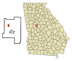
According to the United States Census Bureau, the city has a total area of 2.1 square miles (5.4 km2), all land. [7] The city sits on the Eastern Continental Divide, with the east side draining via Prairie Creek and Edie Creek to the Little Towaliga River, the Towaliga River, the Ocmulgee River, and ultimately the Atlantic Ocean, while the west side drains via Grape Creek to Potato Creek, the Flint River, and ultimately the Gulf of Mexico.
Census | Pop. | Note | %± |
---|---|---|---|
1880 | 442 | — | |
1900 | 440 | — | |
1910 | 400 | −9.1% | |
1920 | 407 | 1.8% | |
1930 | 329 | −19.2% | |
1940 | 352 | 7.0% | |
1950 | 345 | −2.0% | |
1960 | 305 | −11.6% | |
1970 | 270 | −11.5% | |
1980 | 320 | 18.5% | |
1990 | 321 | 0.3% | |
2000 | 522 | 62.6% | |
2010 | 610 | 16.9% | |
2020 | 772 | 26.6% | |
U.S. Decennial Census [8] 1850-1870 [9] 1880 [10] 1890-1910 [11] 1920-1930 [12] 1930-1940 [13] 1940-1950 [14] 1960-1980 [15] 1990 [16] |
Milner first appeared in the 1880 U.S. census and was part of Pike County until Lamar County was formed in 1920.
As of the census [2] of 2000, there were 522 people, 189 households, and 145 families residing in the city. The population density was 372.0 inhabitants per square mile (143.6/km2). There were 201 housing units at an average density of 143.2 per square mile (55.3/km2). The racial makeup of the city was 72.61% White, 26.44% African American, 0.19% Native American, 0.57% Asian, and 0.19% from two or more races.
There were 189 households, out of which 34.4% had children under the age of 18 living with them, 59.3% were married couples living together, 15.3% had a female householder with no husband present, and 22.8% were non-families. 21.2% of all households were made up of individuals, and 7.9% had someone living alone who was 65 years of age or older. The average household size was 2.76 and the average family size was 3.19.
In the city, the population was spread out, with 27.2% under the age of 18, 10.2% from 18 to 24, 30.5% from 25 to 44, 22.0% from 45 to 64, and 10.2% who were 65 years of age or older. The median age was 34 years. For every 100 females, there were 89.8 males. For every 100 females age 18 and over, there were 87.2 males.
The median income for a household in the city was $42,222, and the median income for a family was $44,375. Males had a median income of $31,328 versus $19,625 for females. The per capita income for the city was $17,819. About 6.5% of families and 6.8% of the population were below the poverty line, including 10.9% of those under age 18 and 5.0% of those age 65 or over.
Twin Falls County is a county in the south central part of the U.S. state of Idaho. As of the 2020 census, the population was 90,046, making it the fifth-most populous county in Idaho. The county seat and largest city is Twin Falls. Twin Falls County is part of the Twin Falls, ID Twin Falls Metropolitan Statistical Area.
Lamar is a city in Johnson County, Arkansas, United States. The population was 1,605 at the 2010 census, up from 1,415 at the 2000 census.
Emerson is a city in far southern Bartow County, Georgia, United States, on highways US-41/GA-3, GA-293, and I-75. The population was 1,470 at the 2010 census, an increase of 34% over the 2000 count of 1,092.
White is a city in Bartow County, Georgia, United States. The population was 661 at the 2020 census.
Whitesburg is a town in Carroll County, Georgia, United States. The population was 596 in 2020.
Fort Gaines is a city in and the county seat of Clay County, Georgia, United States. It has a population of 995 as of the 2020 census.
Fairmount is a city in Gordon County, Georgia, United States. As of the 2010 census it had a population of 720. Gordon County is home to New Echota, which was once the Cherokee Nation's capital. It was the origin of the Cherokee written language and newspaper, the Cherokee Phoenix.
White Plains is a city in Greene County, Georgia, United States. The population was 284 at the 2010 census.
Pendergrass is a city in Jackson County, Georgia, United States. The population was 1692 at the time of the 2020 census.
Aldora is a town in Lamar County, Georgia, United States. As of the 2020 census, the city had a recorded population of 0, due to a "0 percent self-response rate" to the 2020 census. The actual population was estimated at 103.
Barnesville is a city in Lamar County, Georgia, United States. As of the 2010 census, the city had a population of 6,755, up from 5,972 at the 2000 census. The city is the county seat of Lamar County and is just outside of the Atlanta metropolitan area.
Colbert is a city in Madison County, Georgia, United States. The population was 630 at the 2020 census.
Hull is a city in Madison County, Georgia, United States. The population was 230 at the 2020 census, up from 198 in 2010.
Eton is a town in Murray County, Georgia, United States. It is part of the Dalton, Georgia Metropolitan Statistical Area. The population was 824 at the 2020 census, down from 910 in 2010.
LaFayette is a city in, and the county seat of, Walker County, Georgia, United States. As of the 2020 census, the city population was 6,888. It was founded as Chattooga.
Lookout Mountain is a city entirely within Walker County, Georgia, United States. Bordering its sister town of Lookout Mountain, Tennessee, Lookout Mountain is part of the Chattanooga metropolitan statistical area. The population was 1,641 at the 2020 census. The city is located on Lookout Mountain, home to such attractions as Rock City. This city is often named as home to Covenant College, but the college is actually across the county line in Dade County.
Burlington is a city in and the county seat of Coffey County, Kansas, United States. As of the 2020 census, the population of the city was 2,634.
Townville is a borough in Crawford County, Pennsylvania, United States. The population was 326 at the 2020 census, up from 323 at the 2010 census.
Sun Valley is a small city in Lamar County, Texas, United States. The population was 69 at the 2010 census, up from 51 at the 2000 census; in 2020, its population was 70.
Toco is a city in Lamar County, Texas, United States. The population was 75 at the 2010 census, and 91 in 2020.