
Bodiniel is a group of small settlements in Cornwall, England, United Kingdom one mile (1.6 km) north of Bodmin town centre. It is in the civil parish of Helland.

The River Allen in north Cornwall is one of two rivers in Cornwall which share this name. In this case the name is the result of a mistake made in 1888 by Ordnance Survey, replacing the name Layne with Allen which is the old name for the lower reaches of the Camel. The other River Allen runs through Truro.

The De Lank River is a small river in north Cornwall, England. It is a tributary of the River Camel and is approximately nine miles (14.5 km) long from its source on Bodmin Moor to its confluence with the Camel two miles (3 km) south of St Breward.
Cooksland is a hamlet in Cornwall, England, UK. It is on the A30 main road about one mile northeast of Bodmin. It is in the civil parish of St Breward
Croanford is a hamlet in Cornwall, England. It is in the parish of Egloshayle.
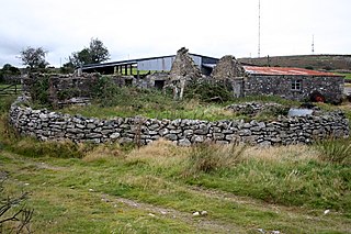
Gonamena is a site of disused mines in Cornwall, England. It is half a mile south of Minions.
Highertown is a hamlet in Cornwall, England. It is on the western edge of Bodmin Moor in the parish of Advent.
Old Cardinham Castle is a hamlet in Cornwall, England, UK. It is in the parish of Cardinham very close to the site of the Norman Cardinham Castle, caput of the feudal barony of Cardinham.
Knightsmill is a hamlet in Cornwall, England. It is half a mile east of St Teath. It is in the civil parish of Tintagel
Lamorick is a hamlet in Cornwall, England. It is half a mile north of Lanivet {where the population for the 2011 census was included.} on the A30 main road.
Lockengate is a hamlet in Cornwall, England, UK. It is two miles south of Lanivet on the A391 road. It is in the civil parish of Luxulyan
Lower Croan is a farmstead in Cornwall, England, UK. It is in the parish of Egloshayle and Croan house and Croanford are to the east. Croan House is a manor house of two storeys and seven bays which was built in the 1690s for a prosperous attorney.

Lower Porthpean is a coastal hamlet in Cornwall, England, UK. It is close to Higher Porthpean and one mile south of St Austell.

Millpool is a hamlet in the parish of Cardinham in Cornwall, England. Millpool is north of the village of Cardinham.
Milltown is a hamlet in Cornwall, England. It is about a mile south of Lostwithiel. There is another hamlet called Milltown in the parish of Cardinham.

Mount is a village in the parish of Warleggan in east Cornwall, England. Mount is southwest of Warleggan.

Mountjoy is a hamlet in the civil parish of Colan in Cornwall, England. It is on the A392 road, east of Quintrell Downs.
Penpillick is a hamlet in Cornwall, England, UK. It is about two miles north of St Blazey on the A390 road.
Penpont is a hamlet in the parish of St Breward, in north Cornwall, England, UK, in the Camel Valley.
Cocks is a hamlet in the parish of Perranzabuloe in Cornwall, England. Cocks is southeast of Perranporth.
