Monawilkin

Last updated

Monawilkin
United Kingdom Northern Ireland adm location map.svg
Red pog.svg
Monawilkin
Location within Northern Ireland
District
Country Northern Ireland
Sovereign state United Kingdom
Post town ENNISKILLEN
Dialling code 028, +44 28
Police Northern Ireland
Fire Northern Ireland
Ambulance Northern Ireland
NI Assembly
List of places
UK
Northern Ireland
54°25′45″N07°51′40″W / 54.42917°N 7.86111°W / 54.42917; -7.86111 Coordinates: 54°25′45″N07°51′40″W / 54.42917°N 7.86111°W / 54.42917; -7.86111

Monawilkin is a townland in the West Fermanagh Scarplands in the Civil Parish of Inishmacsaint, Barony of Magheraboy, Northern Ireland. The townland has an area of 85.1947 hectares (210.521 acres) and has previously been referred to as Meenwilkin (1817) and Munadh Wilkin ("Wilkin's bog" 1834). [1] Monawilkin is the best example of unimproved calcareous grassland (blue moor-grass) in Northern Ireland. This differs from other Sesleria-dominated grasslands in the UK in that it also includes species such as Euphrasia salisburgensis (eyebright). [2] Monawilikin is also an important orchid site, contains the best inland site for moths and butterflies (23 species recorded) in Northern Ireland, and is the only Northern Irish site for Cupido minimus , the small blue butterfly. [2] Consequently, this area was designated as a special area of conservation (SAC) and area of special scientific interest (ASSI). [2] The Monawilkin SAC land cover comprises 3% water bodies, 5% bogs, marshes, and fringe water vegetation, 13% heath and scrub, 50% dry grassland, 14% humid grassland, and 15% broad-leaved woodland. [3]

Contents

Flora

The diversity of floristic communities of Monawilikin is a product of its limestone and at some points sandstone substrata. Typical plant species recorded in the calcareous grassland are kidney vetch, crested hair-grass, and wild thyme, alongside more locally distributed species such as Irish eyebright and blue moor-grass. [2] Monawilkin has been listed for 24 vascular plants in the register of scarce or rare and extinct vascular plants. [4] The scarce or rare plants are listed with their botanical name, their common name, and then the date they were last recorded: Botrychium lunaria (moonwort, 1985), Juniperus communis , (common juniper, 2012), Saxifraga hypnoides (mossy saxifrage, 2013), Rubus botryeros (raspberry, blackberry family, 1904), Lythrum portula (water-purslane, 1985), Primula veris (cowslip, 1998), Gentianella amarelle (autumn gentian, 2012), Gentianella campestris (field gentian, 2012), Plantago maritima (sea plantain), Euphrasia salisburgensis (Irish eyebright, 1995), Potamogeton praelongus (long-stalked pondweed, 1988), Potamogeton × salicifolius (P. lucens × P. perfoliatus, willow-leaved pondweed), Neottia nidus-avis (bird's-nest orchid, 1986), Platanthera bifolia (lesser butterfly orchid, 2013), Platanthera chlorantha (greater butterfly-orchid, 1985), Pseudorchis albida (small-white orchid, 1998), Coeloglossum viride (frog orchid, 1985), Dactylorhiza incarnata ssp pulchella (early marsh orchid, 2013), Ophrys apifera (bee orchid, 2012), Carex distans (distant sedge, 1987), Agrostis vinealis (brown bent), Bromus racemosus (smooth brome, 2012), Inula helenium (Elecampane, 2012), and Doronicum pardalianches (leopard's-bane, 1996) [4] Vascular species found in Monawilin on the Northern Ireland priority species list include Euphrasia salisburgensis (Irish eyebright) and Juniperus communis (juniper). Those plants mentioned in the Irish Red Data Book include Gentianella campestris (field gentian), Pseudorchis albida (small-white orchid), Neottia nidus-avis (bird's nest orchid), and Ophrys apifera (bee orchid). [5]

The site also contains a patchwork of habitat types such as hazel scrub; oak, birch, and holly woodland; calcareous fen (flushes); and acid grassland heath on sandstone. Consequently, there are many pronounced vegetation transitions from acidic to alkaline and from dry to wet.

Fauna

The townland is also a habitat for Hemaris tityus , the daylight-flying narrow-bordered bee hawk-moth (which looks quite similar to a bumble bee), Trichiura crataegi , the pale eggar moth (only Northern Irish recording), and Eulamprotes unicolorella , the twirling moth. [2]

See also

Related Research Articles

<i>Ophrys apifera</i> Species of flowering plant in the orchid family Orchidaceae

Ophrys apifera, known in Europe as the bee orchid, is a perennial herbaceous plant of the family Orchidaceae. It serves as an example of sexually deceptive pollination and floral mimicry, as well as of a highly selective and highly evolved plant–pollinator relationship.

<i>Ophrys insectifera</i> Species of flowering plant in the orchid family Orchidaceae

Ophrys insectifera, the fly orchid, is a species of orchid and the type species of the genus Ophrys. It is remarkable as an example of sexually-deceptive pollination and floral mimicry as well as of a highly-selective and highly evolved plant-pollinator relationship.

Boho, County Fermanagh Human settlement in Northern Ireland

Boho is a hamlet and a civil parish 11 kilometres (7 mi) covering approximately 12 km × 7 km southwest of Enniskillen in County Fermanagh, Northern Ireland. It is situated within Fermanagh and Omagh district.

Windsor Hill

Windsor Hill is a 61.8 hectare biological Site of Special Scientific Interest in Princes Risborough in Buckinghamshire. It lies within the Chilterns Area of Outstanding Natural Beauty, and it is featured in the Nature Conservation Review. A small part is managed by the Berkshire, Buckinghamshire and Oxfordshire Wildlife Trust, and access to this area requires a permit.

Noar Hill

Noar Hill is a 63-hectare (160-acre) biological Site of Special Scientific Interest south of Selborne in Hampshire. It is a Nature Conservation Review site, Grade 2, and part of East Hampshire Hangers Special Area of Conservation. An area of 20 hectares is a nature reserve managed by the Hampshire and Isle of Wight Wildlife Trust.

West Yatton Down

West Yatton Down is a 14.4 hectare biological Site of Special Scientific Interest in Wiltshire, notified in 1971.

Bowerchalke Downs

Bowerchalke Downs, is a 128.6 hectare biological Site of Special Scientific Interest in Wiltshire, notified in 1971. The downs encompass the entire southern outlook of the village of Bowerchalke in the Salisbury district of Wiltshire, England, and are adjacent to both the Hampshire and Dorset county boundaries. The Bowerchalke Downs are located within the Cranborne Chase and West Wiltshire Downs Area of Outstanding Natural Beauty and are part of the Southern England Chalk Formation.

Aller and Beer Woods

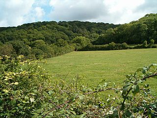
Aller and Beer Woods is a 56.9 hectares biological Site of Special Scientific Interest. off the A372 Othery to Langport road near Aller in Somerset. It was notified in 1952.

East Polden Grasslands

East Polden Grasslands is a 124 hectare biological Site of Special Scientific Interest on the Polden Hills in Somerset, notified in 1999.

Pewsey Downs

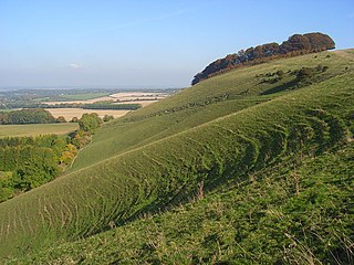
Pewsey Downs is a 305.3 hectare biological Site of Special Scientific Interest on the southern edge of the Marlborough Downs north of Pewsey in Wiltshire, notified in 1951. It includes the Pewsey Downs National Nature Reserve.

Ham Hill, Wiltshire Area of chalk downland in Wiltshire, England

Ham Hill is an area of chalk downland in Wiltshire, England, on the steep banks running alongside the road from the village of Ham to Buttermere, close to the Berkshire border. A biological Site of Special Scientific Interest, notified in 1971, covers 1.5 hectares of the site; this designation is due to the site's species-rich plant and insect communities, which include some rare species. Notable among these is the musk orchid, which has been confirmed at only one other site in Wiltshire.

NVC community CG2 is one of the calcicolous grassland communities in the British National Vegetation Classification system. It is one of three short-sward communities associated with heavy grazing, within the lowland calcicolous grassland group, and is regarded as "typical" chalk grassland.

The Folkestone Downs are an area of chalk downland above Folkestone, where the eastern end of the North Downs escarpment meets the English Channel. Part of the Downs is the Folkestone to Etchinghill Escarpment Site of Special Scientific Interest, designated for its geological and biological interest.

Denge Wood

Denge Wood is a wood located 8 miles southwest of Canterbury in Kent, England. The wood is owned by the Forestry Commission and the Woodland Trust. Part of the wood is also privately owned. Much of Denge Wood is classified as ancient semi-natural woodland suggesting it has been in existence since at least 1600AD and probably longer.

Knockmore is an upland area and townland situated in County Fermanagh, Northern Ireland outside the village of Derrygonnelly, in the historical barony of Magheraboy. This area, together with the adjacent Barrs of Boho and most of the uplands in Boho parish, are described as the Knockmore Scarplands. The focal point of the area is Knockmore summit at 277 metres (909 ft).

<i>Potamogeton compressus</i> Species of aquatic plant

Potamogeton compressus is a species of aquatic plant known by the common names grass-wrack pondweed, flatstem pondweed and eel-grass pondweed.

Rough Bank, Miserden

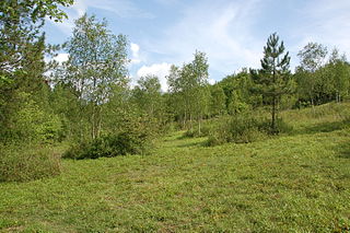
Rough Bank, Miserden is a 9.2-hectare (23-acre) biological Site of Special Scientific Interest in Gloucestershire, notified in 1986. It was purchased by the wildlife charity Butterfly Conservation in 2012.

Farnham Mires Site of Special Scientific Interest in North Yorkshire, England

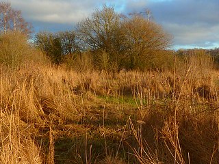
Farnham Mires is a Site of Special Scientific Interest, or SSSI, to the east of the village of Farnham, North Yorkshire, England. It consists of a spring-fed marshy fen or mire with reeds and sedge, and drier calcareous grassland containing a diverse range of flora. It has a history of poaching and fox hunting, but since the late 19th century, the attention of botanists has been drawn to its large variety of flowering plants. It has received some consideration on this account since 1944, and from 1954 it was designated SSSI status. This site has no facilities, and is not open to the public.

References

  1. Ref Placenames NI
  2. 1 2 3 4 5 "Area of Special Scientific Interest". Northern Ireland Environment Agency. Archived from the original on 24 May 2015. Retrieved 23 May 2015.
  3. "Monawilkin Special Area of Conservation". Joint Nature Conservation Committee.
  4. 1 2 Julia Nunn, ed. (2014). "Scarce rare and extinct vascular plants County Fermanagh" (PDF). National Museums & Galleries of Northern Ireland.
  5. The Irish Red Data Book (1988)