Mount Anderson (Antarctica)

Last updated

Mount Anderson
Antarctica relief location map.jpg
Red triangle with thick white border.svg
Mount Anderson
Highest point
Elevation 4,254 m (13,957 ft) [1]
Prominence 1,504 m (4,934 ft) [1]
Listing Ultras of Antarctica
Coordinates 78°09′00″S86°13′01″W / 78.15°S 86.217°W / -78.15; -86.217 [2]
Geography
LocationBlank flag.svg  Antarctica
Parent range Sentinel Range,
(Ellsworth Mountains)
Climbing
First ascent January 7th 2007 - Jed Brown (US) & Damien Gildea (AUS)
Location of Sentinel Range in Western Antarctica. Sentinel-Range-location-map.png
Location of Sentinel Range in Western Antarctica.
Sentinel Range map. Vinson-Map.jpg
Sentinel Range map.

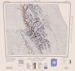
Mount Anderson is a high mountain in the northern part of the Sentinel Range in Ellsworth Mountains, Antarctica. [3] Probuda Ridge is trending northeast of the peak, and Embree Glacier and Ellen Glacier's tributary Fonfon Glacier drain its northeastern and eastern slopes respectively. It is part of the same massif as Mount Bentley and Mount Sisu.

Contents

The mountain was discovered by the Marie Byrd Land Traverse Party, 1957–58, under Charles R. Bentley, and named for Vernon H. Anderson, glaciologist at Byrd Station, 1957, a member of the party. [2]

Maps

Notes

  1. 1 2 "Mount Anderson, Antarctica". Peakbagger.com. Retrieved 17 August 2014.
  2. 1 2 "Mount Anderson". Geographic Names Information System . United States Geological Survey, United States Department of the Interior . Retrieved 17 August 2014.
  3. Gildea, Damien (2001). "Mountaineering in Antarctica". Archived from the original on 28 August 2006. Retrieved 17 August 2014.

Related Research Articles

<span class="mw-page-title-main">Mount Shear</span> Mountain in Ellsworth Land, Antarctica

Mount Shear is a mountain over 4,000 m, standing 4 miles (6 km) northwest of Mount Tyree in the Sentinel Range, Ellsworth Mountains, Antarctica. It surmounts Patton Glacier to the northeast. The peak was discovered by the Marie Byrd Land Traverse Party (1957–58) led by Charles R. Bentley, and was named for James A. Shear, a scientific leader at Hallett Station during the IGY in 1957.

<span class="mw-page-title-main">Embree Glacier</span> Glacier in Antarctica

Embree Glacier is a 20 nautical miles long glacier in the north-central part of Sentinel Range, Ellsworth Mountains, draining the eastern slopes of Mount Hale, Mount Davis and Mount Bentley, the northeast slopes of Mount Anderson, and the northwestern slopes of Probuda Ridge, flowing north-northeastwards and north of Mount Schmid turning east to join Rutford Ice Stream east of Mount Tegge. Named by the US-ACAN for Maj. Henry Embree, USAF, who participated in the establishment of the South Pole Station in 1956. Embree Glacier is in Antarctica.

<span class="mw-page-title-main">Mount Press</span> Mountain in Ellsworth Land, Antarctica

Mount Press is a peak rising to 3,830 m (12,570 ft) in the north-central Sentinel Range in Ellsworth Mountains, Antarctica. It is linked to Eyer Peak by Zvegor Saddle, and surmounts Embree Glacier to the north and Ellen Glacier to the southeast. Mount Press is the summit of Probuda Ridge, and was first ascended by the American Jed Brown and the Chileans Camilo Rada and Maria Paz 'Pachi' Ibarra on 31 December 2006.

<span class="mw-page-title-main">Barnes Ridge (Antarctica)</span>

Barnes Ridge is a ridge 7 nautical miles (13 km) long, rising to over 1,210 metres (3,970 ft) and extending between Young Glacier and Ellen Glacier at the east side of the Sentinel Range, Ellsworth Mountains in Antarctica. It is bounded by Rutford Ice Stream to the east and Arapya Glacier to the west, and connected to Maglenik Heights to the northwest by Dropla Gap. Its eastern slopes are drained by Ranuli Ice Piedmont.

<span class="mw-page-title-main">Mount Bentley</span> Mountain in Antarctica

Mount Bentley is a mountain (4,245 m) standing 2 nautical miles north of Mount Anderson in the main western ridge of the Sentinel Range, Antarctica. It was discovered by the Marie Byrd Land Traverse party, 1957–58, and named for Dr. Charles R. Bentley, leader of the traverse party and chief traverse seismologist at Byrd Station, 1957–59.

<span class="mw-page-title-main">Mount Osborne</span> Mountain in Ellsworth Land, Antarctica

Mount Osborne is a mountain standing 5 nautical miles (9 km) east of Mount Craddock, at the end of a side ridge running from the latter and featuring Sanchez Peak and Stolnik Peak, in the Sentinel Range, Ellsworth Mountains, Antarctica. It surmounts Thomas Glacier to the northeast and Saltzman Glacier to the south.

<span class="mw-page-title-main">Wessbecher Glacier</span>

Wessbecher Glacier is a glacier about 7 nautical miles (13 km) long, draining southeast from Mount Inderbitzen and south from Mount Mullen between Peristera Peak, Lishness Peak and Stikal Peak on the main ridge of Sentinel Range on the west and Marze Peak in Petvar Heights on the east, in the Ellsworth Mountains, Antarctica.

<span class="mw-page-title-main">Crosswell Glacier</span> Glacier in Antarctica

Crosswell Glacier is a glacier 10 nautical miles long, flowing north-northeast from Mount Shinn between Sullivan Heights and Bearskin Ridge, in the central part of the Sentinel Range, Ellsworth Mountains, Antarctica. Together with Patton and Pulpudeva Glaciers, it enters Ellen Glacier northwest of Mamarchev Peak and southeast of Mount Jumper.

<span class="mw-page-title-main">Mount Jumper</span> Mountain in Ellsworth Land, Antarctica

Mount Jumper is a mountain 2,890 metres (9,480 ft) high located 7 nautical miles (13 km) east of Mount Viets in the central part of the Sentinel Range of the Ellsworth Mountains in Antarctica. Debren Pass separates it from the side ridge descending via Evans Peak. The mountain overlooks Ellen Glacier to the north and east, and its tributaries Patton Glacier and Rumyana Glacier to the south and northwest respectively.

<span class="mw-page-title-main">Guerrero Glacier</span> Glacier in Antarctica

Guerrero Glacier is a glacier about 7 nautical miles (13 km) long in Doyran Heights, draining from the southeast slopes of Mount Havener southwest of Beloslav Peak to the south side of Taylor Spur, in the southeast part of the Sentinel Range, Ellsworth Mountains, Antarctica. It was first mapped by the United States Geological Survey from surveys and U.S. Navy air photos, 1957–59, and was named by the Advisory Committee on Antarctic Names for John F. Guerrero, a meteorologist at South Pole Station in 1957.

<span class="mw-page-title-main">Mount Gozur</span> Mountain in Ellsworth Land, Antarctica

Mount Gozur is a mountain, 2,980 metres (9,780 ft) high, in the Maglenik Heights of the central Sentinel Range, in the Ellsworth Mountains of Antarctica, situated just northwest of the head of Young Glacier and 9 nautical miles (17 km) east of Mount Bentley. It was first mapped by the United States Geological Survey from surveys and U.S. Navy air photos, from 1957 to 1959, and was named by the Advisory Committee on Antarctic Names for Captain Alexander Gozur of the United States Air Force, who participated in establishing the South Pole Station in the 1956–57 season.

<span class="mw-page-title-main">Mount Gardner</span> Mountain in Ellsworth Land, Antarctica

Mount Gardner is a mountain, 4,587 metres (15,050 ft) high, standing 1.5 nautical miles (3 km) west of Mount Tyree in the west-central part of the Sentinel Range, in the Ellsworth Mountains of Antarctica. It surmounts Patton Glacier to the northeast.

<span class="mw-page-title-main">Mount Giovinetto</span> Mountain in Ellsworth Land, Antarctica

Mount Giovinetto is the summit of a buttress-type mountain located 2 nautical miles (3.7 km) north of Mount Ostenso and 1.5 nautical miles (2.8 km) south of Mount Viets in the main ridge of the Sentinel Range, Antarctica. It surmounts Rumyana Glacier to the east and Delyo Glacier to the northeast.

<span class="mw-page-title-main">Mount Morris (Antarctica)</span> Mountain in Ellsworth Land, Antarctica

Mount Morris is a steep, sharp mountain about 1 nautical mile (2 km) south of Mount Ostenso, in the main ridge of the Sentinel Range of the Ellsworth Mountains in Antarctica. It surmounts Patton Glacier to the eas-northeast.

<span class="mw-page-title-main">Hansen Glacier</span> Glacier in Antarctica

Hansen Glacier is a tributary glacier 10 nautical miles long, flowing northeast from Mount Tuck between Veregava Ridge and Doyran Heights to join Dater Glacier west of Dickey Peak, in the Sentinel Range of the Ellsworth Mountains in Antarctica.

<span class="mw-page-title-main">Long Gables</span> Mountain in Antarctika

The Long Gables are prominent twin peaks, with heights of 4,150 and 4,110 metres, joined by a col, with the lower rock exposures being in the form of steep buttresses. The peaks rise from the main ridge of the Sentinel Range, Ellsworth Mountains, Antarctica between Mount Anderson and Mount Viets. They surmount Burdenis Glacier to the southeast, Gerila Glacier to the east and Fonfon Glacier to the northeast.

<span class="mw-page-title-main">Hudman Glacier</span> Glacier in Antarctica

Hudman Glacier is a glacier draining south of Mount Landolt between Marze Peak and Miller Peak in Petvar Heights at the south end of the Sentinel Range, in the Ellsworth Mountains of Antarctica, flowing south-southeast to Minnesota Glacier. It was mapped by the United States Geological Survey from surveys and U.S. Navy air photos, 1957–59, and was named by the Advisory Committee on Antarctic Names for Captain Rayburn A. Hudman, United States Marine Corps, who died in the crash of a Lockheed P2V-2n Neptune, modified for extreme range, flying in sub zero temperatures and Ski equipped for landing on the Ice runways at McMurdo Sound Antarctica on October 18, 1956.

<span class="mw-page-title-main">Hough Glacier</span> Glacier in Antarctica

Hough Glacier is a glacier in central Doyran Heights in the Sentinel Range of Ellsworth Mountains, Antarctica, rising just south of Mount Tuck and flowing east-southeast for 10 nautical miles between Guerrero Glacier and Remington Glacier. It was first mapped by the United States Geological Survey from surveys and U.S. Navy air photos, 1957–59, and was named by the Advisory Committee on Antarctic Names for William S. Hough, who made ionosphere studies at South Pole Station in 1957.

<span class="mw-page-title-main">Mount Viets</span> Mountain in Ellsworth Land, Antarctica

Mount Viets is a sharp pyramidal mountain over 3,600 m, standing 1.5 nautical miles (2.8 km) north of Mount Giovinetto in the main ridge of the Sentinel Range, Ellsworth Mountains. It surmounts Delyo Glacier to the east and Burdenis Glacier to the northeast.

Mount Allen' is a mountain located 5.2 mi southeast of Mount Craddock in Owen Ridge, the southernmost portion of the main ridge of Sentinel Range, Ellsworth Mountains in Antarctica. The peak surmounts Saltzman Glacier to the north, Kornicker Glacier to the southeast, Bolgrad Glacier to the southwest and Brook Glacier to the west. It was mapped by the USGS from surveys and USN air photos in 1957–59. It was named by the US-ACAN for Lt. Forrest M. Allen, USNR, the co-pilot on reconnaissance flights from Byrd Station, 1957–58. Mount Allen was first successfully climbed on December 26, 2012, by Pachi Ibarra, Ralf Laier and Todd Passey.

References