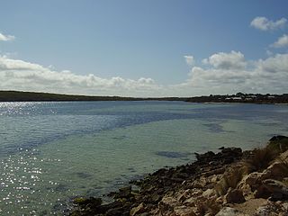
Buckleboo is a locality in the Australian state of South Australia on the Eyre Peninsula located about 313 kilometres (194 mi) northwest of the state capital of Adelaide and about 31 kilometres (19 mi) northwest of the municipal seat of Kimba.

Coffin Bay, originally Coffin's Bay, is a town at the southern extremity of the Eyre Peninsula, a wheat growing area of South Australia. At the 2016 census, Coffin Bay had a population of 611.
Poochera is a small grain belt town 60 km north-west of Streaky Bay on the Eyre Peninsula, South Australia.
Wirrulla is a small grain belt town located 60 km from Streaky Bay on the Eyre Peninsula. The town is a focus point for many of the surrounding agricultural districts, and features a number of silos used to store grain from the surrounding areas. The name of the town is derived from an Aboriginal word meaning "to make haste, to be quick".
Ungarra is a small swamp town located on the Eyre Peninsula, in the Australian state of South Australia about 248 kilometres (154 mi) from the state's capital, Adelaide and around 80 kilometres (50 mi) north of Port Lincoln. At the 2006 census, Ungarra had a population of 241.
Coulta is a town and locality in the Australian state of South Australia located about 293 kilometres (182 mi) west of the state capital of Adelaide and about 60 kilometres (37 mi) north-west of the municipal seat in Port Lincoln.
Rudall is a town and locality in South Australia. At the 2016 census, Rudall had a population of 90. It is named for the cadastral Hundred of Rudall, which was named after politician Samuel Rudall.
Wanilla is a locality in the Australian state of South Australia located on the southern end of Eyre Peninsula about 271 kilometres (168 mi) west of the state capital of Adelaide and about 25 kilometres (16 mi) north-west of the city of Port Lincoln.

The County of Flinders is one of the 49 cadastral counties of South Australia. The county covers the southern part of the Eyre Peninsula “bounded on the north by a line connecting Point Drummond with Cape Burr, and on all other sides by the seacoast, including all islands adjacent to the main land.”

Mortana is a rural locality in South Australia, located on the Eyre Peninsula. It is traversed by the Flinders Highway. The boundaries for the locality were established in April 2001 in respect of the long established local name.

Lincoln National Park is a locality located on the Jussieu Peninsula at the southern tip of the Eyre Peninsula in the Australian state of South Australia about 250 kilometres west of the state capital of Adelaide and about 13 kilometres south of the city of Port Lincoln.
Charra is a locality in the Australian state of South Australia located on the state's west coast overlooking the Great Australian Bight about 584 kilometres north-west of the state capital of Adelaide and about 33 kilometres west of the municipal seat of Ceduna.
Verran is a locality in the Australian state of South Australia located on the Eyre Peninsula about 241 kilometres west of the state capital of Adelaide. Its name is derived from the cadastral unit of the Hundred of Verran, which was named for former Premier John Verran.
Wallerberdina is a locality in the Australian state of South Australia located about 345 kilometres (214 mi) north of the state capital of Adelaide and about 40 kilometres (25 mi) west of the town of Hawker.
Yantanabie is a town and rural locality in the wheat belt of South Australia, 37 miles inland from Streaky Bay, South Australia.
Uley is a locality in the Australian state of South Australia located at the southern tip of the Eyre Peninsula overlooking the body of water known as the Great Australian Bight about 273 kilometres (170 mi) west of the state capital of Adelaide and about 22 kilometres (14 mi) west of the city of Port Lincoln.
Kellidie Bay is a locality in the Australian state of South Australia located on the Eyre Peninsula in the state’s west overlooking parts of the body of water known as Coffin Bay about 290 kilometres (180 mi) west of the state capital of Adelaide and about 42 kilometres (26 mi) south-west of the municipal seat of Cummins.
Moockra is a locality in the Australian state of South Australia located on the eastern side of the Flinders Ranges about 274 kilometres (170 mi) north of the state capital of Adelaide and about 47 kilometres (29 mi) north-east and 36 kilometres (22 mi) south-east respectively of the municipal seats of Melrose and Quorn.
Duck Ponds is a locality in the Australian state of South Australia located on the Eyre Peninsula in the state's west about 258 kilometres (160 mi) west of the state capital of Adelaide, about 51 kilometres (32 mi) south of the municipal seat of Cummins and about 6 kilometres (3.7 mi) west of the city of Port Lincoln.
Brooker is a locality in the Australian state of South Australia located in the state’s west on Eyre Peninsula about 266 kilometres (165 mi) west of the state capital of Adelaide and about 38 kilometres (24 mi) north-west of the municipal seat in Tumby Bay.


