Khyber Pakhtunkhwa, formerly known as North West Frontier Province (NWFP), is a province of Pakistan. Located in the northwestern region of the country, Khyber Pakhtunkhwa is the fourth largest province of Pakistan by land area and the third-largest province by population. It is bordered by Balochistan to the south; Punjab, Islamabad Capital Territory, and Azad Kashmir to the east; and Gilgit-Baltistan to the north and northeast. It shares an international border with Afghanistan to the west. Khyber Pakhtunkhwa has a varied geography of rugged mountain ranges, valleys, rolling foothills, and dense agricultural farms.

The Hindu Kush is an 800-kilometre-long (500 mi) mountain range in Central and South Asia to the west of the Himalayas. It stretches from central and eastern Afghanistan into northwestern Pakistan and far southeastern Tajikistan. The range forms the western section of the Hindu Kush Himalayan Region (HKH); to the north, near its northeastern end, the Hindu Kush buttresses the Pamir Mountains near the point where the borders of China, Pakistan and Afghanistan meet, after which it runs southwest through Pakistan and into Afghanistan near their border.

The Sulaiman Mountains, also known as Kōh-e Sulaymān or Da Kasē Ghrūna, are a north–south extension of the southern Hindu Kush mountain system in Pakistan and Afghanistan. They are also known as Aparanchal Range, or Western Mountains, as they mark the westernmost boundary of the Indian Subcontinent. They rise to form the eastern edge of the Iranian plateau. They are located in the Kandahar, Zabul and Paktia provinces of Afghanistan, and in Pakistan they extend over the northern part of Balochistan and Waziristan as well as Kurram of Khyber Pakhtunkhwa. In southwestern Punjab, the mountains extend into the two districts of Dera Ghazi Khan and Rajanpur, which are located west of the Indus River on the boundary with Balochistan. Bordering the mountains to the east are the plains of the Indus River valley, and to the north are the arid highlands of the Central Hindu Kush whose heights extend up to 3,383 metres (11,099 ft). The total area on which this range spans around 6,475 sq. km. Together with the Kirthar Mountains on the border between Balochistan and Sindh, the Sulaiman Mountains form what is known as the Sulaiman-Kirthar geologic province.

North Waziristan District is a district of Khyber Pakhtunkhwa province in Pakistan. It is the northern part of Waziristan, a mountainous region of northwest Pakistan, bordering Afghanistan and covering 4,707 square kilometres (1,817 sq mi). The capital city of North Waziristan is Miranshah.
Lanḍī Kōtal or Lwargai is a town in the Province of Khyber Pakhtunkhwa in Pakistan, and the administrative capital of Khyber District. It was one of the largest towns in the former Federally Administered Tribal Areas, and is located 1,072 metres (3,517 ft) above sea level, on the route across the mountains to the city of Peshawar. Landi Kotal is at the western edge of the Khyber Pass that marks the entrance to the Nangarhar Province of Afghanistan, which is located just 5 kilometres (3 mi) to the west.

Parachinar is a city and the capital of the Kurram District in the province of Khyber Pakhtunkhwa, Pakistan.
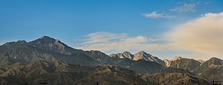
The Spīn Ghar or Safēd Kōh meaning both White Mountains, or sometimes meaning white mountain range, is a mountain range to the south of the Hindu Kush. It ranges from eastern Afghanistan into Khyber Pakhtunkhwa, Pakistan, and forms a natural border between the two areas. Its highest peak is Mount Sikaram on the Afghanistan–Pakistan border, which towers above all surrounding hills to 4,755 m (15,600 ft) above mean sea level. The lower hills are mostly barren and treeless, but pine grows on the main mountains that form the East Afghan montane conifer forests.

Khyber District is a district in the Peshawar Division of the Khyber Pakhtunkhwa province of Pakistan. Until 2018, it was an agency of the erstwhile Federally Administered Tribal Areas. With the merger of FATA with Khyber Pakhtunkhwa in 2018, it became a district. It ranges from the Tirah valley down to Peshawar. It borders Nangarhar Province to the west, Orakzai District to the south, Kurram District to southwest, Peshawar to the east and Mohmand District to the north.

The Kurram River, or Kurrama River, originates from the watershed of Spin Ghar region in the Paktia province of Afghanistan and the Kurram District of Pakistan. It flows through North Waziristan, and the city of Bannu, before joining the Indus River near Isa Khel. It drains the southern flanks of the Spin Ghar mountain range and is a right-bank tributary of the Indus.

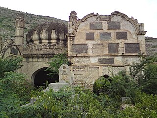
The Battle of Peiwar Kotal was fought on 2 December 1878 between British forces under Major General Frederick Roberts and Afghan forces under Karim Khan, during the opening stages of the Second Anglo-Afghan War. The British were victorious, and seized the strategic Peiwar Kotal Pass leading into the interior of Afghanistan.
Kohat Division is one of the seven divisions in the Khyber Pakhtunkhwa province of Pakistan. It consists of five districts: Hangu, Karak, Kohat, Kurram, and Orakzai. The division borders Bannu Division to the south and west, Peshawar Division to the north and east, the province of Punjab to the east, and Afghanistan to the northwest. CNIC code of Kohat Division is 14.
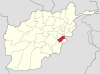
Kurram District is a district in the Kohat Division of the Khyber Pakhtunkhwa province of Pakistan. The name Kurram comes from the river Kwarma in Pashto, which itself derives from the Sanskrit word Krumu.

Gilgit-Baltistan is an administrative territory of Pakistan in the northern part of the country. It was given self-governing status on August 29, 2009. Gilgit-Baltistan comprises 14 districts within three divisions. The four districts of Skardu Kharmang Shigar and Ghanche are in the Baltistan Division, four districts of Gilgit Ghizer Hunza and Nagar districts which were carved out of Gilgit District are in the Gilgit Division and the third division is Diamir, comprising Chilas and Astore. The main political centres are the towns of Gilgit and Skardu.

The Peiwar Kotal Pass, also spelled Paywar, is a mountain pass in the Kurram Valley that connects Paktia Province in Afghanistan to Kurram District in the Khyber Pakhtunkhwa province of Pakistan. It is also known as Kurram pass.

The Khyber Pass is a mountain pass in the Khyber Pakhtunkhwa province of Pakistan, on the border with the Nangarhar Province of Afghanistan. It connects the town of Landi Kotal to the Valley of Peshawar at Jamrud by traversing part of the White Mountains. Since it was part of the ancient Silk Road, it has been a vital trade route between Central Asia and the Indian subcontinent and a strategic military choke point for various states that controlled it. The Khyber Pass is considered one of the most famous mountain passes in the world.
The Chamkani, is a sub-tribe of Ghoryakhel Pashtuns. According to Muhammad Hayat Khan, author of Hayat-i-Afghani Chamkani are descendants of Ibrahim Ghoria. They are also related to Mohmand, Daudzai and Khalil through their Sarbani descent.

There are many types of gemstones of Pakistan. They can be found among the nation's three mountain ranges - the Hindu Kush, the Himalayas, and the Karakoram - in the provinces of Khyber Pakhtunkhwa, Gilgit-Baltistan, Balochistan, and the Federally Administered Tribal Areas. The gemstone industry in Pakistan has the city of Peshawar as its hub, and there are many companies working in it.

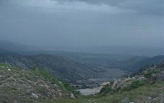
Pewar is a village located 16 km from Parachinar, the capital city of Kurram District in Khyber Pakhtunkhwa, Pakistan. Situated on a narrow stretch of Pakistani territory south of Peshawar, Pewar borders Paktia Province in Afghanistan. It is the closest point in Pakistan to Kabul and lies near the Tora Bora region. The major tribes in Pewar and Parachinar include Turi, Bangash, Orakzai, Zazai, Mangal and Para Tsamkani. Pewar is renowned for its fresh fruits, vegetables, and scenic snowfall.

The Baluchistan xeric woodlands ecoregion covers the middle elevations of a series of mountain ranges of western Pakistan and northeastern Afghanistan, reaching 1,200 kilometres (750 mi) from the Arabian Sea in the south to the Hindu Kush Mountains and the Himalayas in the north. The characteristic vegetation is xeric (dry) woodlands of shrubs and herbaceous cover. The region has rich biodiversity but relatively few endemic species.