Munggu Tajau

Last updated
Munggu Tajau
Borneo Locator Topography.png
Red pog.svg
Munggu Tajau
Coordinates: 1°26′00″N111°37′00″E / 1.43333°N 111.61667°E / 1.43333; 111.61667 Coordinates: 1°26′00″N111°37′00″E / 1.43333°N 111.61667°E / 1.43333; 111.61667
Country Flag of Malaysia.svg  Malaysia
State Flag of Sarawak.svg  Sarawak
Elevation
168 m (551 ft)

Munggu Tajau is a settlement in Sarawak, Malaysia. [1] It lies approximately 143.7 kilometres (89.3 mi) east of the state capital Kuching. Neighbouring settlements include:
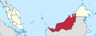
Sarawak State of Malaysia

Sarawak is a state of Malaysia. The largest among the 13 states, with an area almost equal to that of Peninsular Malaysia, Sarawak is located in northwest Borneo Island, and is bordered by the Malaysian state of Sabah to the northeast, Kalimantan to the south, and Brunei in the north. The capital city, Kuching, is the largest city in Sarawak, the economic centre of the state, and the seat of the Sarawak state government. Other cities and towns in Sarawak include Miri, Sibu, and Bintulu. As of the 2015 census, the population of Sarawak was 2,636,000. Sarawak has an equatorial climate with tropical rainforests and abundant animal and plant species. It has several prominent cave systems at Gunung Mulu National Park. Rajang River is the longest river in Malaysia; Bakun Dam, one of the largest dams in Southeast Asia, is located on one of its tributaries, the Balui River. Mount Murud is the highest point in Sarawak.
Malaysia Federal constitutional monarchy in Southeast Asia

Malaysia is a country in Southeast Asia. The federal constitutional monarchy consists of 13 states and three federal territories, separated by the South China Sea into two similarly sized regions, Peninsular Malaysia and East Malaysia. Peninsular Malaysia shares a land and maritime border with Thailand and maritime borders with Singapore, Vietnam, and Indonesia. East Malaysia shares land and maritime borders with Brunei and Indonesia and a maritime border with the Philippines and Vietnam. Kuala Lumpur is the national capital and largest city while Putrajaya is the seat of federal government. With a population of over 30 million, Malaysia is the world's 44th most populous country. The southernmost point of continental Eurasia, Tanjung Piai, is in Malaysia. In the tropics, Malaysia is one of 17 megadiverse countries, with large numbers of endemic species.

Kuching City and State Capital in Sarawak, Malaysia

Kuching, officially the City of Kuching, is the capital and the most populous city in the state of Sarawak in Malaysia. It is also the capital of Kuching Division. The city is situated on the Sarawak River at the southwest tip of the state of Sarawak on the island of Borneo and covers an area of 431 square kilometres (166 sq mi) with a population about 165,642 in the Kuching North administrative region and 159,490 in the Kuching South administrative region—a total of 325,132 people.

Ajong Place in Sarawak, Malaysia

Ajong is a settlement in Sarawak, Malaysia. It lies approximately 145.4 kilometres (90.3 mi) east of the state capital Kuching. Neighbouring settlements include:

Nanga Kron Place in Sarawak, Malaysia

Nanga Kron is a settlement in Sarawak, Malaysia. It lies approximately 145.4 kilometres (90.3 mi) east of the state capital Kuching. Neighbouring settlements include:

Related Research Articles

Tebedu Place in Sarawak, Malaysia

Tebedu is a border town in the Serian division of southwestern Sarawak, Malaysia, on the Indonesia-Malaysia border. It lies approximately 63.2 kilometres (39 mi) south of the state capital Kuching.

Siburan Place in Sarawak, Malaysia

Siburan is a small town in Serian Division, Sarawak, Malaysia. Located along Kuching-Serian Highway.

Maludam Place in Sarawak, Malaysia

Maludam is a very small town and sub district in Betong Division, Sarawak, Malaysia. It is made up of a small town including some modern longhouses with a few Malay fishing villages nearby. The majority of people are Malays, with some Ibans and Chinese. Maludam was made a district in 1985.

Setumbin Place in Sarawak, Malaysia

Setumbin is a settlement in Sarawak, Malaysia. It lies approximately 121 kilometres (75.2 mi) east-south-east of the state capital Kuching. Neighbouring settlements include:

Empaong Place in Sarawak, Malaysia

Empaong is a settlement in Sarawak, Malaysia. It lies approximately 134.8 kilometres (83.8 mi) east of the state capital Kuching. Neighbouring settlements include:

Bekenu Place in Sarawak, Malaysia

Bekenu is a small fishing town near Miri, in Sarawak, Malaysia. It lies approximately 477.6 kilometres (297 mi) northeast of the state capital Kuching.

Sekatap Place in Sarawak, Malaysia

Sekatap is a settlement in the Betong division of Sarawak, Malaysia. It lies approximately 137.8 kilometres (86 mi) east of the state capital Kuching.

Ramudu Hulu Place in Sarawak, Malaysia

Ramudu Hulu is a settlement in Sarawak, Malaysia. It lies approximately 613 kilometres (381 mi) east-north-east of the state capital Kuching.

Kampung Angus Place in Sarawak, Malaysia

Kampung Angus is a settlement in the Miri division of Sarawak, Malaysia. It lies approximately 476.8 kilometres (296 mi) northeast of the state capital Kuching.

Kampung Alit Place in Sarawak, Malaysia

Kampung Alit is a settlement in the Saratok division of Sarawak, Malaysia. It lies approximately 100.6 kilometres (63 mi) east-north-east of the state capital Kuching.

Lio Lesong Place in Sarawak, Malaysia

Lio Lesong is a settlement in the Upper Baram region of Sarawak, Malaysia. It lies approximately 527.6 kilometres (328 mi) east-north-east of the state capital Kuching.

Kampung Manjelin Place in Sarawak, Malaysia

Kampung Menjelin is a settlement in the Miri division of Sarawak, Malaysia. It lies approximately 478.3 kilometres (297 mi) northeast of the state capital Kuching.

Kampung Jangalas Place in Sarawak, Malaysia

Kampung Jangalas is a settlement in the Miri division of Sarawak, Malaysia. It lies approximately 477.2 kilometres (297 mi) northeast of the state capital Kuching.

Kampung Sasam Place in Sarawak, Malaysia

Kampung Sasam is a settlement in the Miri division of Sarawak, Malaysia. It lies approximately 479.3 kilometres (298 mi) northeast of the state capital Kuching.

Long Semado Place in Sarawak, Malaysia

Long Semado is a settlement in the Lawas division of Sarawak, Malaysia. It lies approximately 654.6 kilometres (407 mi) east-north-east of the state capital Kuching.

Long Baleh Place in Sarawak, Malaysia

Long Baleh is a settlement in the Marudi division of Sarawak, Malaysia. It lies approximately 597.3 kilometres (371 mi) east-north-east of the state capital Kuching.

Rumah Sait Place in Sarawak, Malaysia

Rumah Sait is a settlement in the Kanowit division of Sarawak, Malaysia. It lies approximately 143.6 kilometres (89 mi) east of the state capital Kuching.

Long Karabangan Place in Sarawak, Malaysia

Long Karabangan is a settlement in the Lawas division of Sarawak, Malaysia. It lies approximately 648.8 kilometres (403 mi) east-north-east of the state capital Kuching.

Kampung Gaya Place in Sarawak, Malaysia

Kampung Gaya is a settlement in the Lawas division of Sarawak, Malaysia. It lies approximately 669.1 kilometres (416 mi) east-north-east of the state capital Kuching.

Matop Place in Sarawak, Malaysia

Matop is a settlement in the Spaoh division of Sarawak, Malaysia. It lies approximately 131.8 kilometres (82 mi) east of the state capital Kuching.

References

  1. "Gawis, Malaysia". Geonames. 1994-02-10. Retrieved 2010-12-27.