Nagothane

Last updated

Nagothane
town
India Maharashtra location map.svg
Red pog.svg
Nagothane
Location in Maharashtra, India
Coordinates: 18°32′N73°08′E / 18.53°N 73.13°E / 18.53; 73.13
CountryFlag of India.svg  India
State Maharashtra
District
- Raigad
Taluka Roha
Government
  BodyGram panchayat
Elevation
12 m (39 ft)
Population
 (2011)
  Total12,549
Languages
  Official Marathi
Time zone UTC+5:30 (IST)
PIN
402106
Telephone code02194

Nagothane is a census town in Roha Taluka, in the Raigad district of the Indian state of Maharashtra. The Kanyakumari-Panvel National Highway, famously known as Mumbai-Goa Highway (NH66) goes through this town.

Contents

Geography

Nagothana is located at 18°32′N73°08′E / 18.53°N 73.13°E / 18.53; 73.13 . [1] It has an average elevation of 12 metres (39 feet).

This village is prettily situated in a hollow surrounded by wooded hills, on the right bank of the Amba river or Nagothana creek about twenty-four miles from its mouth. Between Nagothana and the mouth of the Amba, the creek varies from an eighth to three quarters of a mile in breadth. Above Dharamtar the bed is blocked with sand banks, and, within four miles of Nagothana, it is crossed by reefs of rock which can be passed only at full tide. The creek is so filled up with sand that it is not navigable even for country craft. Steamers cross daily from Mumbai to Dharamtar. From Dharamtar a steam launch plied to Nagothana till 1914-15 but it was discontinued with the growth in automobiles. The vessels chiefly employed on the creek are phatemaris and macvas, with an occasional bandar-boat used by travellers between Mumbai and Mahabaleshwar. Phatemaris are mostly used for carrying rice and salt; and macvas for rice and firewood. In the fair season there is a considerable traffic at Nagothana, chiefly the export of rice and the import of salt and fishes. Here its usually hot and humid in the summers and it experiences very heavy rainfall with thunderstorm during the monsoon season amounting up to 90 inches rainfall per year. Besides it is an industrial area with companies of petrochemical, steel industries amounting employment opportunities to a great extent. It is situated about 100 km away from Mumbai and is on the Mumbai-Goa national highway 17. To the east of this town are the parts of Sahyadris which add to the beauty of the town.

History

In the beginning of the sixteenth century Nagothana belonged to Gujarat [De Barros, VII. 217, in Nairne's Konkan, 41.]. In 1529 Hector de Sylveira of Bassein went up the river Nagothana, and burnt six towns belonging to the king of Cambay. The Commander of Nagothana took the field against him with five hundred horse and a large force of infantry, and endeavoured to cut off his retreat [Faria in Kerr, VI. 210.]. In 1540 Dom Joao De Castro mentions the Nagothana river as running into the south of Bombay harbour [Dom Joao De Castro, Prim. Rot. 63.]. On the defeat of the prince of Gujarat by the Portuguese, the neighbourhood of Nagothana seems to have passed from Gujarat to Ahmadnagar, the allies of the Portuguese, with whom it remained till in 1636. The Moghals handed the Ahmadnagar Konkan to Bijapur. About ten years later is passed to Shivaji. It was the also one of the center to produce currency which was used in the era of Shivaji. In 1670 Nagothana is mentioned by Ogilby as a town and landing-place at the extreme south of Gujarat [Atlas, V. 243–244, Ogilby compiled from earlier writers.], and in 1675 it appears in Fryer as Magatan [New Account, 50, 61, 77.]. It is called Negotan [Aitchison's Treaties, V. 15.] in a treaty between the English and the Pesva in 1739, and is probably the Nagina of Tiffenthaler with 249 villages and a revenue of Rs. 17,726 a year [Des. Hist. Et. Gog. I. 505.]. In 1818 it is described as less prosperous than Pen, because the river was longer and shallower and there were no salt-works [Revenue Diary 142, p. 2370.].

Places of interest

Nagothana Bridge Nagothana Bridge.jpg
Nagothana Bridge

The chief object of interest is the old Musalman bridge about half a mile south-west of Nagothana. It is 480 feet long, nineteen feet high, and nine feet nine inches broad between the parapets, this narrowness being the chief peculiarity. The span of the main arch is twenty-two feet nine inches [East India Papers, III. 786.]. It is said to have been built about 1580 by Kaji Ala-ud-din of Ceul at a cost of Rs. 3,00,000. As this date falls between the siege of Ceul, during the alliance of the Musalman kings against the Portuguese, and the activity of the Nizamsahi troops twenty years later, it is probable that the bridge was built to facilitate the march of troops from Ahmadnagar, probably by the Koarl pass. In 1826 repairs costing Rs. 2,590 were sanctioned [East India Papers, III 786; Nairne's Konkan, 38.]. The bridge is at present in good condition and is much used by foot travellers, bullock carts and occasionally automobiles, the approaches not admitting of the passage of two carts. Till the mid 90s it was also used by heavy vehicles but was stopped, probably due to the age of the bridge. The masonry work is repaired from time to time.

The town comes under the electrification scheme under which the electricity generated at the Tata Power House at Bhira will be used to electrify the southern part of the district. Nagothana has a Zilla Parishad dispensary, three primary schools, two dharmasalas, a State Transport Stand, a post and telegraph office and a panchayat office.

must see in Nagothane

Activities one can do from here:

Places of Tourist Interest near Nagothane:

Leisure Stay and Adventure Activities provided by adventure resorts at Nagothana.

Demographics

Nagothane is a Census Town city in district of Raigarh, Maharashtra. The Nagothane Census Town has population of 12,549 of which 6,520 are males while 6,029 are females as per report released by Census India 2011. [2]

Population of Children with age of 0-6 is 1598 which is 12.73% of total population of Nagothane (CT). In Nagothane Census Town, Female Sex Ratio is of 925 against state average of 929. Moreover, Child Sex Ratio in Nagothane is around 1015 compared to Maharashtra state average of 894. Literacy rate of Nagothane city is 87.70% higher than state average of 82.34%. In Nagothane, Male literacy is around 91.13% while female literacy rate is 83.94%.

Nagothane Census Town has total administration over 2,873 houses to which it supplies basic amenities like water and sewerage. It is also authorized to build roads within Census Town limits and impose taxes on properties coming under its jurisdiction.

Though rice/paddy is the major crop which is cultivated here, since the 1980s Nagothana got recognition for its special type of beans called 'Kadve Vaal'. Historically it was also recognised for sesame and teak wood.

In the late 1980s a decision was made by the Government to install India's first Gas Cracker Complex at Nagothana. It was called as Indian Petrochemicals Corporation Limited, Maharashtra Gas Cracker Complex. Raw material for the Petrochemical plant was transported through pipelines from Bombay High (Oil & Natural Gas Corporation). This facility is called as RIL-Nagothane Manufacturing Division after IPCL was acquired by Reliance Industries Limited in 2002.

Related Research Articles

<span class="mw-page-title-main">Thane district</span> District of Maharashtra in India

Thane district is a district in the Konkan Division of Maharashtra, India. At the 2011 Census it was the most populated district in the country, with 11,060,148 inhabitants; however, in August 2014 the district was split into two with the creation of a new Palghar district, leaving the reduced Thane district with a 2011 Census population of 8,070,032. The headquarters of the district is the city of Thane. Other major cities in the district are Navi Mumbai, Kalyan-Dombivli, Mira-Bhayander, Bhiwandi, Ulhasnagar, Ambarnath, Badlapur, Murbad and Shahapur.

<span class="mw-page-title-main">Uran</span> Place in Maharashtra, India

Uran is a coastal town in Raigad District's Navi Mumbai, Maharashtra state in Konkan division. It lies to the east of Mumbai across the Dharamtar Creek. Uran is primarily a fishing and agriculture village, which has developed into the special economic zone of Uran. The primary languages spoken are Agri and Koli which is a dialect of Marathi-Konkani.

<span class="mw-page-title-main">Manmad</span> Town in Maharashtra, India

Manmad ( [mənmaːɖ]) is one of the towns in Nashik district in the state of Maharashtra in India. It is the third largest city in Nashik district, with a population of approximately 80,000. Geographically it lies within Nandgaon Tehsil in Nashik District. Though it has a larger area and population than most Tehsils in the district, it does not have a Tehsil office.

<span class="mw-page-title-main">Sindhudurg district</span> District of Maharashtra in India

Sindhudurg district is an administrative district of the Konkan division in India, which was carved out of the erstwhile Ratnagiri district. The district headquarters are located at Oros and the district occupies an area of approximately 5,207 km2 and has a population of 849,651, of which 12.59% were urban. As of 2011, it's the least populous district of Maharashtra.

Panvel is a city and taluka in Raigad district of Maharashtra, India. It is highly populated due to its closeness to Mumbai. Panvel is also governed for development purpose by the body of Mumbai Metropolitan Region. Panvel Municipal Corporation is the first Municipal Corporation in Raigad and the 27th Municipal corporation of Maharashtra State.

<span class="mw-page-title-main">Khed, Ratnagiri</span> Town in Maharashtra, India

Khed is a municipal council in the Ratnagiri district of the state of Maharashtra, India. Khed town is situated on the Mumbai - Ratnagiri Highway.

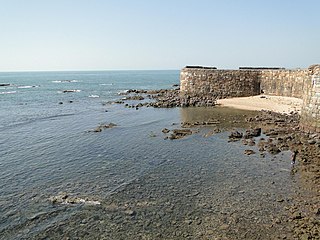
Revdanda is a village near Alibaug, Raigad District, Maharashtra. It is the site of the medieval 'Chaul harbor'.

Kudal is a census town in Sindhudurg district, Maharashtra, India. It is situated on River Karli in southwest Maharashtara. Kudal is the fourth largest town in Sindhudurg after Sawantwadi, Malvan and Kankavli. As of 2011, the population is 16,015. Kudal supports one MIDC area in the Konkan division. The Kudal railway station is located on the Konkan Railway route and connects the town with Mumbai metro situated in the Bombay, Baroda and Central India Railway of the north, and Mangalore on the south. It is a major stop for the Konkan Railway. The Deccan Odyssey train also stops in Kudal. National Highway 66 passes through Kudal. Apart from that, it also has two bus stations, a new one and old one. The old one is situated in market while the new one is just adjacent to the NH-66. Kudal is situated in centre of the Sindhudurg district and also considered one of the fastest-growing towns in the Konkan region. The Desai's were the original rulers of Kudal, who were tributaries of the Bijapur Sultanate, later the Marathas and then under the British.

<span class="mw-page-title-main">Western India</span> Group of Western Indian states

Western India is a loosely defined region of India consisting of western states of Republic of India. The Ministry of Home Affairs in its Western Zonal Council Administrative division includes the states of Goa, Gujarat, and Maharashtra along with the Union territory of Dadra and Nagar Haveli and Daman and Diu, while the Ministry of Culture and some historians also include the state of Rajasthan. The Geological Survey of India includes Maharashtra but excludes Rajasthan whereas Ministry of Minority Affairs includes Karnataka but excludes Rajasthan.

<span class="mw-page-title-main">Mahad</span> City & Sub-district in Maharashtra , India

Mahad ( [məɦaːɖ]) is a city in Raigad district situated in the North Konkan region of Maharashtra state, India. It is located 108.5 km (67.4 mi) from District Headquarters Alibag, and 167 km (104 mi) from Mumbai. Mahad is known for Raigad Fort, the capital of the Maratha Empire in Shivaji's era and the revolutionary Mahad Satyagraha launched by at Chavdar Tale in the wake of modern India.

<span class="mw-page-title-main">Chiplun</span> City in Maharashtra, India

Chiplun ( [t͡ʃipɭuːɳ]) is a city in Ratnagiri district in the state of Maharashtra, India. It is one of the financial and commercial Hubs of Ratnagiri district, and the headquarters of Chiplun taluka. It is about 250 km south of Mumbai and 90 km North of Ratnagiri in the Konkan region of Maharashtra, on the Mumbai–Goa highway (NH-66). It has a long history and a strong cultural background. Recent decades have seen much industrial development in it and its and surrounding areas.

<span class="mw-page-title-main">Devgad taluka</span>

Devgad is a taluka in Sindhudurg district of Maharashtra, India consisting of 98 villages. It is located on the Arabian Sea in the coastal Konkan region of Maharashtra, south of Mumbai. Devgad is known globally for its exports of locally grown Alphonso mangoes.

<span class="mw-page-title-main">Mangaon</span> Sub District Town in Maharashtra, India

Mangaon is a small town and tehsil (council) in the Konkan Division, India. It is located in the Raigad district, 80 km (49.7 mi) from Alibaug headquarters, and 139 km (86.4 mi) from the capital city of Bombay (Mumbai). The area is enroute towards Panjim side of Goa.

Pen is a town and taluka in Raigad district of Indian state of Maharashtra. It is well known for world class Ganesh idols. It is the geographical and cultural center of Raigad district. Pen is also known for Salt cultivation by Aagri and Koli community.

<span class="mw-page-title-main">Kolad</span> Village in Maharashtra

Kolad is a village in Raigad district, Maharashtra State, India. It is 117 km from Mumbai on the National Highway no 66(Mumbai-Goa) its also connected to Pune via Kolad Pune- Kolad state highway. It lies on the banks of River Kundalika. The village post office Postal Index Number is 402304 & 402109.

<span class="mw-page-title-main">Prabalgad</span> Fort in India

Prabalgad is a fort located between Matheran and Panvel and comes under the Raigad District in the state of Maharashtra, India.

<span class="mw-page-title-main">Dharamtar</span> Sea port in Maharashtra, India

Dharamtar port, commonly known as JSW Dharamtar Port is on the right bank of the Amba river and is 10 miles (16 km) from its mouth. Approximately 2 km (1.2 mi) from Wadkhal village on NH-17. The port is 0.5 km (0.31 mi) from the state highway that runs through Pen to Alibag and is 2 km (1.2 mi) away from National Highway 17 (Mumbai—Goa). The port is also adjacent to Mumbai–Goa–Konkan railway line with an approved rail siding. It is a tri-modal port with rail.

Gazetteer of the Bombay Presidency is a publication of the erstwhile British India first published in the year 1884 and printed at the Government Central Press, Bombay in 1884. Since the early 19th Century the English East India Company and later the British Empire annexed most of Western India and collectively named the provinces in Western India as Bombay Presidency.

Satawali is a census town in Lanja-Taluka Ratnagiri district in the Indian state of Maharashtra.

<span class="mw-page-title-main">Palghar district</span> District Of Maharashtra in India

Palghar District is a district in the state of Maharashtra in Konkan Division. The headquarters of the district is the town of Palghar. Other major cities in the district are Vasai-Virar, Talasari, Jawhar and Dahanu.

References

  1. Falling Rain Genomics, Inc - Nagothana
  2. "Nagothane City Population Census 2011 - Maharashtra". www.census2011.co.in. Retrieved 16 December 2015.