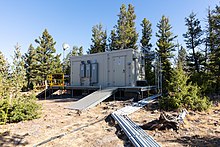
The Wind River Experimental Forest is an ecological and silvicultural research in Stabler, Washington, in the United States. Used as a research site by the U.S. Forest Service beginning in 1908, and functioning as an experimental forest since 1932, it is "known as the cradle of forest research in the Pacific Northwest". The site is probably best known for the Wind River Canopy Crane Research Facility (WRCCRF), a 285-foot (87 m)-high freestanding tower crane which supported an 8-person gondola allowing scientists to view the forest canopy from above. The tallest trees in the forest are about 220 feet (67 m).
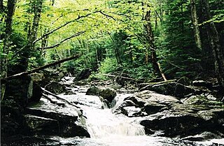
Ecosystem ecology is the integrated study of living (biotic) and non-living (abiotic) components of ecosystems and their interactions within an ecosystem framework. This science examines how ecosystems work and relates this to their components such as chemicals, bedrock, soil, plants, and animals.
The Long Term Ecological Research (LTER) Network consists of a group of over 1800 scientists and students studying ecological processes over extended temporal and spatial scales. Twenty-eight LTER sites cover a diverse set of ecosystems. It is part of the International Long Term Ecological Research Network (ILTER). The LTER Program was established in 1980 and is funded by the U.S. National Science Foundation. Data from LTER sites is publicly available in the Environmental Data Initiative repository and findable through DataONE search.
The Rocky Mountain Research Station (RMRS) is one of five regional units that make up the United States Forest Service Research and Development organization — the most extensive natural resources research organization in the world. The station headquarters are located in Fort Collins, Colorado. Research is structured within eight science program areas. The Station employs over 400 permanent full-time employees, including roughly 100 research scientists.
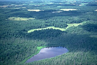
The Cedar Creek Ecosystem Science Reserve is an ecological research site located primarily in East Bethel, Minnesota in the counties of Anoka and Isanti on the northern edge of the Minneapolis-Saint Paul metropolitan area.
An experimental forest, or experimental range, as defined by the United States Forest Service, is "an area administered ... 'to provide for the research necessary for the management of the land.'"

Katey M. Walter Anthony is an Alaskan aquatic ecologist and biogeochemist researching carbon and nutrient cycling between terrestrial and aquatic systems, and the cryosphere and atmosphere.

DataONE is a network of interoperable data repositories facilitating data sharing, data discovery, and open science. Originally supported by $21.2 million in funding from the US National Science Foundation as one of the initial DataNet programs in 2009, funding was renewed in 2014 through 2020 with an additional $15 million. DataONE helps preserve, access, use, and reuse of multi-discipline scientific data through the construction of primary cyberinfrastructure and an education and outreach program. DataONE provides scientific data archiving for ecological and environmental data produced by scientists. DataONE's goal is to preserve and provide access to multi-scale, multi-discipline, and multi-national data. Users include scientists, ecosystem managers, policy makers, students, educators, librarians, and the public.
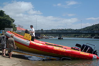
The South African Environmental Observation Network (SAEON) is a science network of people, organisations and, most importantly observation platforms, that perform Long-Term Ecological Research (LTER) in South Africa and its surrounding oceans. The SAEON is of global importance as an innovative approach in ecology to understand environmental change and to determine the impact of anthropogenic forces at multiple scales but it is a remarkably complex challenge to statistically discern between ubiquitous natural variability and exogenous forcing. The SAEON constitutes a national government response to the World Summit on Sustainable Development (Earth Summit 2002) and is a component of the GEO (Group on Earth Observations). The SAEON has become the leader in environmental science and observation in South Africa, but has been criticised for taking a long time to establish, a situation which was inevitable in view of SAEON's multiple stakeholder corps. It has also been raised that the cost of replicated experimental treatments across SAEON sites will be high.
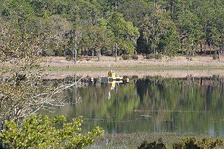
Lake Barco is a lake in Putnam County, Florida, United States. It is within the Ordway-Swisher Biological Station of the Institute of Food and Agricultural Sciences. It is roughly circular, about 200 metres (660 ft) in diameter. The nearest settlement is Melrose, Florida, about 5 kilometres (3.1 mi) to the northwest.

The Institute of Arctic and Alpine Research (INSTAAR) is a scientific institute that is part of the University of Colorado Boulder. Its research mission is to "[develop] scientific knowledge of physical and biogeochemical environmental processes at local, regional and global scales, and appl[y] this knowledge to improve society's awareness and understanding of natural and anthropogenic environmental change."

The Santa Rita Experimental Range and Wildlife Area is the longest continuously active rangeland research facility and among the five oldest biological field stations in the United States. Located south of Tucson in Pima County, Arizona, the 52,000 acre Santa Rita Experimental Range (SRER) was founded in 1903 and administered by the United States Forest Service until 1987, when the University of Arizona College of Agriculture took over administration of the site. The mission at the SRER is "to advance research and education on the ecology and management of desert rangelands through the secure, long-term access to research areas, state-of-the-art facilities, new discoveries, and research legacies."
Niwot Ridge is an alpine ecology research station located 65 km northwest of Denver in north-central Colorado. It is on the Front Range of the southern Rocky Mountains and lies within the Roosevelt National Forest. Niwot Ridge is 2,900 metres (9,500 ft) high.

The Jornada Biosphere Reserve is a UNESCO Biosphere Reserve in southern New Mexico. It is one of three biosphere reserves representing the Chihuahuan Desert. The area extends from the crest of the San Andres Mountains, which are dominated by shrub woodlands, to the Jornada Plains characterized by semi-desert grasslands.

Sharon J. Hall is an ecosystem ecologist and associate professor at the School of Life Sciences at Arizona State University. Her research focuses on ecosystem ecology and the ways that human activity interacts with the environment.
Wendy Yang is a professor of Plant Biology at the University of Illinois Urbana-Champaign where she works on soil biogeochemistry and ecosystem ecology.
Emily S. Bernhardt is an American ecosystem ecologist, biogeochemist, and professor at Duke University.

The Luquillo Experimental Forest is a protected area of tropical rainforest in northeastern Puerto Rico. The experimental forest is located in the Sierra de Luquillo some 50 km (30 mi) east of San Juan, the capital of the island. It is a UNESCO Biosphere Reserve and is used for research into silviculture, forest regeneration, and other purposes.
Christine Goodale is an ecosystem ecologist and an Associate Professor in the Department of Ecology and Evolutionary Biology at Cornell University. Goodale conducts research that studies the cycling of water, carbon, nitrogen and other nutrients through forest ecosystems.
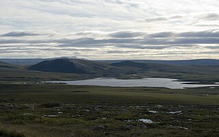
Toolik Lake is an Arctic lake located within the North Slope Borough, Alaska. It is in a remote wilderness area managed by the Bureau of Land Management accessed by the Dalton Highway. It is 130 mi (210 km) south of Prudhoe Bay in the northern foothills of the Brooks Range. The name is derived from the Iñupiat word tutlik, meaning yellow-billed loon.


