This article needs additional citations for verification .(May 2013) |
New Panvel | |
|---|---|
Node of Navi Mumbai | |
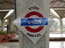 Panvel Station | |
 New Panvel New Panvel | |
| Coordinates: 18°59′N73°06′E / 18.98°N 73.1°E | |
| Country | |
| State | Maharashtra |
| City | Navi Mumbai |
| District | Raigad |
| Metro | Mumbai |
| Nearest City | |
| Founded by | City and Industrial Development Corporation (CIDCO) |
| Area | |
• Total | 24 km2 (9 sq mi) |
| Elevation | 3.52 m (11.55 ft) |
| Population (2005) | |
• Total | 3.5 Lakhs |
| • Density | 15,644/km2 (40,520/sq mi) |
| Languages | |
| • Official | Marathi |
| Time zone | UTC+5:30 (IST) |
| PIN | 410206 |
| Telephone code | 022 |
| Vehicle registration | MH-46 |
| Civic agency | Panvel Municipal Corporation |
| Climate | Humid, monsoon, Tropical (Köppen) |
New Panvel is a residential, commercial and educational node of Navi Mumbai, Raigad District, Maharashtra and comes under the Konkan division. New Panvel was developed on marshy land and was previously a Mango cultivated area. [ citation needed ]