Mumbra

Last updated

Mumbra
Neighborhoods of Thane City
Sunset At Mumbra.jpg
Sunrise view of Mumbra
India Maharashtra location map.svg
Red pog.svg
Mumbra
Location of Mumbra in Maharashtra, India
Coordinates: 19°10′48″N73°01′21″E / 19.18000°N 73.02250°E / 19.18000; 73.02250
CountryIndia
State Maharashtra
District Thane
MetroMumbai
Government
  TypeMunicipal Corporation
  BodyThane Municipal Corporation
Area
  Total13.97 km2 (5.39 sq mi)
Population
 (2023)
  Total500,000
  Density36,000/km2 (93,000/sq mi)
Time zone UTC+5:30 (IST)
PIN code
400 612
Telephone code(022)
Vehicle registration MH-04 Thane city
Lok Sabha constituency Kalyan
Vidhan Sabha constituency Mumbra-Kalwa
Website http://mumbra.org/

Mumbra is a neighborhood in Thane city in Thane District Western India in the state of Maharashtra, a Mumbai suburb within the Mumbai Metropolitan Region. It is administered by Thane Municipal Corporation.

Contents

History

Mumbra was a flourishing shipbuilding center in early times.

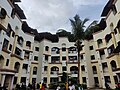
Much of the land around Mumbra was agricultural land until 1975. Between 1968 and 1975, Mumbai experienced significant population growth and greater population density. Then, about 1975, Mumbra's agricultural land was urbanized. This signaled an expansion of the greater Mumbai area, which realized significant population growth in the 1980s. [1] Wafa Hill's "A, B, C" was one of the first planned Thane Municipal Corporation (TMC) approved buildings developed in the 1990s. Which lead the foundation for urbanization in Mumbra. [2]

In 1991 there were about 44,000 people. [3] After the riots of 1992 many Muslims fled Mumbai and settled in Mumbra; 10 Sq mile land was allotted by state Government under custody of state waqf board for resettlement of fled Muslims of different part of Mumbai. It is India's largest Muslim locality also known by India's largest Muslim Ghetto. [4] Non-Governmental Organization(NGO) who is working for Mumbra area is Mumbra Welfare Association registered under Registered in Central Government of India (U88900MH2024NPL422145) of Section 8 Company of Ministry of Corporate Affairs (MCA). Registered in NGO Darpan maintained by NITI Aayog. Certified under section 12A and Section 80G

Demographics

The population of Mumbra was 5 lakhs as of 2023. [3] More than 85% of Mumbra's residents are Muslim. [5]


Transport

Bus service is available through the Thane Municipal Transport (TMT) and Navi Mumbai Municipal Transport (NMMT). [6]

Rail service is available at the Mumbra railway station on Central line, also called as mainline. [7] Mumbra is 29 kilometres (18 mi) from the Mumbai airport. [8]

The main source of Transport in Mumbra is Auto-Rickshaw. Mumbra didn't have any bus starting from Mumbra railway station and hence Auto-Rickshaws was the only possible conveyance.[ citation needed ]

But now, TMT Thane Municipal Transport runs bus service starting from Mumbra Railway Station to Bharat gears company.

State transport (MSRTC) operate regular bus service between Panvel, Bhiwandi, and Shil Phata.[ citation needed ]

Mumbra is known for its green lavish mountains and waterfalls enhancing the beauty of the city.[ citation needed ]

Related Research Articles

<span class="mw-page-title-main">Mumbai</span> Capital of Maharashtra, India

Mumbai is the capital city of the Indian state of Maharashtra. Mumbai is the financial capital and the most populous city of India with an estimated population of 12.5 million (1.25 crore). Mumbai is the centre of the Mumbai Metropolitan Region, the sixth-most populous metropolitan area in the world with a population of over 23 million. Mumbai lies on the Konkan coast on the west coast of India and has a deep natural harbour. In 2008, Mumbai was named an alpha world city. Mumbai has the highest number of billionaires out of any city in Asia.

<span class="mw-page-title-main">Thane</span> Metropolis in Maharashtra, India

Thane is a metropolitan city located on the northwestern side of the state of Maharashtra in India and on the northeastern side of Mumbai. It is an immediate neighbour of Mumbai city proper, and a part of the Mumbai Metropolitan Region. It is situated in the north-eastern portion of the Salsette Island.

<span class="mw-page-title-main">Transport in Mumbai</span> Different types of public transport in Mumbai

Transport in Mumbai is achieved by both public and private transport. As of 2016, 52% of commuters use public transport. Mumbai has the largest organized bus transport network among major Indian cities.

<span class="mw-page-title-main">Kalyan</span> City in Maharashtra, India

Kalyan is a city on the banks of Ulhas River in Thane district of Maharashtra state in Konkan division. It is governed by Kalyan-Dombivli Municipal Corporation. Kalyan is a subdivision (Taluka) of Thane district. Kalyan and its neighbouring township of Dombivli jointly form Kalyan-Dombivli Municipal Corporation, abbreviated as KDMC. It is a founding city of the Mumbai Metropolitan Region. Kalyan is the 7th biggest city in Maharashtra and 29th in India. Kalyan also serves as a major railway station for the trains bound to Mumbai and is a large junction separating two routes, one going Karjat and other Kasara.

<span class="mw-page-title-main">Thane district</span> District of Maharashtra in India

Thane district is a district in the Konkan Division of Maharashtra, India. At the 2011 Census it was the most populated district in the country, with 11,060,148 inhabitants; however, in August 2014 the district was split into two with the creation of a new Palghar district, leaving the reduced Thane district with a 2011 census population of 8,070,032. The headquarters of the district is the city of Thane. Other major cities in the district are Navi Mumbai, Kalyan-Dombivli, Mira-Bhayander, Bhiwandi, Ulhasnagar, Ambarnath, Badlapur, Murbad and Shahapur.

<span class="mw-page-title-main">Amravati</span> City in Maharashtra, India

Amravati is a city in Maharashtra located in the Vidarbha region. It is the ninth largest city in Maharashtra, India & second largest city in the Vidarbha region in terms of population. It is the administrative headquarter of Amravati district as well as Amravati Division which includes Amravati District, Akola District, Buldhana District, Washim District & Yavatmal District. It is one of Maharashtra's nominated cities under Smart Cities Mission.

<span class="mw-page-title-main">Navi Mumbai</span> Planned city in Maharashtra, India

Navi Mumbai is a planned city next to Mumbai (Bombay), located in the Konkan division of the western Indian state of Maharashtra, on the mainland of India. Navi Mumbai is situated across two districts, Thane (Taana) & Raigad. It is a part of the Mumbai Metropolitan Area.

<span class="mw-page-title-main">Economy of Mumbai</span>

Mumbai, is the financial centre and the most populous city of India with an estimated city proper population of 12.5 million (1.25 crore). The city is the entertainment, fashion, and commercial centre of India. Mumbai hosts the largest urban economy of any city in India as it is the financial capital of an almost US$ 4 trillion Indian economy in nominal terms. According to recent estimates Mumbai Metro's nominal GDP is estimated to be US$277.98 billion,and GDP (PPP) is estimated to be US400 billion, Mumbai's GDP (PPP) per capita rounds up to around US$23,000. It is the richest Indian city and 12th richest city in the world with a net wealth of around US$1 trillion with 46,000 millionaires and 92 billionaires. Mumbai accounts for slightly more than 6.16% of India's economy, contributing 10% of factory employment, 30% of income tax collections, 45% of entertainment tax, 60% of customs duty collections, 20% of central excise tax collections, 40% of foreign trade, 100% of stock market assets and rupees 1,60,000 crore in corporate taxes to the Indian economy.

Kalwa is a neighborhood in Thane city ]] administered under Thane Municipal Corporation in Thane district, in the State of Maharashtra, India. The nearest railway station is the Kalwa railway station on the Central Line of the Mumbai Suburban Railway. Previously, Kalwa railway station had 2 platforms but now it has increased to 4.

<span class="mw-page-title-main">Transport in Kolkata</span>

The transport system of Kolkata, a city in India, is a mix of modern mass rapid transport and old transport modalities like rickshaws. Kolkata is connected to the rest of India by the National Highways, the extensive network of the Indian Railways, National Waterways and by air. The most traffic to Northeast India route is via Kolkata.

<span class="mw-page-title-main">Vasai-Virar</span> Place in Maharashtra, India

Vasai-Virar is an agglomeration of four previously governed municipal councils: Vasai (Bassein), Virar, Nallasopara and Navghar-Manikpur, as well as a few towns to the east and west of the urban area. It lies in the Konkan division of Maharashtra, India.

<span class="mw-page-title-main">CBD Belapur</span> Business District of Navi Mumbai in Maharashtra, India

The Central Business District of Belapur is an upmarket neighbourhood of Navi Mumbai. The Navi Mumbai Municipal Corporation is headquartered in Belapur. The Reserve Bank of India maintains a branch office at CBD Belapur. This area is one of the fastest developing regions in Navi Mumbai in terms of new residential and commercial construction projects. CBD Belapur is connected to other parts of Mumbai through railways, BEST & NMMT buses. It had a ferry service for traveling to Elephanta caves from Sector-11.

Thane Municipal Transport (T.M.T.) operates their services in Thane city and into neighboring cities like Mumbai, Navi Mumbai, Bhiwandi, Mira-Bhayandar and Vasai-Virar.

<span class="mw-page-title-main">Patlipada</span> Suburb in Thane, Maharashtra, India

Patlipada, previously a village in the Indian state of Maharashtra, is now a part of Thane city. It has a residential complex and the official residence of the Thane Municipal Commissioner.

Kausa is a village of Thane District in the state of Maharashtra in India. It is administered by the Thane Municipal Corporation.

Station Area Traffic Improvement Scheme (SATIS) is a World Bank funded station area traffic improvement project. It is implemented by Mumbai Metropolitan Region Development Authority (MMRDA) and Thane Municipal Corporation. This project is executed under Mumbai Urban Transport Project road component. The project aims at easing commuter and pedestrian movement by building skywalks, foot over bridges, separate parking areas for auto-rickshaws and taxis at four crowded suburban railway stations Borivali, Dadar, Chembur and Ghatkopar implement by MMRDA and Thane SATIS is implemented by Thane Municipal Corporation. On 22 October 2022, MMRDA announced new SATIS implementation at Ambernath railway station.

<span class="mw-page-title-main">Andheri railway station</span> Railway station in Maharashtra, India

Andheri is a passenger rail station located at Andheri suburb of Mumbai. It serves the Western line and Harbour lines of the Mumbai Suburban Railway. It is also a stop for some express trains and August Kranti Rajdhani Express. The station also inter-connects the Line 1 of the Andheri metro station. Andheri station first came under prominence after the development of Salsette–Trombay Railway services in 1928 by the British Empire of India during the pre-independence period.

<span class="mw-page-title-main">Vasai-Virar City Municipal Corporation</span> Local civic body in Vasai-Virar, Maharashtra, India

Vasai-Virar City Municipal Corporation (VVCMC) is the civic body that governs areas and villages in Vasai-Virar taluka in Maharashtra, India comprising the most populated part of Palghar district. According to the 2011 census, it is the fifth largest city in Maharashtra with a population of more than 1.3 million. The city is located 50 km north of Mumbai, on the north bank of Vasai Creek, part of the estuary of the Ulhas River. It was formed on 3 July 2010 by combining four municipal councils and 53 gram panchayats.

On 4 April 2013, a building collapsed on tribal land in Mumbra, a suburb of Thane in Maharashtra, India. It has been called the worst building collapse in the area. Seventy-four people were killed, while more than 100 survived. The search for additional survivors ended on 6 April 2013.

Boisar is the largest industrial suburb in the Mumbai Metropolitan Region in the Indian state of Maharashtra. It was originally a part of the Thane district before becoming a part of the Palghar district. It is approximately 111 kilometers away from the state capital Mumbai, and is 98 km (61 mi) from the union territory Daman. It is located in the district Palghar in Maharashtra.

References

  1. Metropolitan planning and management in the developing world: spatial decentralization policy in Bombay and Cairo. United Nations Centre for Human Settlements (UN-HABITAT). 1993. pp. 39–40. ISBN   9211312337. OCLC   32406987.
  2. Mumbracity.com online portal on Mumbra
  3. 1 2 "Thane building collapse: Mumbra tragedy a fallout of illegal construction boom". Indian Express. 9 April 2013. Retrieved 9 April 2013.
  4. Peer, Basharat (10 June 2016). "In India's largest Muslim ghetto". The Hindu . Retrieved 5 July 2022.
  5. Halarnkar, Samar (24 November 2011). "Lesson from Mumbra". Hindustan Times.
  6. "Direct Mumbra-Vashi bus service from today". The Times of India . 5 October 2008. Archived from the original on 29 June 2013. Retrieved 8 April 2013.
  7. "Mumbra Local Station Information". Mumba Life Life. Retrieved 9 April 2013.
  8. "Distance from Mumbra to domestic airport at Mumbai". Distances Between. Retrieved 9 April 2013.