
The Toronto Transit Commission (TTC) is the public transport agency that operates bus, subway, streetcar, and paratransit services in Toronto, Peel Region and York Region in Southern Ontario, Canada. It is the oldest and largest of the urban transit service providers in the Greater Toronto Area, with numerous connections to systems serving its surrounding municipalities.
Rockcliffe Park is a neighbourhood in Rideau-Rockcliffe Ward, close to the centre of Ottawa, Ontario, Canada. Established in 1864, organized as a Police village in 1908, and an independent village from 1926, and ultimately amalgamated with the rest of Ottawa on January 1, 2001. As of 2011, it had a population of 2,021. In 1977 the entire village of Rockcliffe Park was designated a Heritage Conservation District. Rockcliffe Park is one of only a handful of surviving nineteenth-century communities of its kind in North America.

Quinte West is a city, geographically located in but administratively separated from Hastings County, in Southern Ontario, Canada. It is located on the western end of the Bay of Quinte on Lake Ontario. The Lake Ontario terminus of the Trent–Severn Waterway is located in the municipality.

Heron Gate or Herongate is a neighbourhood in Alta Vista Ward and Gloucester-Southgate Ward in the south end of Ottawa, Ontario, Canada. It is defined by the Herongate Tenant Coalition as being bounded on the north by Heron Road, on the west by Heron-Walkley Park and Albion Road, and by the Walkley rail corridor on the south. The total population for this area according to the Canada 2016 Census was 9,714.

The Sunshine Coast Regional District is a regional district in British Columbia, Canada. It is located on the southern mainland coast, across Georgia Strait from Vancouver Island. It borders on the qathet Regional District to the north, the Squamish-Lillooet Regional District to the east, and, across Howe Sound, the Metro Vancouver District to the south. The regional district offices are located in the District Municipality of Sechelt.

Langford is a city on southern Vancouver Island in the province of British Columbia, Canada. Langford is one of the 13 component municipalities of Greater Victoria and is within the Capital Regional District. Langford was incorporated in 1992 and has a population of over 40,000 people. Its municipal neighbours are Colwood to the southeast, Highlands to the north, Metchosin to the southwest, and View Royal to the northeast.

North Okanagan—Shuswap is a federal electoral district in the province of British Columbia, Canada, that has been represented in the House of Commons of Canada since 1988. The district has been sporadically known as Okanagan—Shuswap.

Alta Vista is a neighbourhood in Alta Vista Ward in Ottawa, Ontario, Canada. Its boundaries according to the Alta Vista Community Association are that part of Alta Vista Ward south of Smyth Road in the north, north of Walkley Road and east of the Rideau River, and west of the "greenspace underneath Haig Drive". However, the name is ambiguous, as there are several sub-neighbourhoods in this area,, as the neighbourhood could refer to the ward as a whole, down to thecore Alta Vista area,, centred on Alta Vista Drive.
Lower Post is an aboriginal community in northern British Columbia, Canada, located on Highway 97, the Alaska Highway, approximately 15 miles southeast of Watson Lake, Yukon. Its historical mile designation is Mile 620. It is located near the confluence of the Dease and Liard Rivers.
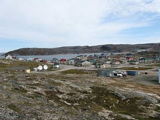
Ivujivik is a northern village in Nunavik, Quebec, and the northernmost settlement in any Canadian province, although there are settlements further north in the territories. Its population in the Canada 2016 Census was 414. Unlike most other northern villages in Nunavik, it has no Inuit reserved land of the same name associated with it.

Eabametoong, also known as Fort Hope or Eabamet Lake by Canada Post, is an Ojibwe First Nations band government in Kenora District, Ontario, Canada. Located on the shore of Eabamet Lake in the Albany River system, the community is located approximately 300 km (190 mi) northeast of Thunder Bay and is accessible only by airplane via Fort Hope Airport or water, or by winter/ice roads, which connect the community to the Northern Ontario Resource Trail. The Eabametoong First Nation Reserve is completely surrounded by territory of the Unorganized Kenora District.
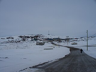
Quaqtaq is a northern village in Nunavik, northern Quebec, Canada. Its population was 403 in the Canada 2016 Census.

Spences Bridge is a community in the Canadian province of British Columbia, situated 35 km north east of Lytton and 44 km south of Ashcroft. At Spences Bridge the Transcanada Highway crosses the Thompson River. In 1892, Spences Bridge's population included 32 people of European ancestry and 130 First Nations people. There were five general stores, three hotels, one Church of England and one school. The principal industries are fruit growing and farming. The population as of 2016 is 99.

Island Lake is a small community in northeast Manitoba, Canada. The community consists of an archipelago near the north shore of Island Lake which includes the following islands: Stevenson, Wass, Hamilton, Boothe, Chapins, RC Mission, Gravel, and Lindsays.
The Long Plain First Nation is an Ojibway and Dakota First Nations band government whose reserve is located in the Central Plains Region of Manitoba, Canada. Its reserve lands include the Long Plain Reserve #6, the Keeshkeemaquah Reserve near Portage La Prairie, and the Madison Indian Reserve #1—the first urban reserve in Winnipeg.

Stoughton is a town in Saskatchewan, Canada. In 2011 it had a population of 649. Stoughton was originally called New Hope. The tiny settlement of New Hope was barely three years old when the Canadian Pacific Railway (CPR) arrived in this part of the province in 1904. The CPR chose a location a lttle to the south for its closest depot, which it called Stoughton. The community of New Hope soon moved to join it.

Kangiqsujuaq is a northern village in Nunavik, Nord-du-Québec, Quebec, Canada. It had a population of 750 in the Canada 2016 Census. The community has also been known as Wakeham Bay. The name "Kangiqsujuaq" means "the large bay" in Inuktitut.

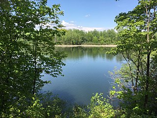
Riverside Park is a neighbourhood in the south end of Ottawa, Canada.
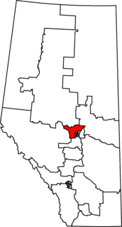
Sturgeon River—Parkland is a federal electoral district in the Edmonton Capital Region of northern Alberta, Canada, and has been represented in the House of Commons of Canada since 2015. It was created in 2012 from the electoral districts of Edmonton—Spruce Grove (61%), Westlock—St. Paul (33%) and Yellowhead (6%).

Bay of Quinte is a federal electoral district in central Ontario, Canada, centred on the Bay of Quinte.